
Federal and tribal sources describe Port Angeles Harbor as the largest natural deep-water harbor on the U.S. West Coast, with depths over 90 feet near its eastern end, sheltered by the 2.5-mile spit of Ediz Hook. The Port of Port Angeles calls itself the first full-service port available to ships coming into the Strait of Juan de Fuca.
George believes that makes Port Angeles one of the finest natural ports anywhere, and that the town has spent too long treating its waterfront as a place where mills used to be. In his view the harbor's depth and shelter, two large former mill sites, and the open water to Victoria, the San Juans and Puget Sound add up to a port city that has not been finished yet.
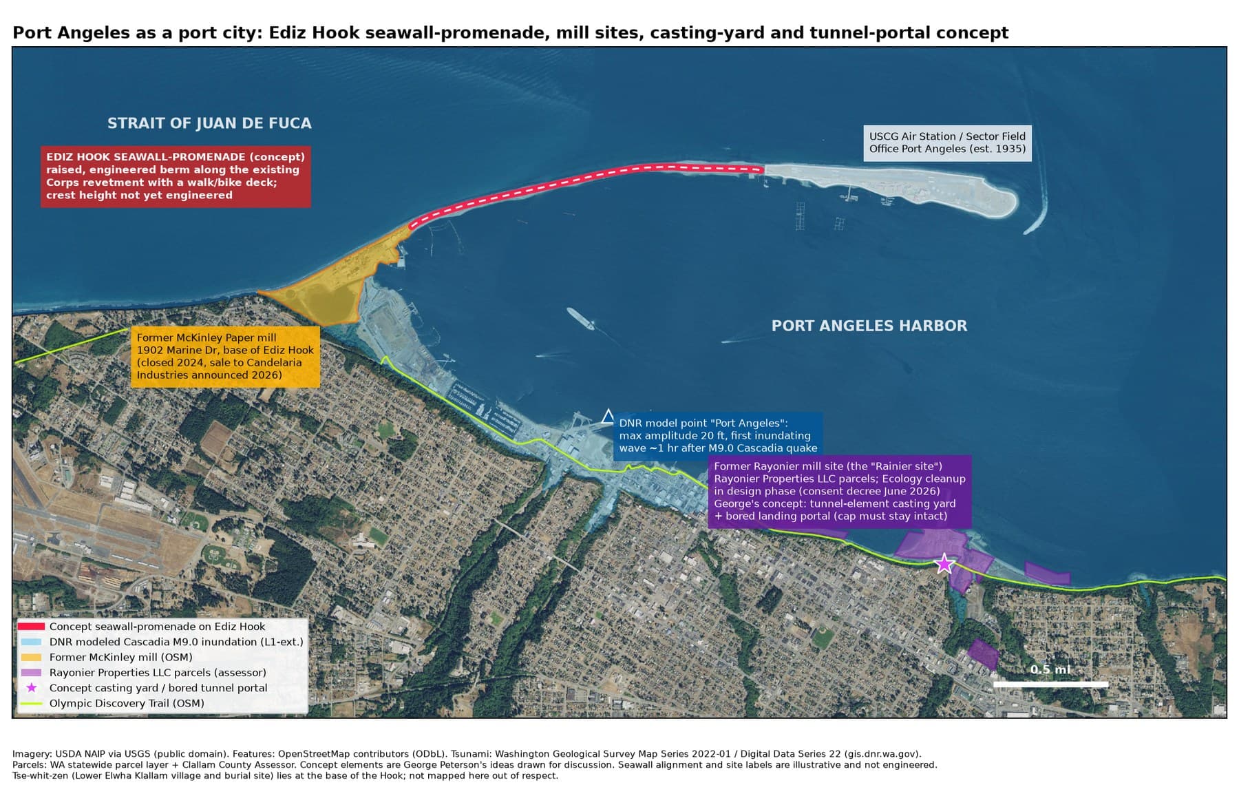
George sees the former Rayonier mill on the east waterfront as the front door of the city: the cruise terminal, the main port, and the hub where the tunnels begin. The old creosote dock and jetty come out under the state cleanup, and a new cruise pier on clean piles takes their place in the same spot, with a public promenade on top, in the spirit of City Pier downtown, extending the waterfront walk. Any acquisition would help fund and speed up the cleanup and habitat mitigation, under the state's cleanup oversight. The shoreline is restored with native planting, along with the Ennis Creek estuary. Passengers step off the ships onto a plaza at grade and into autonomous taxis waiting at the curb, with no climb and no shuttle bus.
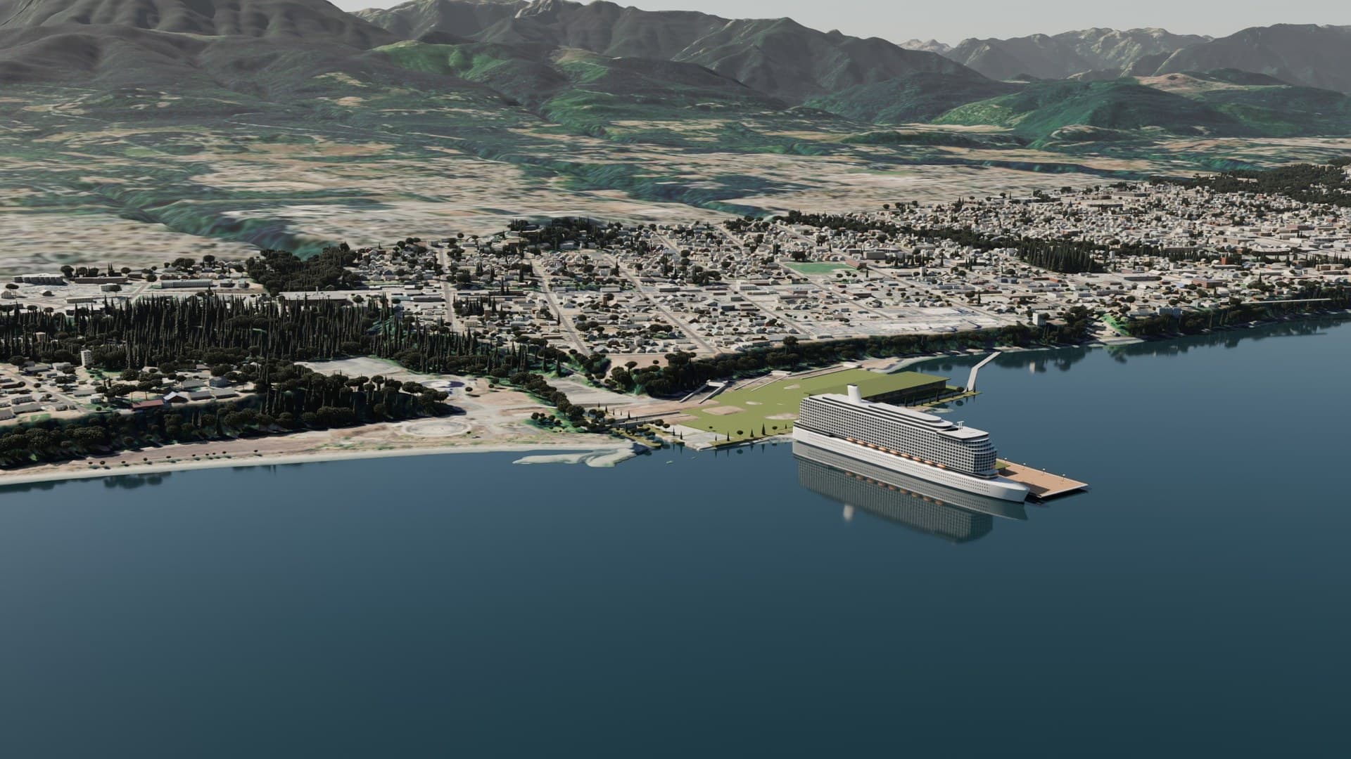
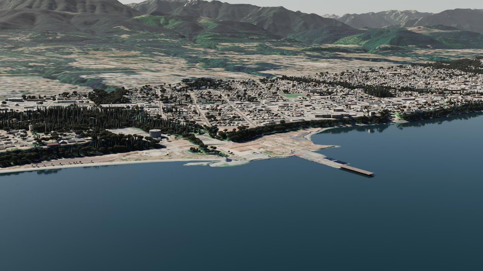
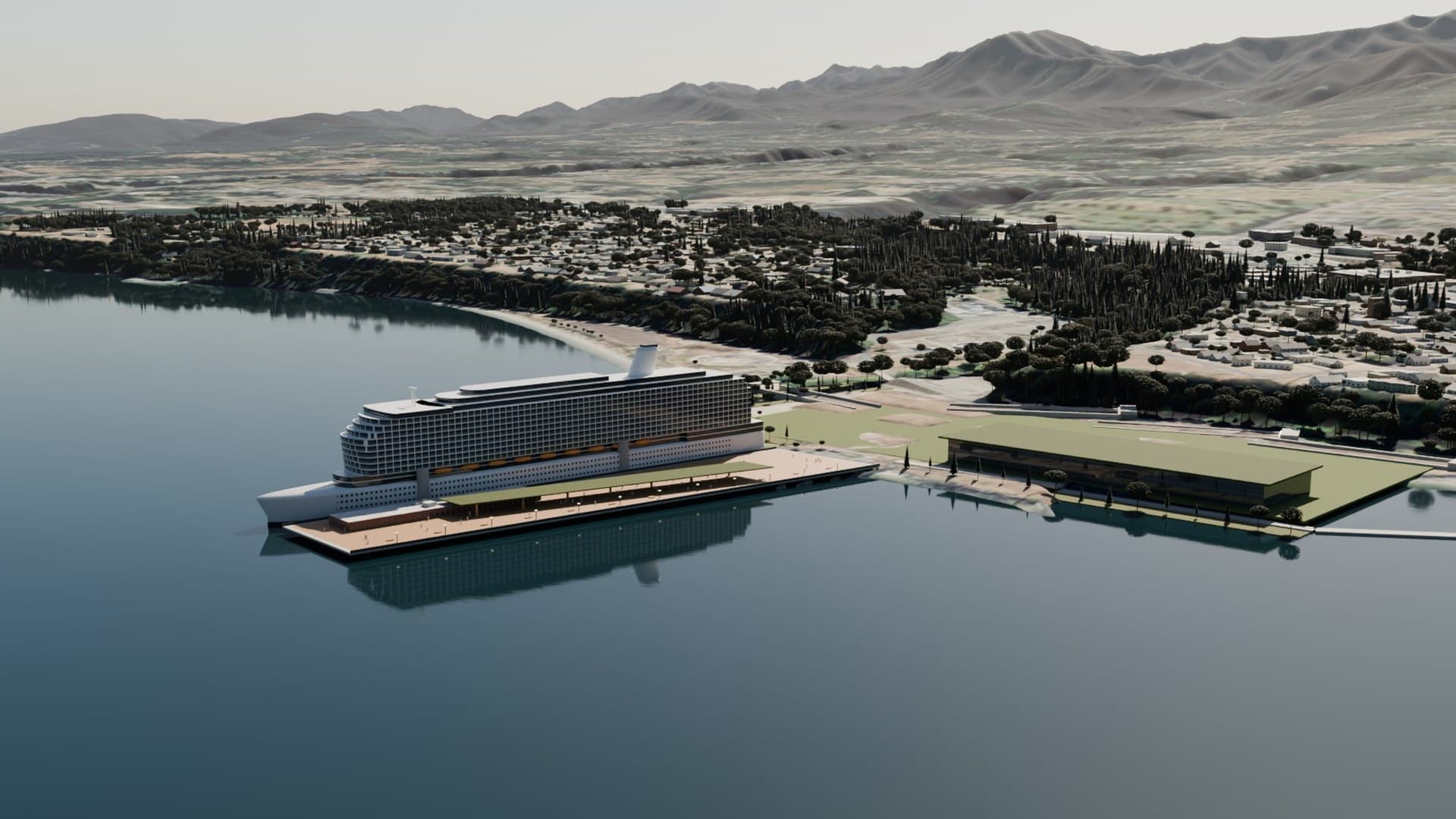
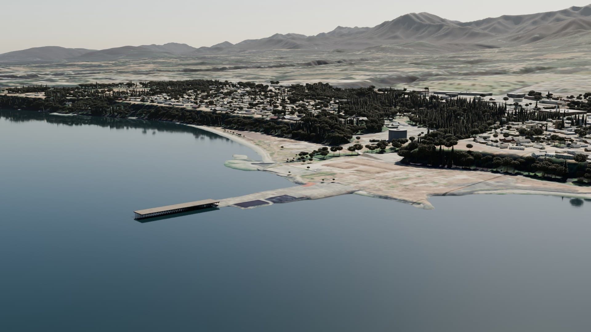
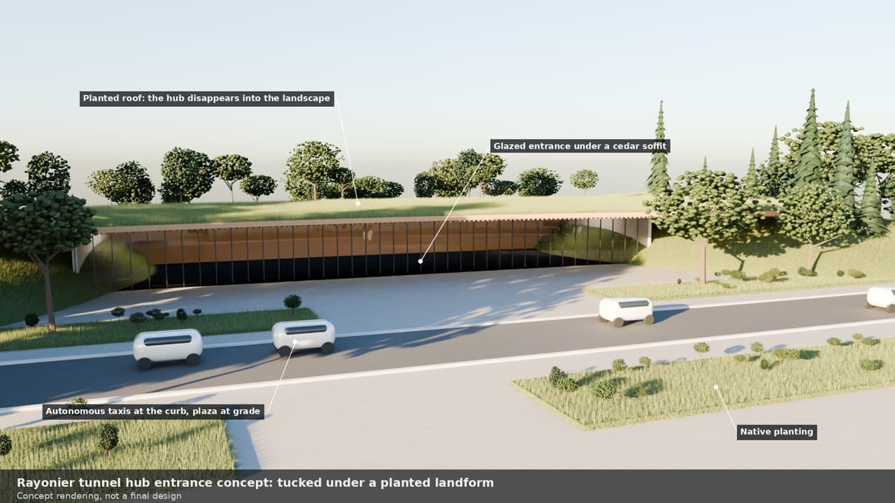
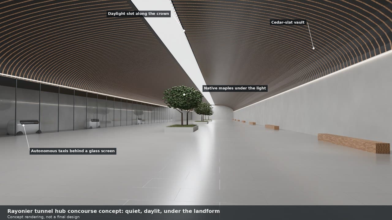
From the hub, the three concept lines of the Salish Tunnel system start. The West End line runs west to Joyce and Clallam Bay and ends at Neah Bay, Makah connection. East, a shared trunk runs to Sequim at Port Williams and on to Port Townsend, where the Olympia line turns south under Hood Canal and the Seattle line runs on to Edmonds and downtown Seattle. All three are drawn as one continuous tunnel joined at the hub, with no breaks between stops.
The Washington Department of Ecology oversees the Rayonier cleanup, now in the "design the cleanup" phase. Ecology expects soil cleanup to take no more than 7 years and groundwater and sediment cleanup no more than 10, and says future land use is up to the owner and local government. A new pier, a terminal, a plaza and portals fit George's plan for the site well, since they are new construction that works with the cleanup design rather than digging a basin.
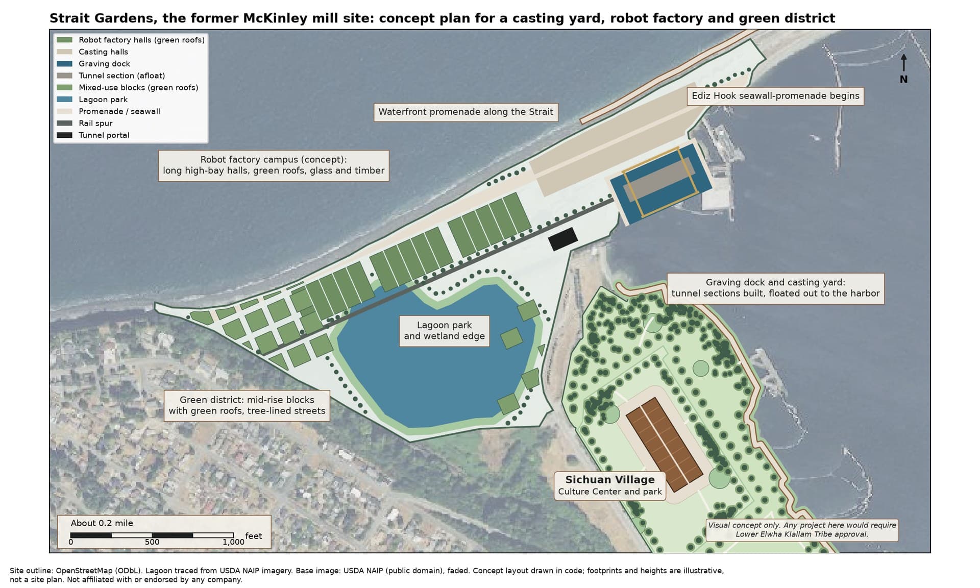
The working name for the former McKinley mill site at the base of Ediz Hook is Strait Gardens: a green waterfront district that is also a working yard. It has two jobs.
The first is the casting yard. Tunnel sections are built in a graving dock along the water, floated out, towed to their place and sunk into a trench on the seabed. That is how the world's big immersed tunnels have been made: Denmark built a purpose-built factory in Copenhagen North Harbour for the Øresund tunnel, and the Fehmarnbelt tunnel between Denmark and Germany is being cast at a factory at Rødbyhavn with six production lines and basins nearly 36 feet deep.
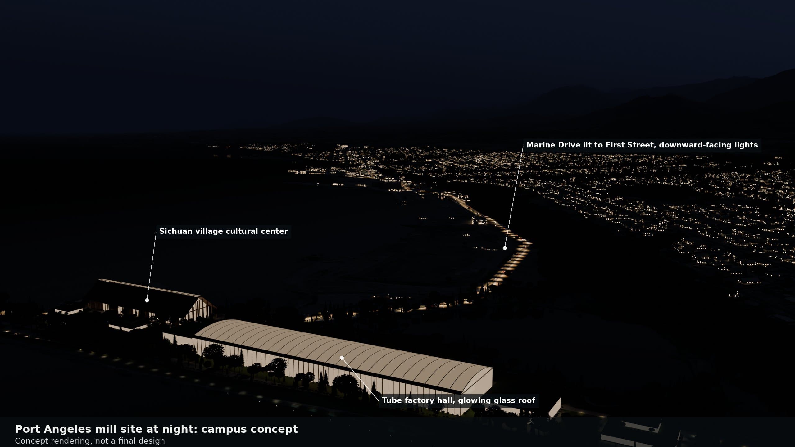
The second is an advanced factory campus. George's vision is a robot factory, for example building humanoid robots like Optimus, and parts for Starbase programs, alongside a factory that builds and services tunnel-boring machines for the yard next door. The halls are long, low and high-bayed, with green roofs, glass and timber, and they connect straight to rail, the tunnels and the port. Tesla and SpaceX are not involved and have not endorsed any of this.
The look takes its cue from Singapore's garden city: green roofs, vertical greenery, garden towers around a restored lagoon, park corridors running between the halls, and a restored shoreline with a public promenade along the Strait.
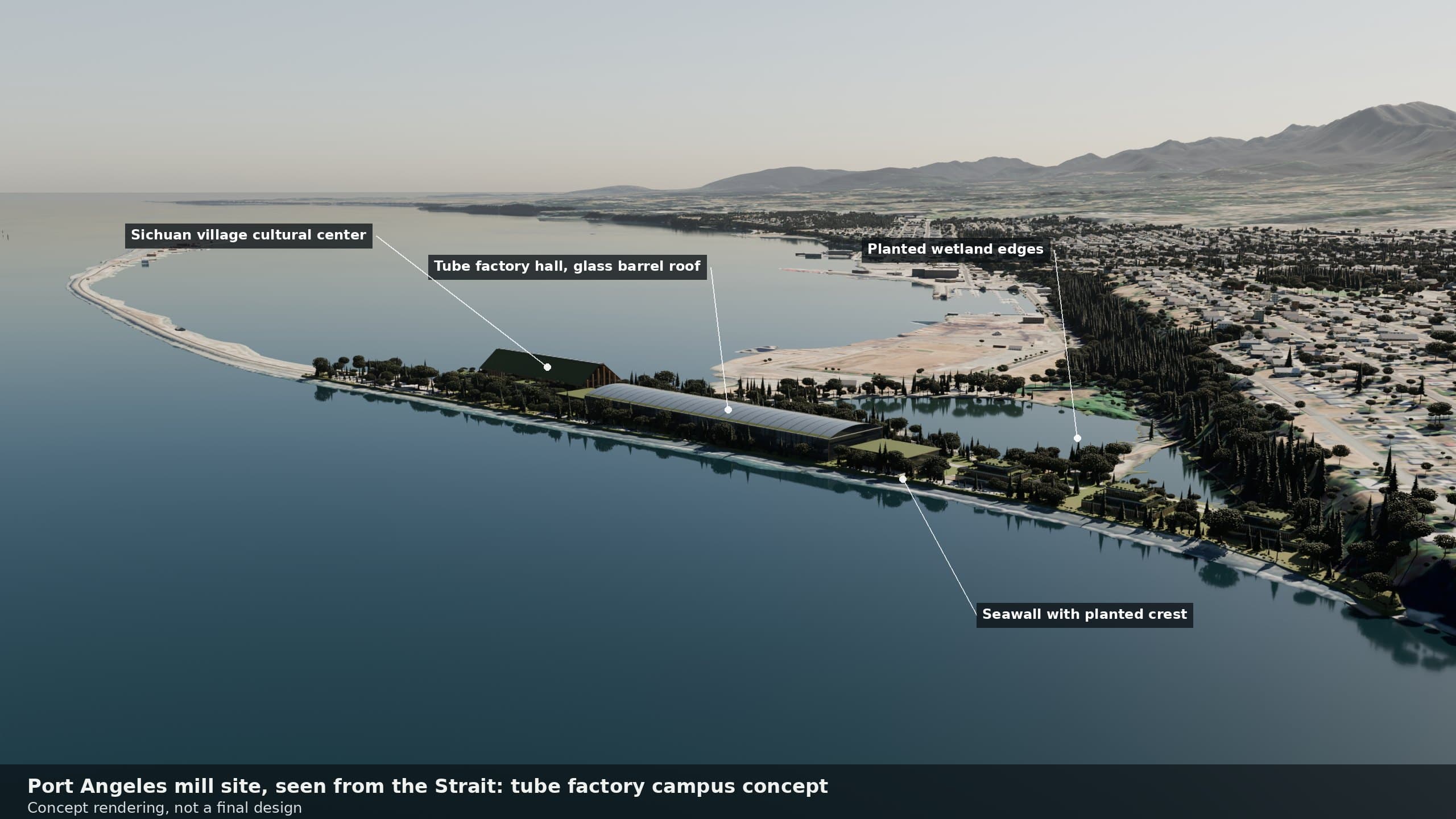
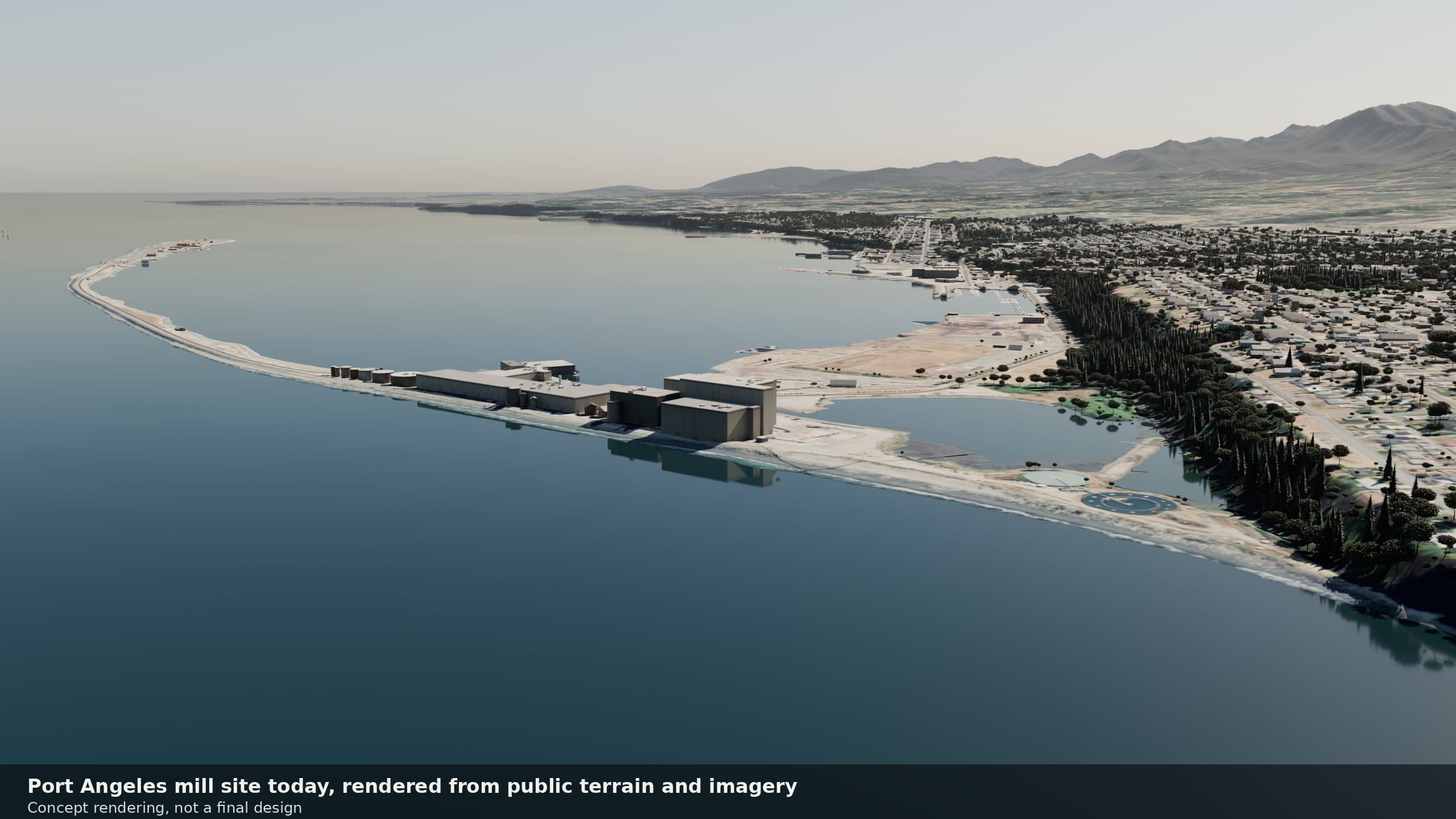
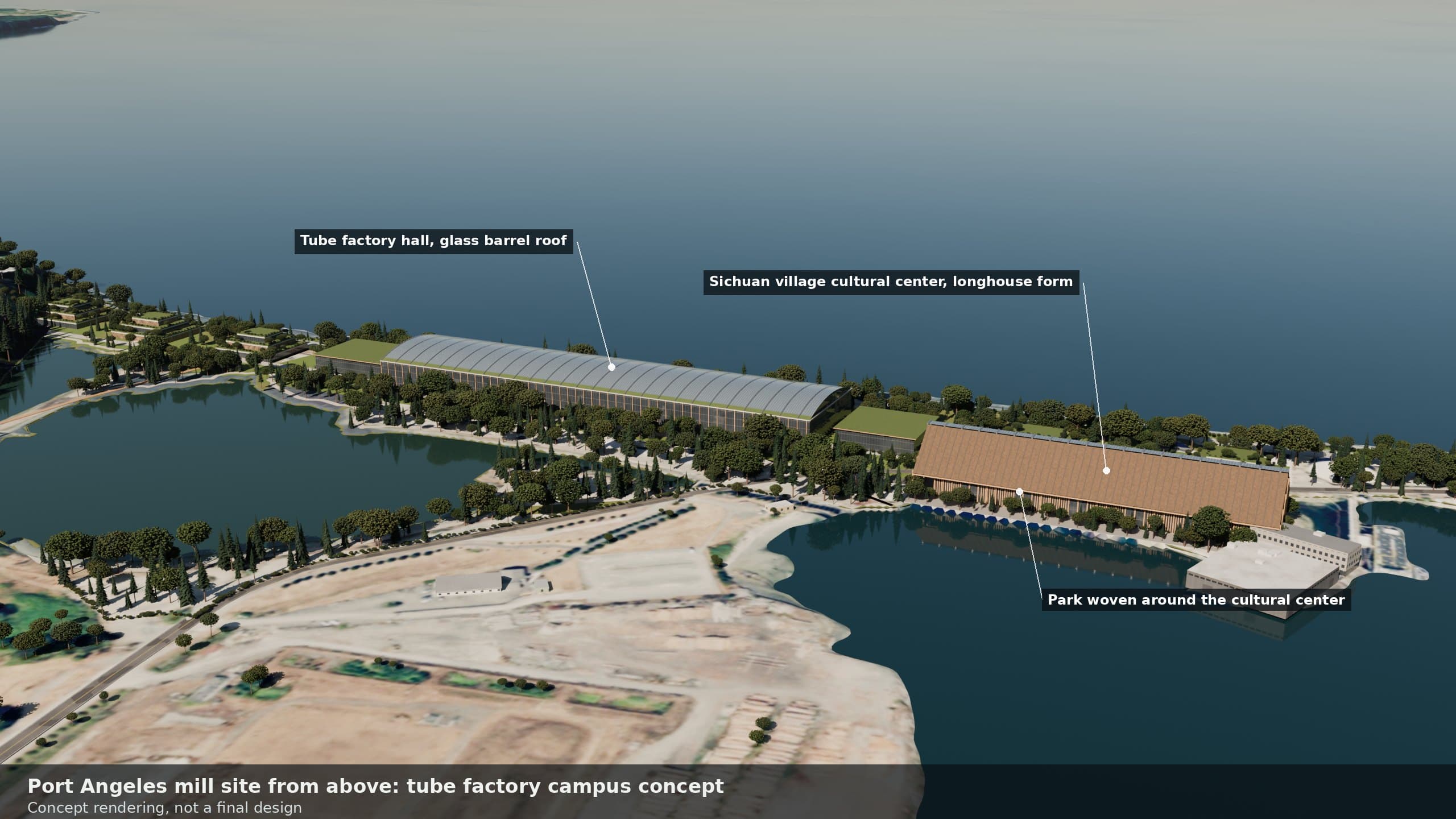
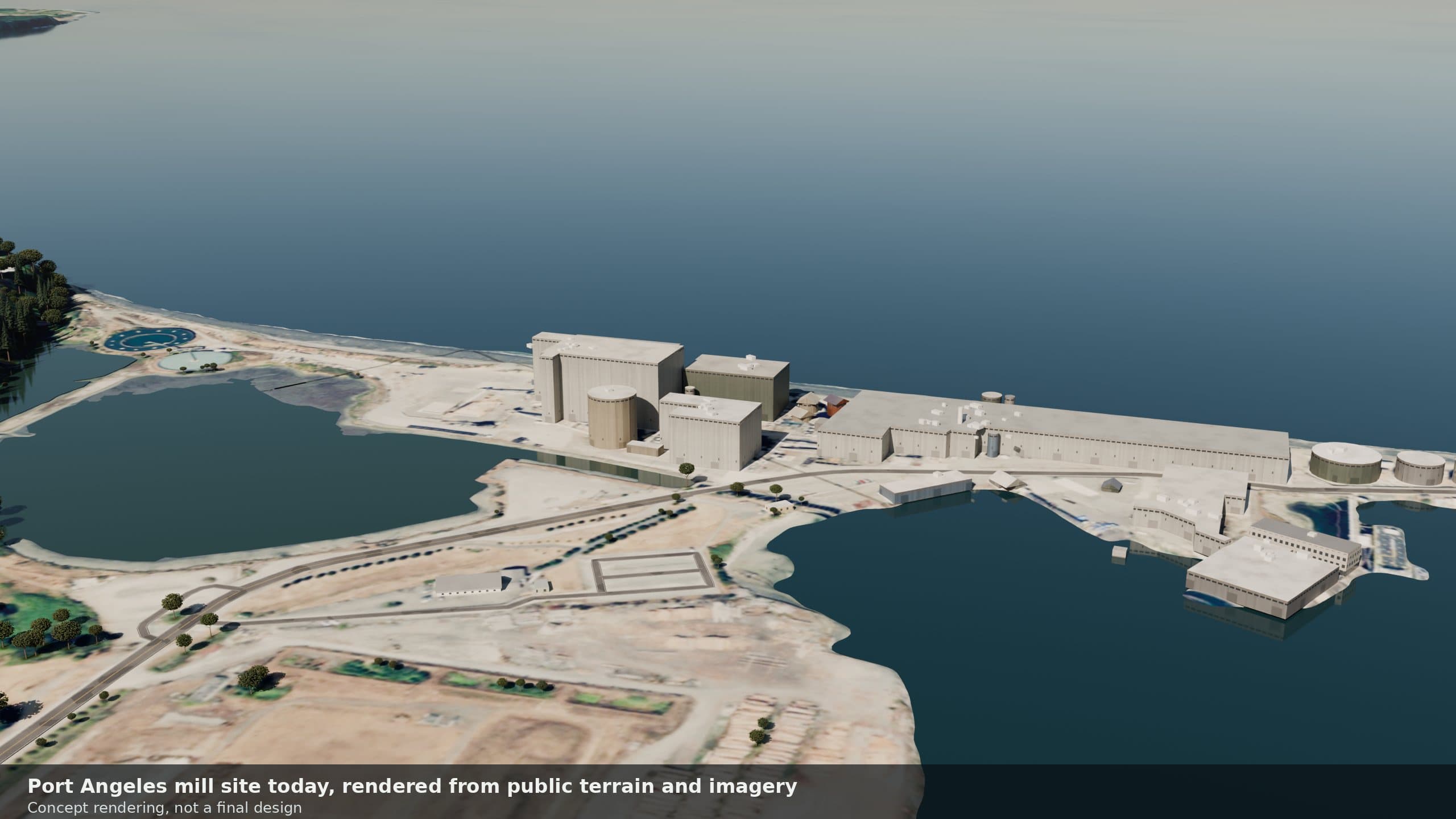
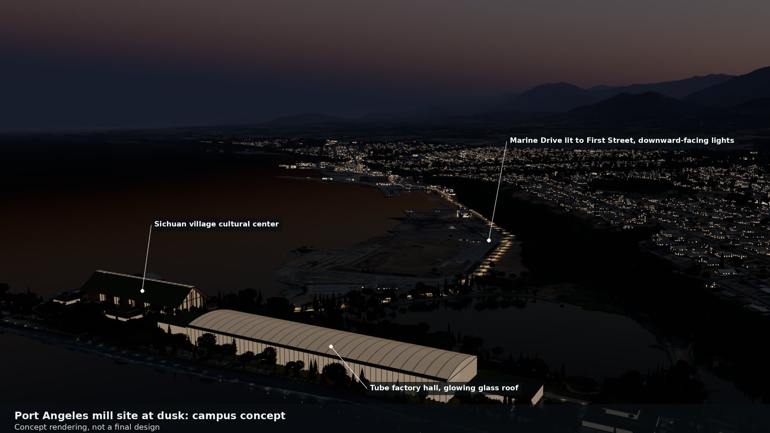
The concept plan below shows the layout of the yard, the halls and the green district. More on the Mill site page.
Step 1
Cast on shore
Sections are cast in concrete, or built in steel, at a yard on the old mill waterfront.
Step 2
Float out
Ends are sealed with temporary bulkheads, the basin or dock is flooded, and the section floats.
Step 3
Tow
Tugs tow the floating section across the harbor to its place on the route.
Step 4
Sink and join
Ballast lowers it into a dredged trench; water pressure seals the joint to the last section.
Washington has worked on this waterfront before, and the lesson matters. The state began a graving yard at the base of Ediz Hook to build Hood Canal Bridge pontoons and stopped in December 2004 after Tse-whit-zen, a Lower Elwha Klallam village and burial ground, was uncovered there. George believes any yard on this waterfront should start by inviting the Lower Elwha Klallam Tribe to the table.
Building for the world
Long term, George believes Port Angeles could make tunnel elements and ship them to projects around the Pacific, the way shipyards export hulls. There is a partial precedent: the steel sections of Boston's Ted Williams Tunnel were built in Baltimore and carried about 400 miles by sea. A yard that first serves the network's own tunnel lines is the natural first step toward that larger idea.
Latest news
What is happening at the mill site now, from public records and local reporting, newest first.
Latest news: McKinley mill site
Last checked
- City CouncilUpcoming
Candelaria scheduled to brief the City Council
The October 20 Port Angeles City Council agenda lists a presentation by Candelaria, described as the potential purchaser of the McKinley mill, as an information-only item. No Council action is listed.
Source: City of Port Angeles, City Council agenda, October 20, 2026 (item I-1)
- News
EDC director describes a small data center idea at the mill
At a County candidate forum, the Clallam EDC director described the buyer's idea as a small data center of under 2,000 square feet that would use no water, and said the moratorium came before any permits were submitted. This is a secondhand description, not a filed proposal.
Source: Peninsula Daily News
- City Council
Candelaria representative and supporters speak at Council
Draft minutes of the October 6 Council meeting record that a Candelaria Industries representative spoke during public comment about small modular computer containers and their water use and noise. Several other speakers, including the Clallam EDC director, urged the Council to work with or explore the company's proposal.
Source: City of Port Angeles, City Council agenda packet, October 20, 2026 (minutes of October 6)
- Port
Port CEO asks Council for workshops on the mill site
At the moratorium hearing, Port of Port Angeles CEO Paul Jarkiewicz asked the Council for a workshop or two to understand what was intended for the mill site. Other speakers asked for permanent limits on data centers.
Source: Peninsula Daily News
- News
Moratorium stays unchanged as Council outlines next rules
Radio Pacific reported that the Council kept the six-month pause as is, and that a Council member suggested future rules regulate the impacts of large resource users rather than defining data centers. The Planning Commission and Utility Advisory Committee are expected to help draft recommendations.
Compiled automatically from public sources: City of Port Angeles meeting records, the Port, Clallam County, the buyer's own statements, and local news. Summaries are our own. Third Harvest is not affiliated with any of the parties named here.
There are two main ways to put a tunnel under water, and George considers the difference the key technical point of the whole project.
Immersed tubes are prefabricated sections laid in a trench dredged in the seabed, joined underwater, then backfilled and armored. Øresund, Fehmarnbelt, Korea's Busan-Geoje link, the Hong Kong-Zhuhai-Macao crossing and BART's Transbay Tube under San Francisco Bay were built this way.
Bored tunnels are dug through rock or soil beneath the seabed by a tunnel boring machine, like the Channel Tunnel or Norway's Rogfast.
George's direction is that most Salish Sea tunnels should be immersed tubes, with boring used only where a tunnel arrives at a port: short bored sections that carry the tube under the shoreline and the waterfront to a portal on land.
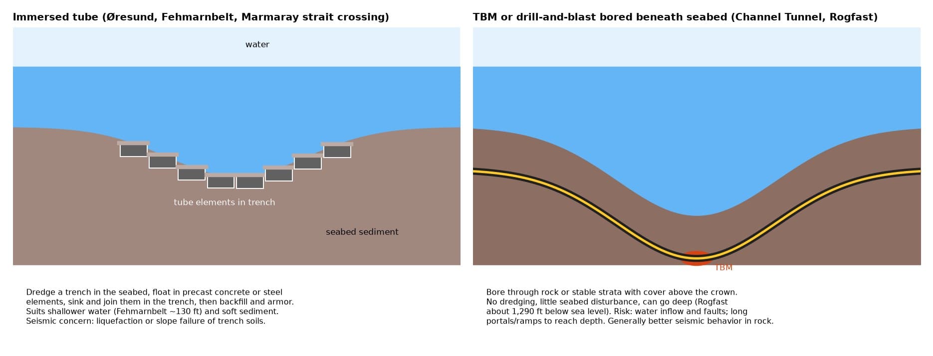
He also believes a specialist tunneling contractor should be hired for that portal boring. No contractor has been chosen or contacted. George's split, immersed tubes by marine contractors and boring only at the landings, keeps each builder on the kind of work it already does.
The industry body ITA-AITES says immersed tunnels are typically built in about 16 to 100 feet of water, and the deepest built are about 200 feet (Marmaray, Istanbul), 160 feet (Busan-Geoje) and 150 feet (Hong Kong-Zhuhai-Macao). The harbor approaches fit that range well.
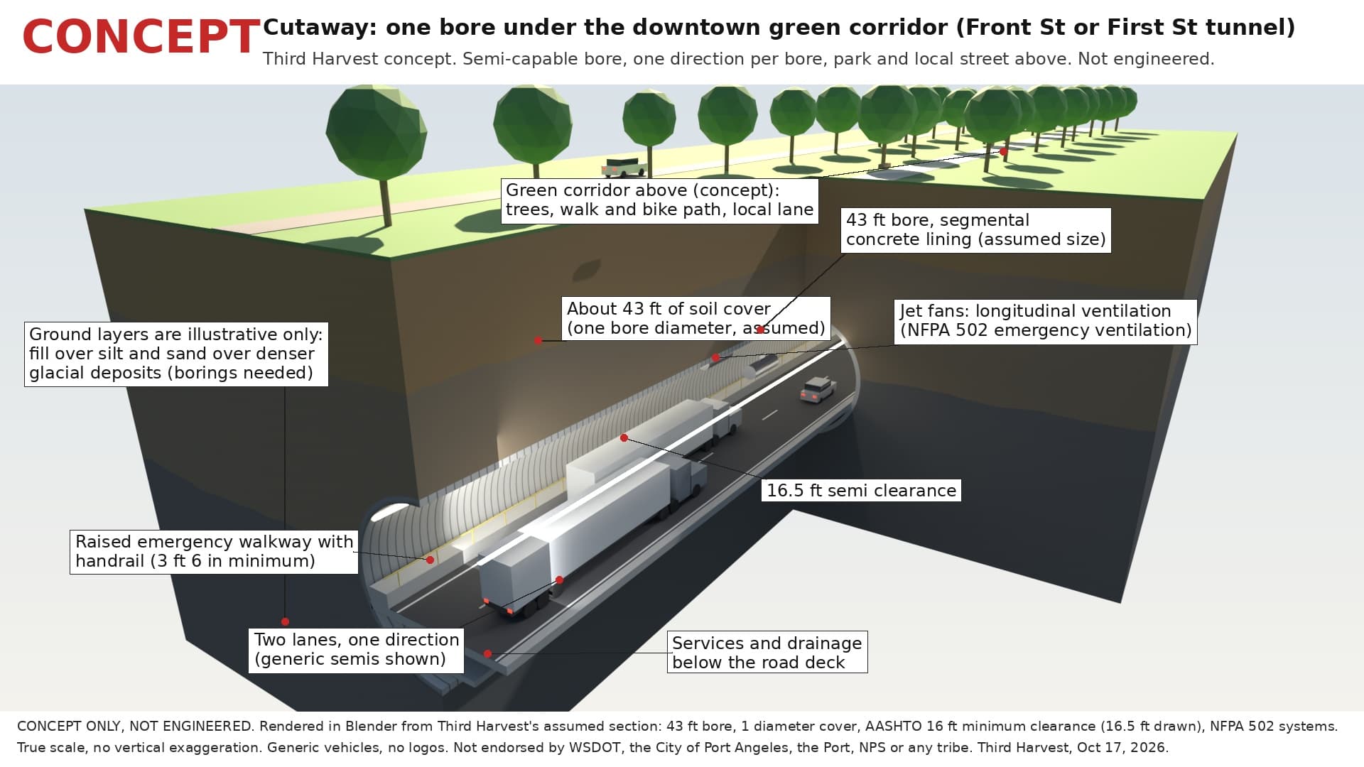
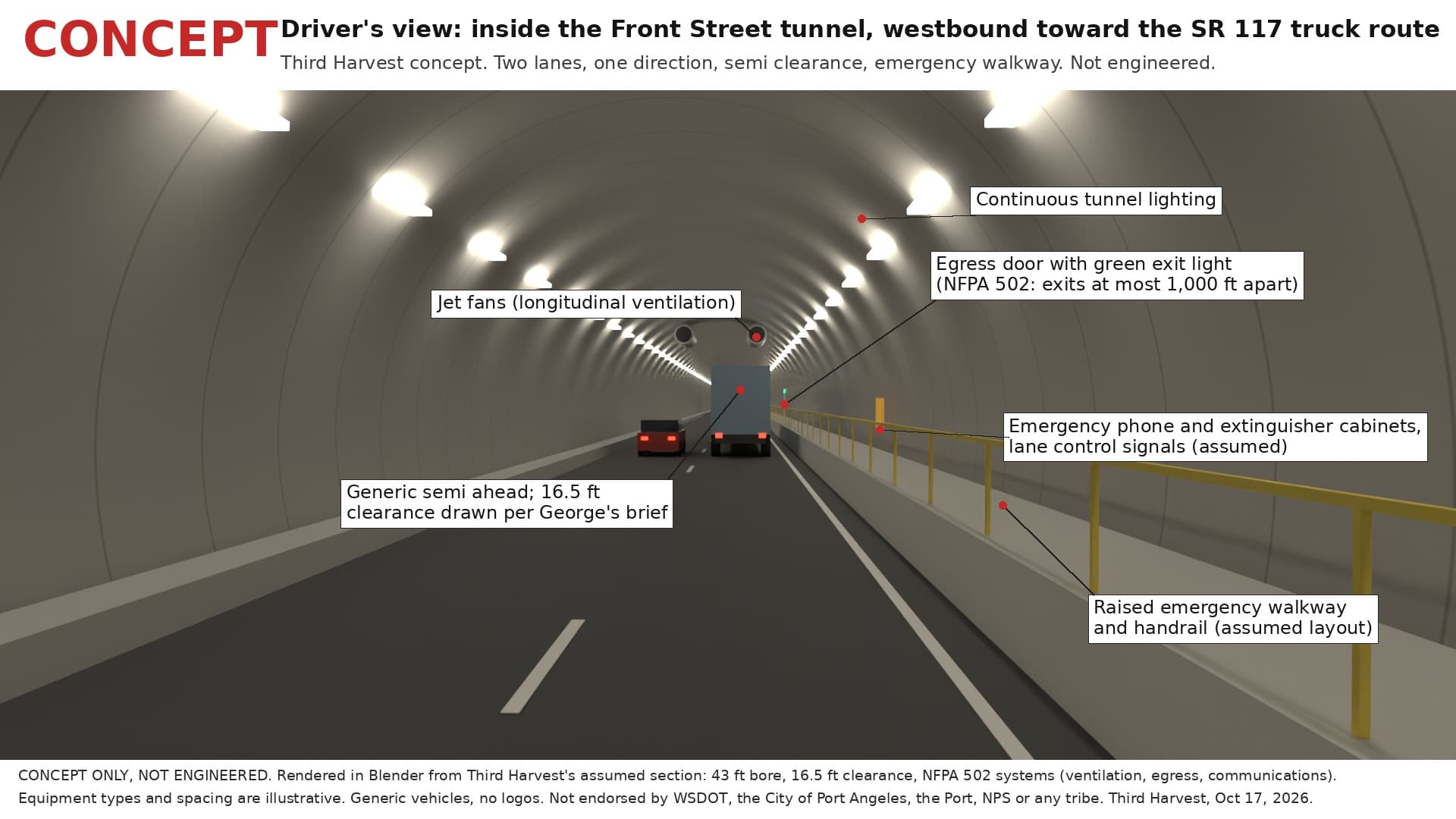
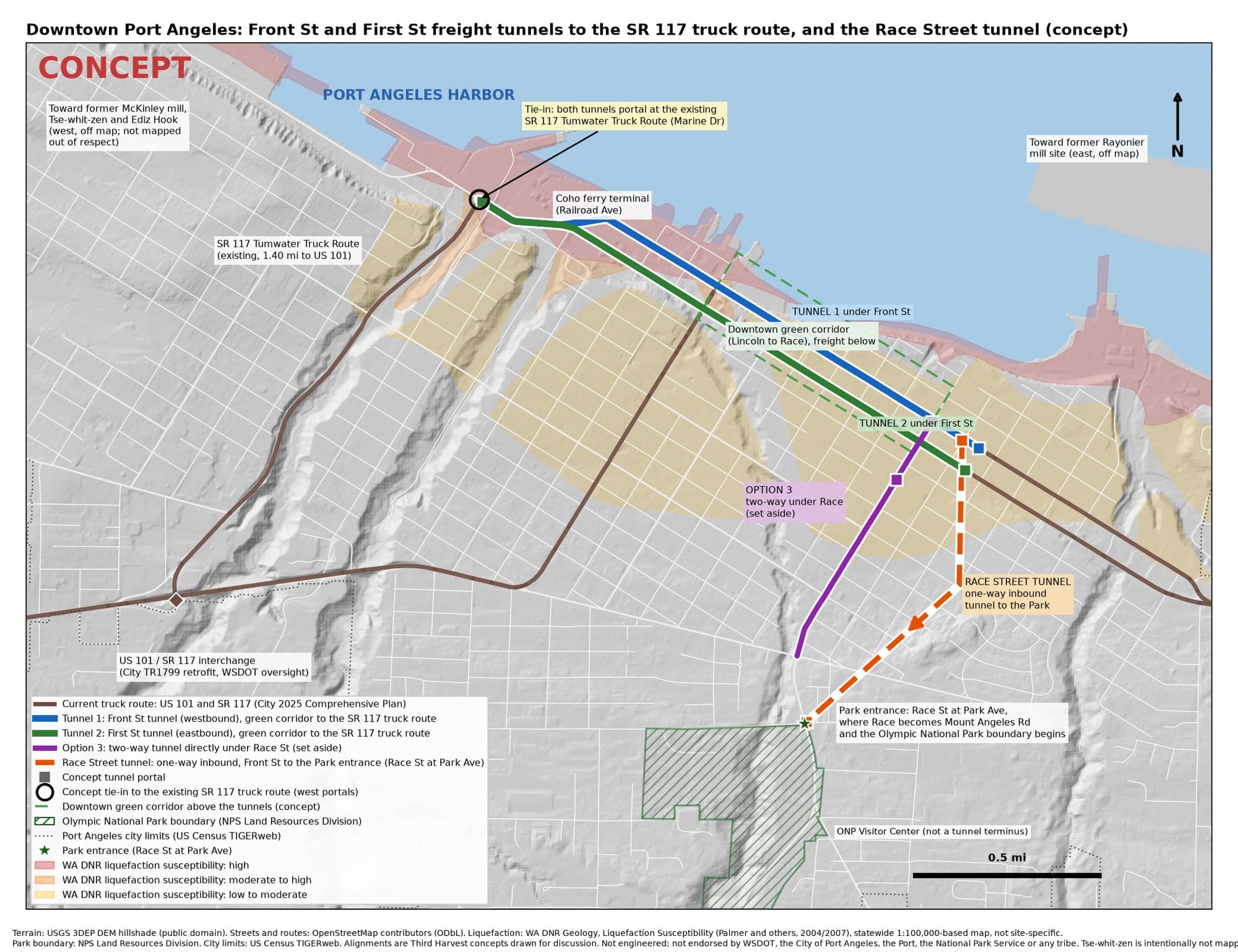
George's plan takes US 101 through-traffic and freight under downtown in two tunnels, one under Front Street and one under First Street. Both run west and connect to the existing US 101 truck route further down, the SR 117 Tumwater Truck Route, as one continuous underground freight path, so trucks never surface downtown.
Above them, Front Street and the core become a green corridor with safe crossings, local and delivery access, and a clear emergency-access lane.
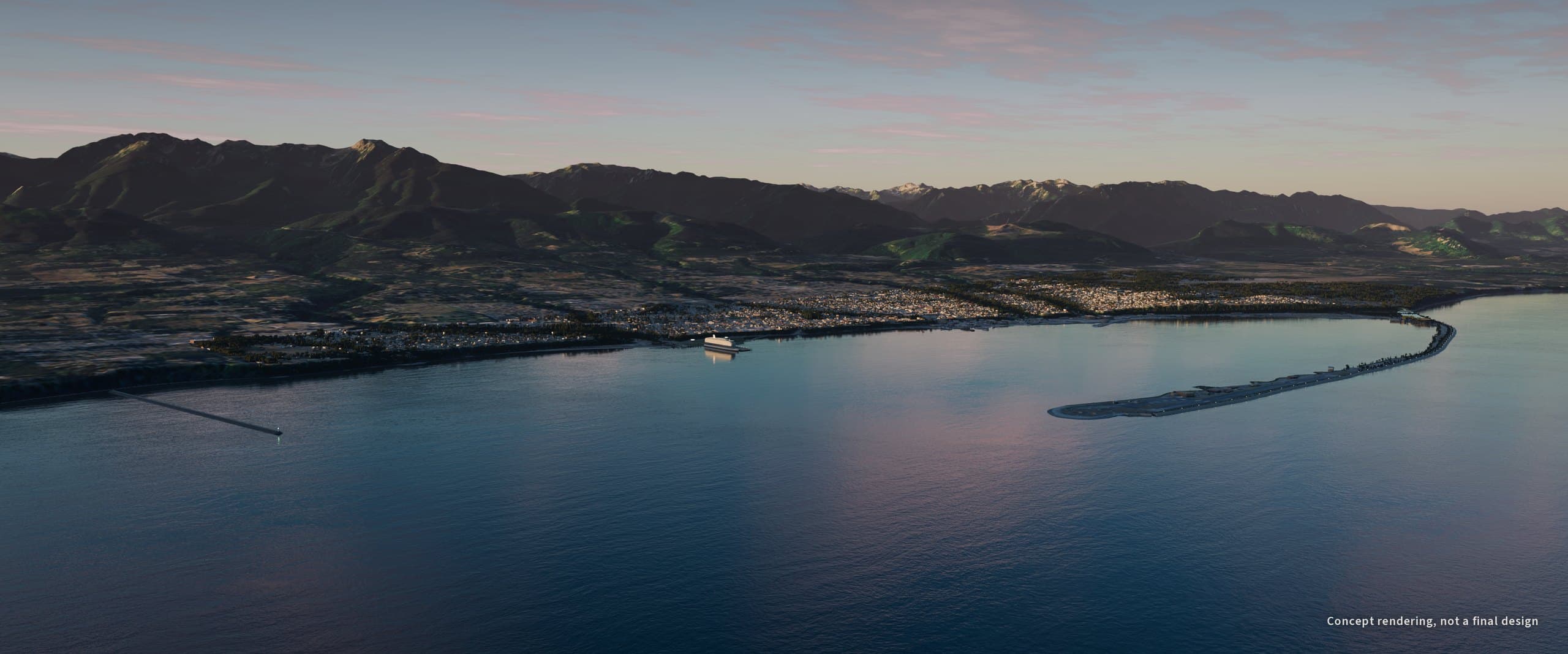
Ediz Hook already protects the harbor. The U.S. Army Corps of Engineers has kept it armored with stone and fresh cobble since 1977, because bluff armoring and the old Elwha dams starved the spit of the sediment that used to rebuild it.
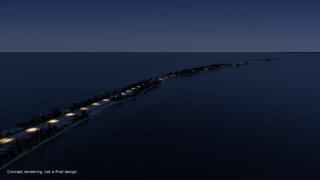
George's idea is to rebuild the whole north shore of the Hook as an engineered tsunami seawall that doubles as a promenade for walking and biking, kept low and green so people still see the water. It runs the full length of the Hook, through the Coast Guard Air Station and the Navy's pier to the tip. His reasoning is simple: the wall protects the base, and carrying it to the end makes the whole Hook permanently stronger. The federal section is federal land, so that stretch needs federal agreement.
Both shores are restored with native planting: shore pine, Douglas-fir and native meadow on the bay side and behind the wall, with low native grasses only near the airfield.
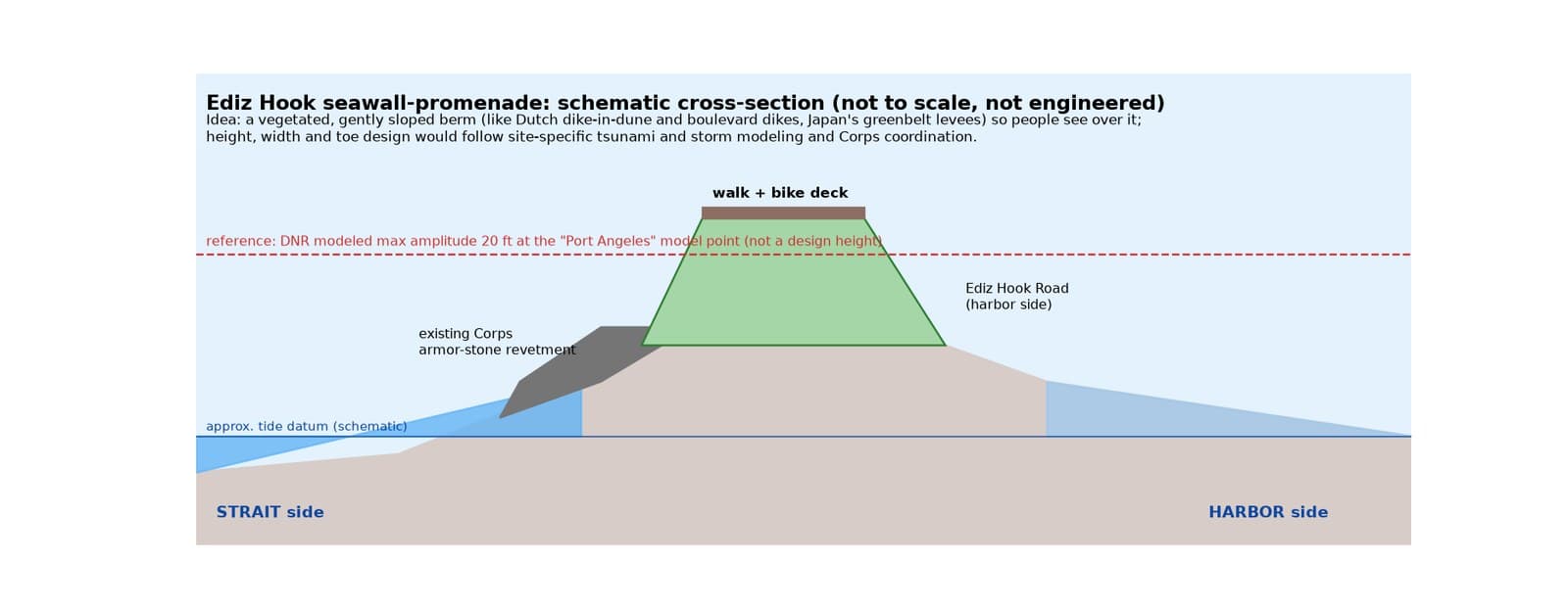
The models he points to are Dutch sea defenses you can stroll on: Katwijk hides its dike inside widened dunes, and Scheveningen built its sea defense into a boulevard with cycle paths. Seattle's Elliott Bay seawall shows the habitat side: a textured face, a light-passing sidewalk and a habitat bench, where observers counted 10,000 juvenile salmon in a single day in May 2018. Design guidance exists for this work: ASCE 7 has carried a tsunami chapter since 2016, and FEMA P-646 covers structures people can climb onto to escape a tsunami.
George calls the network the Salish Tunnel system, and he sees the Rayonier hub as its start: three lines, drawn as one continuous tunnel with no breaks between stops. The West End line runs west to Joyce, about 13 miles from the hub, then about 26 miles to Clallam Bay, and about 18 miles more to Neah Bay, Makah connection, the last stop: about 57 miles in all. East, a shared trunk runs about 24 miles to Sequim at Port Williams Beach and about 17 miles more to Port Townsend. From Port Townsend the Olympia line runs about 108 miles under Hood Canal to Olympia, about 149 miles from the hub. The Seattle line runs about 31 miles subsea through Admiralty Inlet to Edmonds and about 17 miles more under the Sound to downtown Seattle, about 89 miles from the hub. These are concept routes, not engineered alignments.
| Line | Stretch | Along the line |
|---|---|---|
| West End | Rayonier hub to Joyce | about 13 mi |
| West End | Joyce to Clallam Bay | about 26 mi |
| West End | Clallam Bay to Neah Bay, Makah connection | about 18 mi |
| West End | Rayonier hub to Neah Bay, Makah connection, in all | about 57 mi |
| East trunk | Rayonier hub to Sequim, Port Williams | about 24 mi |
| East trunk | Sequim to Port Townsend | about 17 mi |
| Olympia | Port Townsend to Olympia, under Hood Canal | about 108 mi |
| Olympia | Rayonier hub to Olympia, in all | about 149 mi |
| Seattle | Port Townsend to Edmonds, subsea through Admiralty Inlet | about 31 mi |
| Seattle | Edmonds to downtown Seattle, subsea under the Sound | about 17 mi |
| Seattle | Rayonier hub to downtown Seattle, in all | about 89 mi |
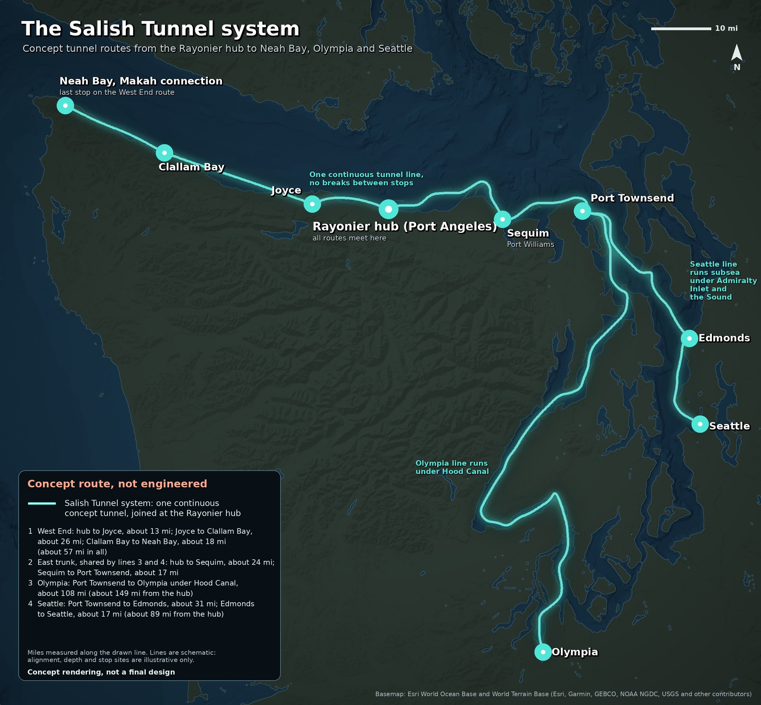
The land and coastal legs come first: west to Neah Bay, and east to Sequim and Port Townsend. The crossing from Port Townsend to Edmonds goes under Admiralty Inlet, where NOAA puts the sill near 210 feet, and then under deeper water toward Edmonds.
George believes some tunnel sections could double as data centers cooled by the sea, with dry walk-in access for maintenance. Underwater data centers are real: Microsoft's Project Natick ran 864 servers in a sealed pod off Scotland from 2018 to 2020 and reported one-eighth the failure rate of a land-based group. China's HiCloud runs commercial subsea modules off Hainan and Shanghai, and Norway cools mountain data halls with cold fjord water.
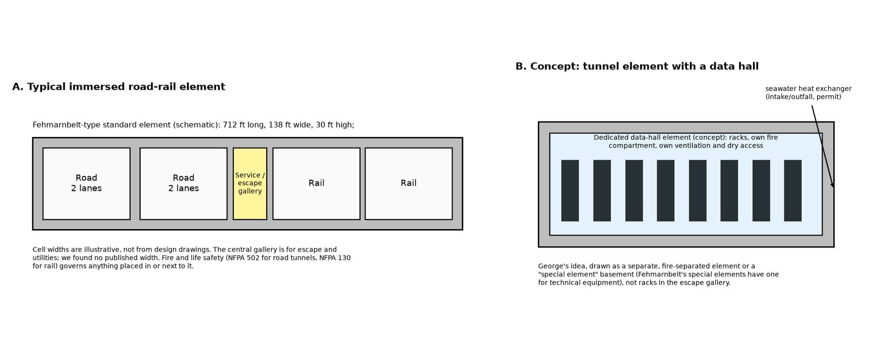
In George's design the data halls sit in their own fire-sealed elements beside the traffic tubes, since fire codes for road and rail tunnels (NFPA 502 and NFPA 130) keep the escape galleries clear for people.
For George's vision to move from idea to project, these pieces line up:
- The tribes are partners George would invite. The Lower Elwha Klallam Tribe at Tse-whit-zen, the base of the Hook and the Rayonier waterfront, and the treaty tribes whose fishing grounds these routes cross.
- The waterfront is available. The Rayonier cleanup design and its owner, and the McKinley site's new owner.
- Federal agreement for the seawall's run through the Coast Guard Air Station and the Navy's pier.
- The Corps, the City and the Port agree on what Ediz Hook becomes, with site-specific tsunami modeling setting the wall's height.
- The seabed is surveyed so real borings decide where tubes go and where boring is needed.
- A builder is chosen. George believes a specialist tunneling contractor should do the portal boring. None has been contacted, and there is no agreement of any kind.
- U.S. Geological Survey, Port Angeles Harbor case description (largest natural deep-water harbor on the U.S. West Coast, depths over 90 feet): https://www.cerc.usgs.gov/orda_docs/CaseDetails?ID=233
- Lower Elwha Klallam Tribe, habitat restoration and Port Angeles Harbor: https://www.elwha.org/departments/natural-resources/habitat-restoration/
- Port of Port Angeles, harbor overview: https://portofpa.com/marine/harbor-overview/
- Washington Department of Ecology, Rayonier Mill cleanup (status, timelines, land use): https://ecology.wa.gov/spills-cleanup/contamination-cleanup/cleanup-sites/puget-sound/port-angeles-harbor/rayonier-mill
- Lower Elwha Klallam Tribe, Tse-whit-zen: https://www.elwha.org/culture-history/tse-whit-zen/
- U.S. Army Corps of Engineers, Seattle District, Ediz Hook: https://www.nws.usace.army.mil
- Peninsula Daily News, Navy pier on Ediz Hook in use (Sept 2018): https://www.peninsuladailynews.com/2018/09/16/navys-peninsula-submarine-escort-facility-in-use-now/
- Washington Geological Survey, tsunami hazard maps of the Olympic Peninsula: https://washingtonstategeology.wordpress.com/2022/01/10/new-tsunami-hazard-maps-of-the-olympic-peninsula/
- City of Seattle, Elliott Bay seawall: https://www.seattle.gov/waterfront/projects/seawall
- FEMA P-646, Guidelines for Design of Structures for Vertical Evacuation from Tsunamis: https://www.fema.gov/sites/default/files/2020-08/fema_earthquakes_guidelines-for-design-of-structures-for-vertical-evacuation-from-tsunamis-fema-p-646.pdf
- ITA-AITES, immersed tunnels working group: https://www.ita-aites.org/
- Femern, Fehmarnbelt tunnel construction: https://femern.com/
- Pacific Northwest Seismic Network, Cascadia Subduction Zone: https://pnsn.org/outreach/earthquakesources/csz
- Northwest Indian Fisheries Commission, treaty rights: https://nwifc.org/about-us/treaty-rights/
- Terrain: USGS 3DEP. Imagery: USDA NAIP. Bathymetry: NOAA ETOPO1. Map features and building footprints: OpenStreetMap contributors.