
Vision · Concept
Return to Earth, starting at Quillayute
Third Harvest believes the Olympic Peninsula deserves a thousand-year purpose: forests, water, food, a working port, and a place to come home to.
That horizon is far off. The gap between now and then is the work, and it is ours to do.
What happens between now and then is on us.
This is the hub for Third Harvest's vision. Start with the timeline and the deck: the idea, the renderings and the concepts, what Forks has already built, and where Quillayute starts. Then open any project below.
From today to the thousand-year horizon
Concept. Goals, not schedules anyone has agreed to.2026
Today
Plans, research and the first conversations.
Near-term steps (this decade)
Later steps, toward the century-one goal
2126
Century-one goal
The first tunnel segment open at Port Angeles, and, if an Olympic Peninsula tribe chooses to partner, a first tribally operated facility.
3026
The thousand-year horizon
A Peninsula with a lasting purpose and economy, and a place to come home to.
Return to Earth: a thousand-year homecoming
Everyone is talking about leaving Earth. Third Harvest is asking a different question: if people ever come back from Mars, where do they come home to?
Our proposal is the Olympic Peninsula: a place to start over, built slowly and on purpose, with a purpose and an economy meant to last a thousand years.
Today, 2026
Plans, research and the first conversations.
Century-one goal, 2126
The first tunnel segment open at Port Angeles, and, if an Olympic Peninsula tribe chooses to partner, a first tribally operated facility.
The thousand-year horizon, 3026
A Peninsula with a lasting purpose and economy, and a place to come home to.
What happens between now and then is on us.
Concept. Goals, not schedules anyone has agreed to. See the timeline.
This is Third Harvest's concept and aspiration. No agency, company or tribe has designated, endorsed or agreed to it.
Why a homecoming
- A place to land. The people who go out will need somewhere to land, heal and relearn life on a planet. We want to build that place before anyone asks for it.
- A thousand-year purpose. Forests, water, food, a working port and a small airport: an economy that serves the Peninsula now and a homecoming later. The century-one goal is a first tunnel segment open at Port Angeles and, if an Olympic Peninsula tribe chooses to partner, a first tribally operated facility. What happens between now and then is on us.
- Third Harvest's view. A Mars story with only a departure asks people to give something up. A story with a homecoming gives them a place in it, and we believe that may soften some of the objections.
What this is not
Not a designation by any government, space agency or company. Not a plan anyone has approved, and no company has joined or endorsed it.
Starbase Quillayute, at first light
 Concept rendering
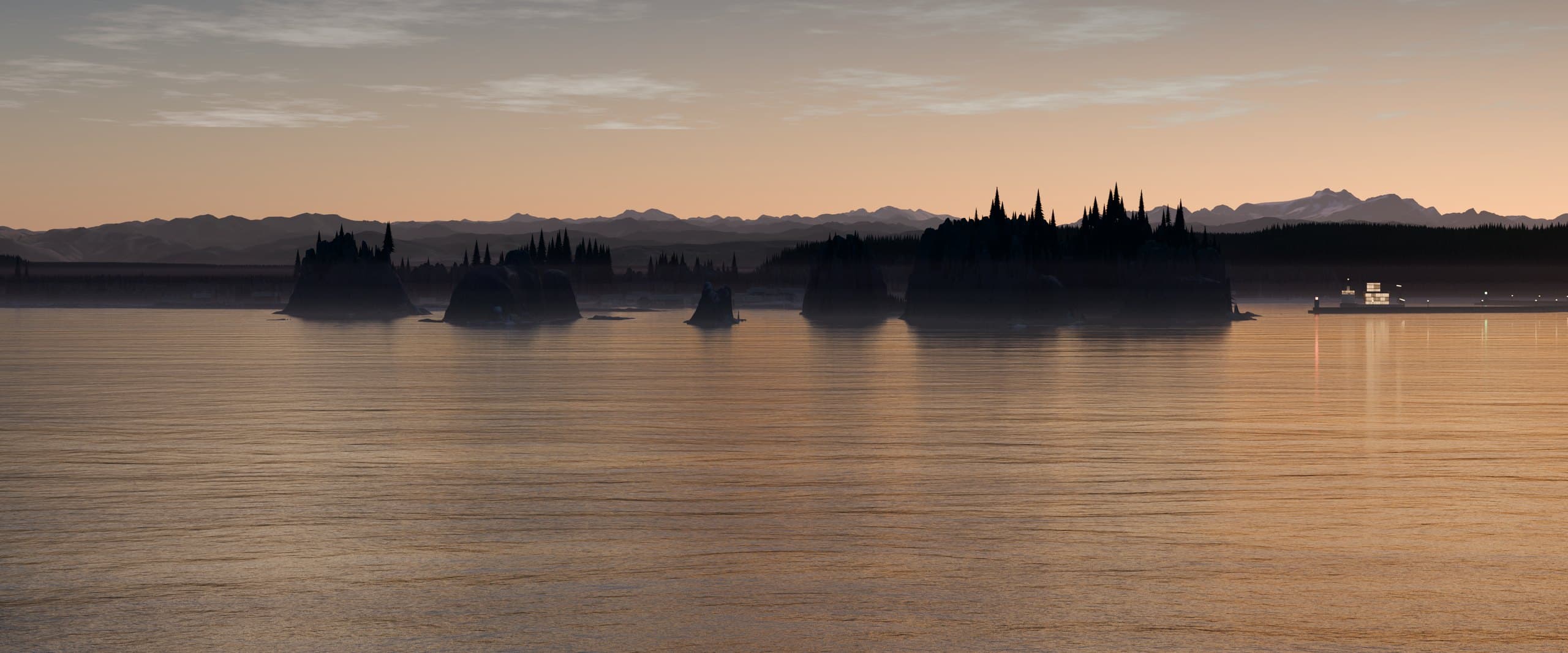
These renderings are meant to open doors: to show possible partners what the Peninsula could offer before anyone is asked to commit. Third Harvest plans to look for siting and infrastructure partners for the Olympic Peninsula.
No company has been contacted. No company, agency or tribe is involved in, or has endorsed, anything in this deck.
Quillayute Airport today, and the concept
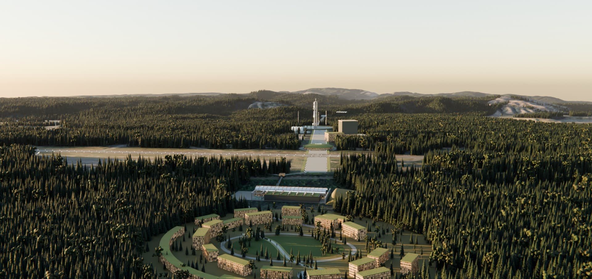
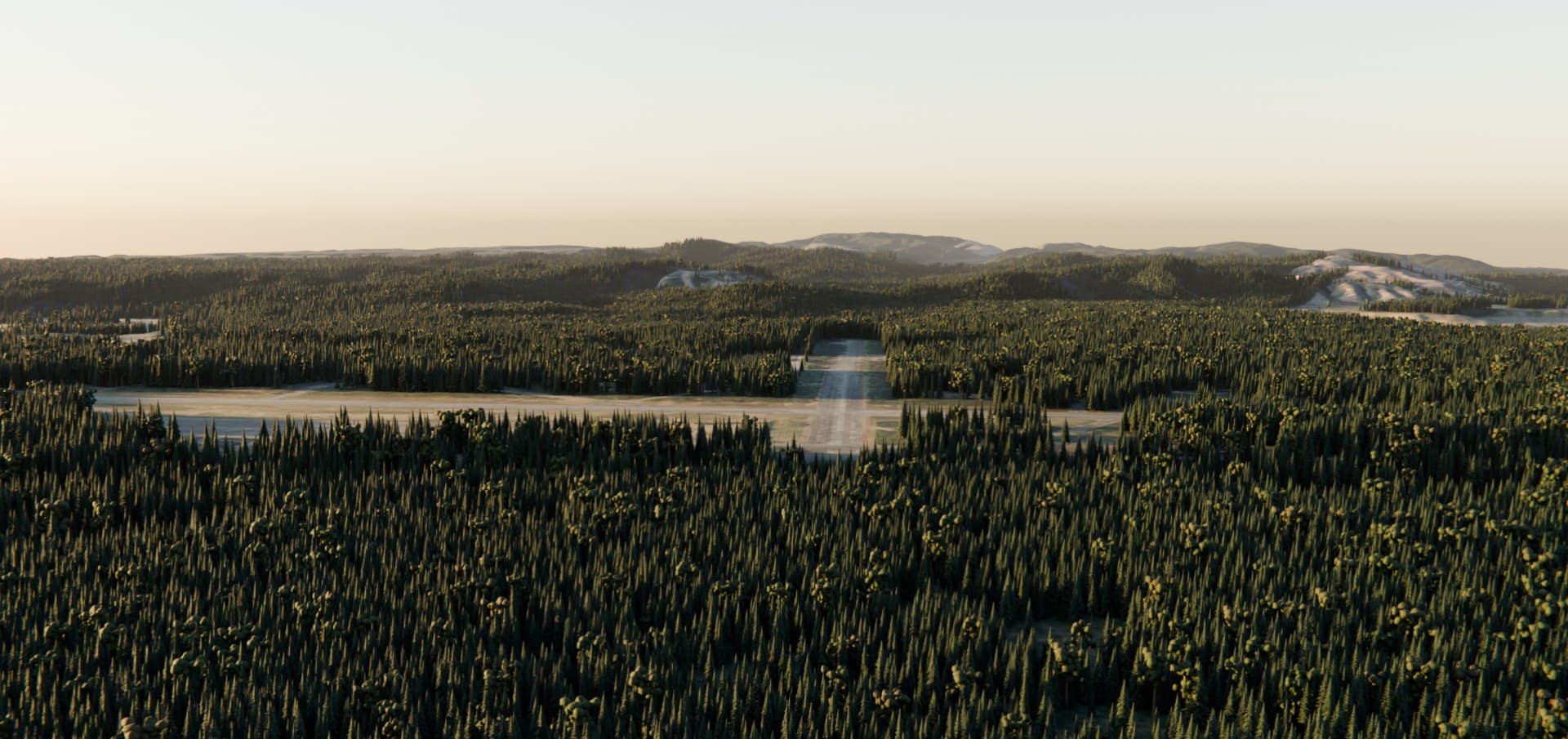
Real terrain (USGS 3DEP) and aerial imagery (USDA NAIP), with forest drawn where the imagery shows canopy. Quillayute Airport belongs to the City of Forks. None of this is approved or endorsed by the City, the FAA, any tribe or any company. A ground-level rendering of the Return-to-Earth Center comes next. Read the deep page →
Port Angeles as a true port city
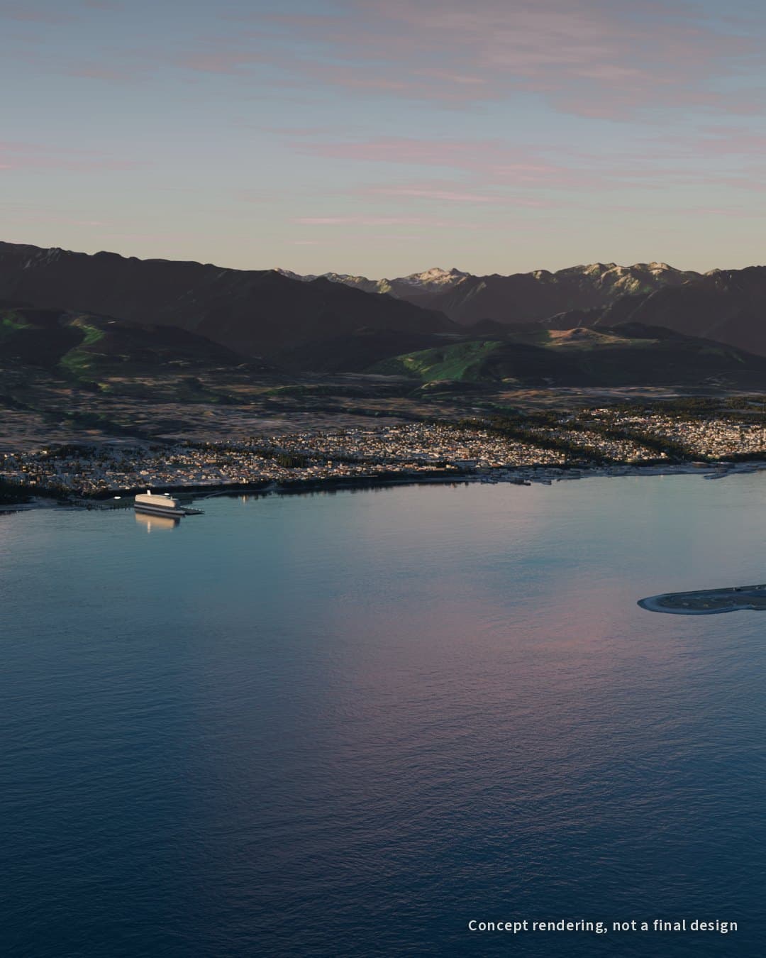
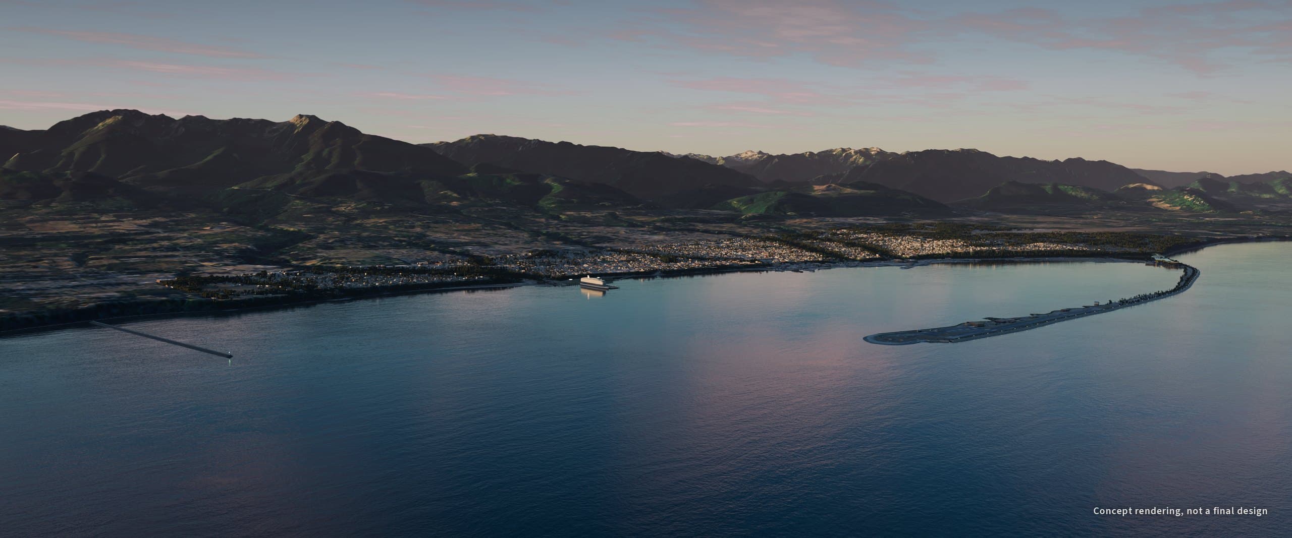
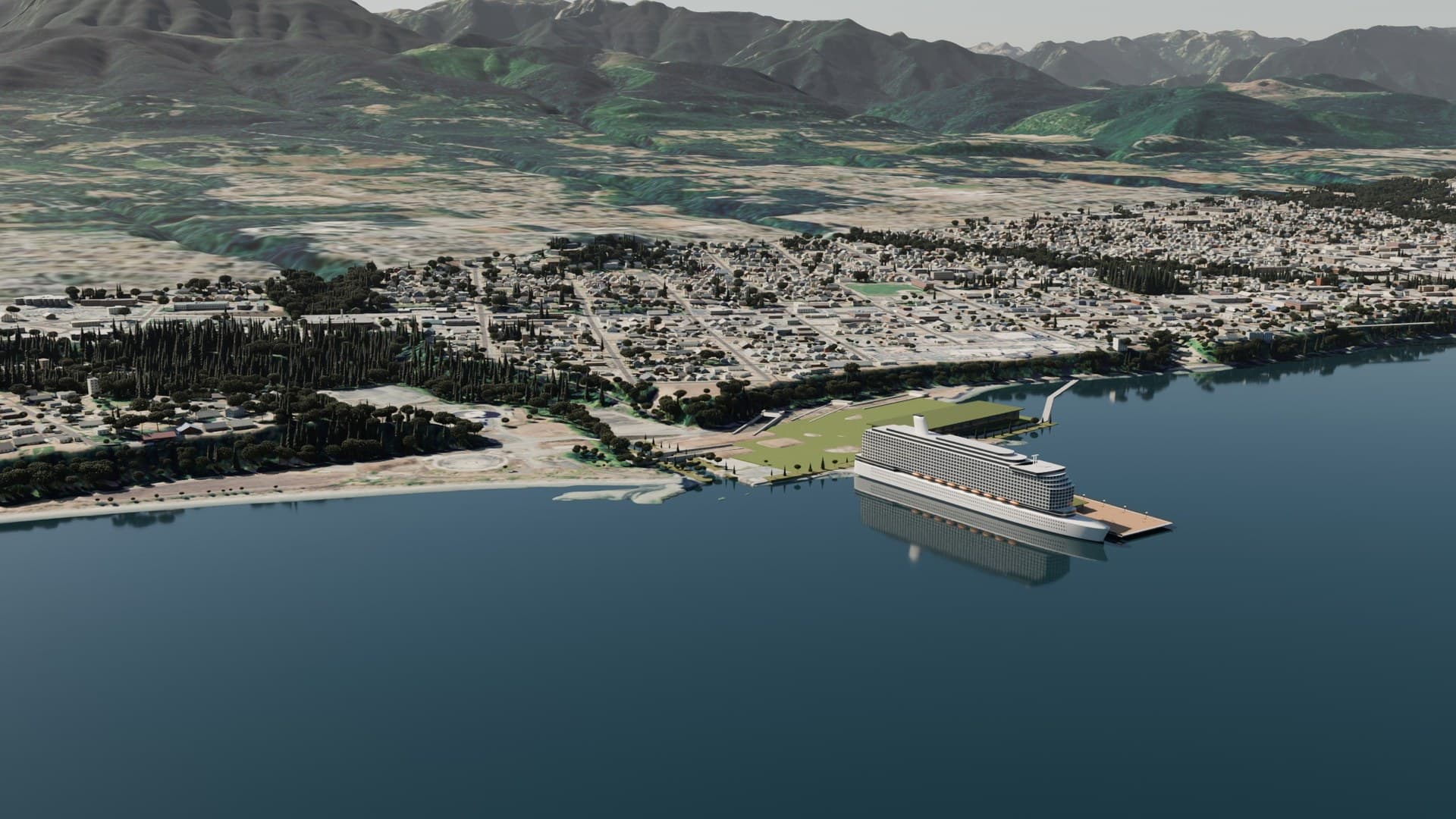
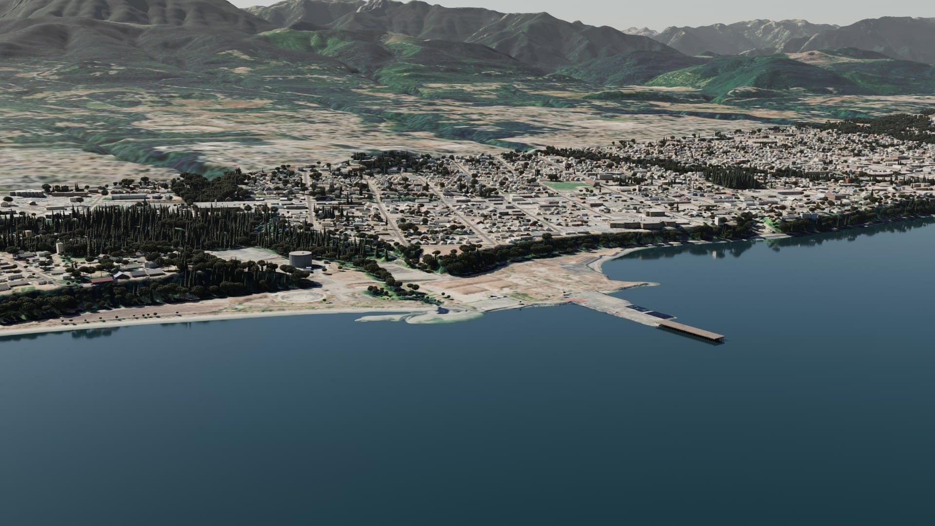
Mill flip: the mill site as the tunnel tube factory →
Port Angeles Harbor is considered the largest natural deep-water harbor on the U.S. West Coast, with depths over 90 feet near its eastern end, sheltered by the 2.5-mile spit of Ediz Hook (USGS; Lower Elwha Klallam Tribe). The Port Angeles page →
How the pieces fit
Exists today
- Quillayute Airport, owned by the City of Forks, with a 2024 master plan1
- Port Angeles Harbor, a natural deep-water harbor behind Ediz Hook2
- US 101, SR 112 and the SR 117 truck route, the Peninsula's freight roads3
- The Coho ferry from Port Angeles to Victoria4
- Olympic National Park and the Hurricane Ridge road5
Planned by others
- Forks: airport grants, runway work and a new sawmill at the industrial park1
- City of Port Angeles: SR 117 truck route interchange at US 101, to take about 1,400 freight vehicles a day off downtown streets3
- WSDOT: two US 101 roundabouts east of Port Angeles, construction expected in 20276
- Ecology: the Rayonier mill cleanup, now in design7
Only Third Harvest's idea
- Starbase Quillayute at the airport
- The Salish Tunnel system, a tunnel network from a Rayonier hub to Joyce, Clallam Bay and Neah Bay, Makah connection; to Sequim and Port Townsend; and on to Olympia and to Edmonds and Seattle
- Downtown freight tunnels and a Race Street tunnel toward the Park
- Strait Gardens, the Ediz Hook seawall and native gateway roundabouts
The left two columns are public record. The right column is a concept that no agency, tribe or company has reviewed or agreed to.
- City of Forks, Quillayute Airport Master Plan, 2024; see the Forks slides in this deck.
- USGS, Port Angeles Harbor case description.
- City of Port Angeles, RFQ TR1799, 2026.
- Black Ball Ferry Line, About Us.
- National Park Service, Visiting Hurricane Ridge.
- Radio Pacific, WSDOT timeline for US 101 roundabouts, Dec 2025.
- Washington Department of Ecology, Port Angeles Rayonier Mill.
Forest, food and a thousand-year economy
- The working forest. Clallam County has about 1,034,606 acres of forest, and about 430,732 acres of it is working forest.1 Timber sales help pay for the hospital, fire districts, the library and county roads.2 Third Harvest wants to keep that land working, harvested selectively and replanted. Forest management
- A nursery behind every harvest. Third Harvest is building toward the largest native plant nursery in Washington, so harvested ground and restoration sites come back with the right trees and understory. The nursery
- Food from the land and the water. The understory as a second crop between harvests, and a working harbor where the Boat Haven's slips were 99% full in July 2025.3 Fisheries
- One public measuring stick. The Harvest Oracle would value the forest, the land and the infrastructure the same way, so everyone sees the same numbers. The Harvest Oracle
- Why a thousand years. Forests grow on a scale of decades and centuries. An economy built on growing things, and on replanting what it takes, can outlast any one project in this deck. What happens between now and then is on us.
- Port of Port Angeles, 2024 port report.
- Peninsula Daily News, Clallam board wants timber sales, Sept 9, 2025.
- Port of Port Angeles, operations report for July 2025 (444 of 450 slips).
What Forks has already built
- Master plan adopted July 22, 2024 (Resolution 518), the City's guiding document for Quillayute Airport.
- About $2.1 million in federal airport grants since 2025: $410,000 in September 2025 for design, pavement and gate work; $1.25 million in May 2026 to reseal the runway and apron; $443,000 in FY2026 to rebuild the terminal.
- Phase 2 runway work under way with Western United Civil Group.
- A 10-year sawmill lease with Riverside Forest Products at the Forks Industrial Park, backed by about $1.14 million in County and state grants and loans, most of it to bring heavy power to the site.
- City of Forks Resolution 518: forkswashington.org. FAA grant lists: FY2025 AIP ($300,000) and FY2025 AIG ($110,000), FY2026 AIP ($1,250,000), FY2026 AIG ($443,000).
- Phase 2 contract: Council minutes Apr 27, 2026; payment of $414,079.88 on the Oct 12, 2026 claims list.
- Riverside lease: Forks Forum. $675,000 County Opportunity Fund grant and $260,000 loan: Peninsula Daily News. $200,000 state Strategic Reserve Fund: WA Commerce.
Where the airport is today
- A small-plane field. Runway 4/22, 4,210 by 100 feet, designed as a Utility runway for aircraft of 12,500 pounds or less.
- Limited utilities. Single-phase power on Quillayute Road, none at the runway or hangar areas; one well; a septic system from 1943.
- The County controls zoning. The City owns the airport, but Clallam County zones it, as Western Rural Center (WRC).
- Only about 7.8 of 753 acres are set aside in the master plan for non-aviation use.
- Quillayute Airport Master Plan, 2024: forkswashington.org (runway design, utilities, land use and the 753.4-acre property map).
- Zoning: Clallam County public zoning map service and Clallam County Code 33.15.045. The master plan labels the zone "WRD"; the County's map and code say WRC.
Building on what Forks has built
Third Harvest's understanding is that the City's agenda, carried by City Attorney and Planner Rod Fleck, is to get somebody in at Quillayute.
Our offering is meant to build on that work, not reinvent it: the adopted master plan, the federal grants, the runway being resealed now, the terminal being rebuilt, and the power and jobs coming to the Industrial Park.
How to read this
This is our reading of public City records. It is not a quote from Mr. Fleck or a statement by the City, and nobody at the City has been contacted for this page.
Path forward
Third Harvest's view
Given the economic scale, we believe an administrative decision could handle expanded non-aviation use at Quillayute.
Where that holds
Uses the zone already allows outright (offices, shops, lodging, storage), code interpretations, and permits below environmental review thresholds.
What the code requires beyond that
- City and FAA first. The City amends its master plan and Airport Layout Plan; the FAA reviews and gives approval or consent, with environmental review. Selling or releasing land needs a formal FAA release.
- County pre-application meeting to confirm zoning, rural center limits, critical areas and forest conversion.
- Industrial, research or airport expansion: a conditional use permit decided by the Hearing Examiner after a public hearing (Type III), targeted at 120 days after a complete application, not counting environmental impact statement time.
- Uses the code does not list: a Hearing Examiner similar-use ruling, bundled with that permit.
- Campus scale beyond the rural center: a comprehensive plan amendment and rezone decided by the County Commissioners. Applications are due by the end of September for the next year.
- Environmental review (SEPA), likely a full impact statement at campus scale, ideally shared with the FAA's review.
Clallam County Code 33.15.045 (WRC uses), 33.27 (conditional uses), 33.40.050 (similar uses), 26.10.540 (timelines), 31.08.305 (comprehensive plan filing) and 33.35 (rezones), at clallam.county.codes. FAA Order 5190.6C, Chapter 22. Third Harvest's research note, not legal advice.
Scale: where Quillayute starts
The Louisiana site is about 166 times the size of Quillayute Airport. The City of Starbase, Texas is about 10.8 times. The non-aviation reserve is about 1 percent of the airport.
Concept comparison. Squares show true relative area, not real boundaries.
Quillayute Airport is small next to the launch sites in the news. Third Harvest sees it as a starting footprint, not the whole picture.
Third Harvest's proposal for how it could grow:
- A partnership with Olympic Peninsula tribes, on terms they set: leases, joint development and revenue sharing on trust land.
- Phased purchase of surrounding private timberland.
- Land swaps with the Washington Department of Natural Resources.
No tribe has been asked, and none has agreed to anything. This slide compares publicly reported sizes only; it does not suggest that any company is involved in, or interested in, Quillayute.
- Louisiana: 125,000 acres (about 195 square miles), planned. Louisiana Economic Development; Reuters, Aug 25, 2026.
- Texas: city limits after the Sept 21, 2026 annexation of about 7,133 acres (Ordinance OR-2026-26); about 8,100 acres total per RGV Business Journal. City limits include land owned by others.
- Quillayute: 753.4 acres on the master plan property map, about 7.8 acres reserved for non-aviation use. 2024 Airport Master Plan.
The city that grows around it
It starts with a partnership, not a purchase.
Third Harvest's proposal puts the economic future of neighboring tribes at the foundation of everything that comes after the airport. The idea is a city where tribal nations can, if they choose, be owners, builders and long-term beneficiaries. That could take the form of joint ventures, tribally owned businesses, revenue sharing, jobs and training, and housing and utilities that support each nation's own plans.
Partnership lands
- Tribal land stays tribal. Any role is each tribe's decision alone.
- The Nation's relocation to higher ground comes first.
- Real tools exist: tribal leasing, tribal enterprises, and federal financing programs.
Concept proposal by Third Harvest. No tribe has been consulted, and none has agreed to any part of this concept.
Room to grow, phase by phase
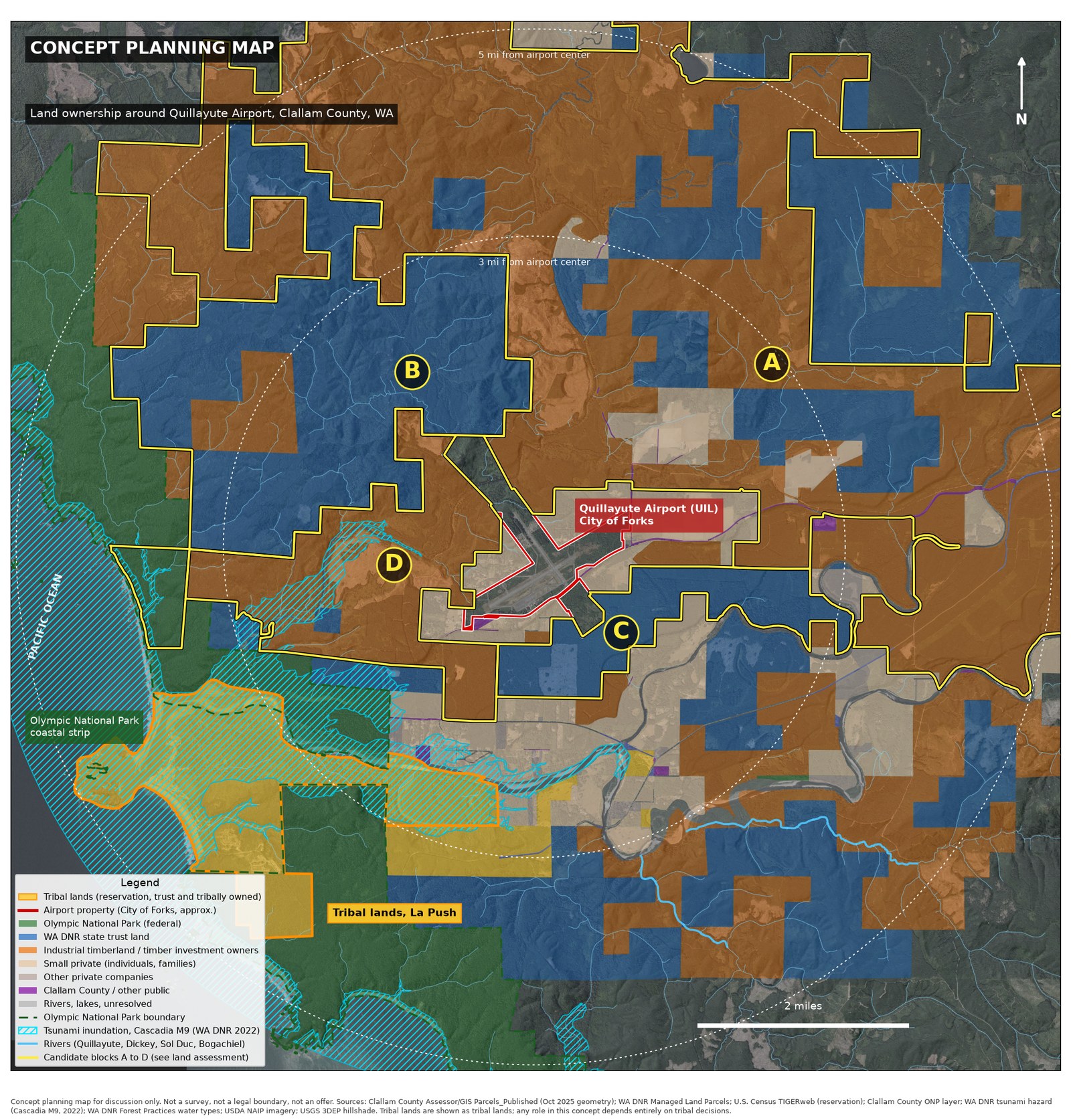
Within five miles of the runway, most land sits with a few large owners: timber investment firms, Washington's state trust forests, the National Park and tribal lands on the coast.
- Airport first. Build on the City of Forks' 753-acre airport under its adopted master plan.
- Partnership foundation. Invite neighboring tribes to shape the district, on their terms.
- Neighboring timberland. Options and long leases on the closest private forest blocks, with permanent protection for the rest.
- State trust land. Land exchanges and transfers that keep Washington's school and county trusts whole.
- A real town. A new fully contained community under state growth law, with its own water, power and housing.
Planned around rivers, salmon streams, tsunami zones and the Park, not over them.
Concept planning only. Not an offer, appraisal or survey. No landowner, tribe or agency has been contacted, and no tribe has agreed to any part of this concept. Ownership from public Clallam County and WA DNR records, Oct 2026.
Starbase Quillayute, in full
The deep page walks through why Quillayute Airport, neighbors first, Port Angeles as a true port city, tunnels under the Salish Sea, and what we do not know yet.
We will post what we learn, including the parts that do not go our way.
What happens between now and then is on us.
Use the arrow keys or swipe to move between slides.
Concept · The Salish Tunnel system
One hub. Three lines. No breaks.
The Salish Tunnel system starts at the Rayonier hub in Port Angeles. From there, one continuous concept tunnel would run west along the Strait to Joyce and Clallam Bay, ending at Neah Bay, Makah connection, about 57 mi in all. East, a shared trunk runs to Sequim at Port Williams and on to Port Townsend, about 42 mi. From there the Olympia line runs under Hood Canal to Olympia, about 149 mi from the hub, and the Seattle line runs subsea through Admiralty Inlet to Edmonds and under the Sound to downtown Seattle, about 89 mi from the hub. No breaks between stops.
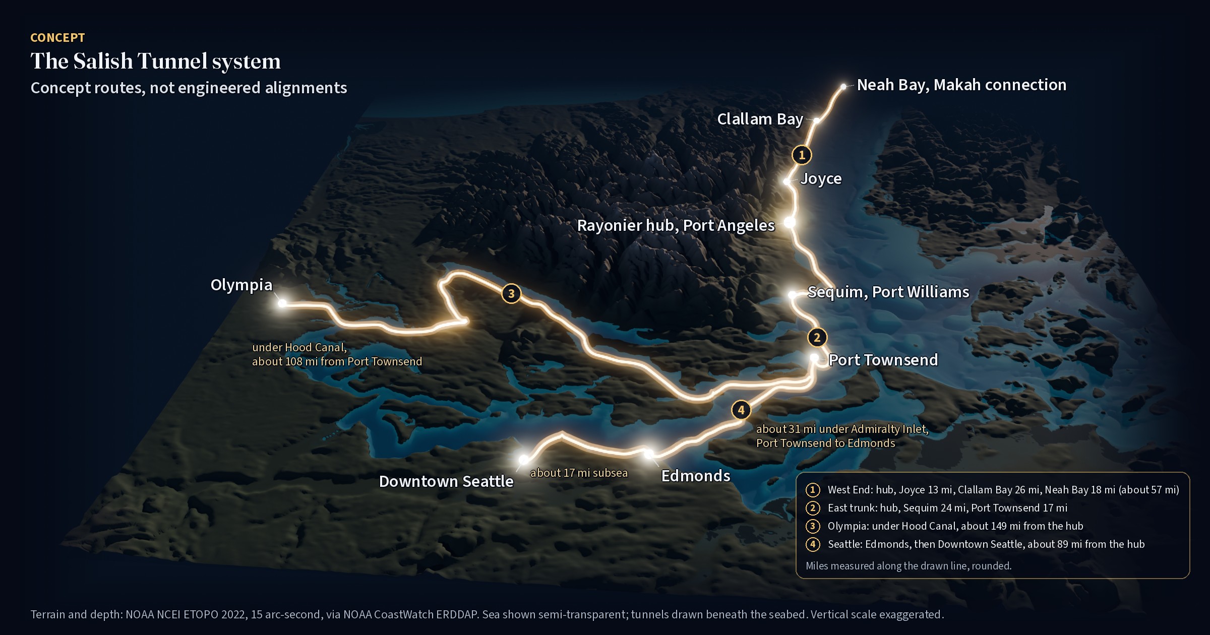
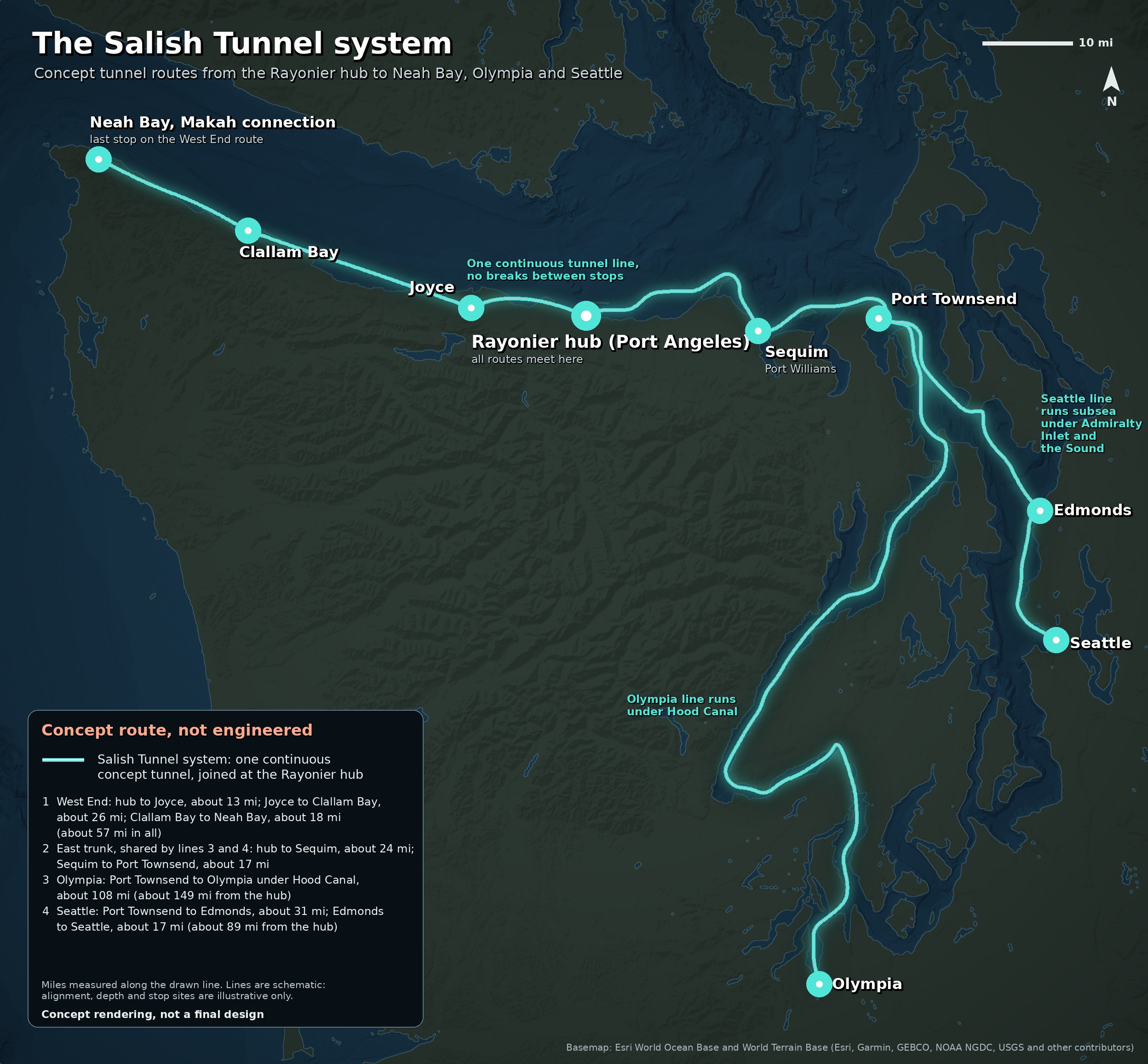
Stops on the Salish Tunnel system
- 1
Rayonier hub (Port Angeles)
All routes meet here. The West End line runs west; the east trunk runs to Sequim and Port Townsend, where the Olympia and Seattle lines split.
- 2
Joyce
West End line. About 13 mi from the hub.
- 3
Clallam Bay
West End line. About 26 mi past Joyce.
- 4
Neah Bay, Makah connection
Last stop on the West End line. About 18 mi past Clallam Bay, about 57 mi from the hub.
- 5
Sequim, Port Williams
East trunk. About 24 mi from the hub, at Port Williams Beach.
- 6
Port Townsend
East trunk. About 17 mi past Sequim. The Olympia and Seattle lines split here.
- 7
Olympia
Olympia line. About 108 mi past Port Townsend, running under Hood Canal; about 149 mi from the hub.
- 8
Edmonds
Seattle line. About 31 mi past Port Townsend, subsea through Admiralty Inlet.
- 9
Downtown Seattle
Seattle line. About 17 mi past Edmonds, subsea under the Sound; about 89 mi from the hub.
Where this fits in the thousand years
Tunnels are the kind of work that outlasts the people who start it. On the timeline this is a later step, built toward the century-one goal and sketched now so the hard questions get asked early. See the timeline.
What happens between now and then is on us.
The same map, with the route list, is on the Rayonier hub page.
Things a real study would face
- The West End line runs about 57 mi along the Strait through Joyce and Clallam Bay to Neah Bay, crossing rivers and salmon streams. Each stop would need a portal site, local agreement and its own environmental review.
- The Olympia line runs about 149 mi from the hub by way of Sequim and Port Townsend and passes under Hood Canal: deep water, Navy activity and treaty fishing areas.
- The Seattle line crosses under Admiralty Inlet and Puget Sound to Edmonds and downtown Seattle: deep water, busy shipping lanes, Navy activity, treaty fishing areas and overlap with state ferry routes.
- Every route crosses tribal usual-and-accustomed areas, so tribes would need to be at the table from the start.
The projects
Each part of the vision has its own page. Open a tab for a short summary, a share link and related parts.
Starbase QuillayuteDraft
The Return to Earth deep page: why Quillayute Airport, neighbors first, what Forks has already built, and what we do not know yet.
Where this fits in the thousand years: Near-term step. The airport-first phase builds on what Forks has already planned, and it is where the thousand years start.
Race Street Olympic National Park ProjectPublished
A one-way inbound tunnel from Front Street and US 101 up Race Street toward the Olympic National Park entrance. Concept.
Where this fits in the thousand years: Near-term step. A one-way inbound tunnel toward the Park, among the first projects to study and propose.
Port Angeles tunnelPublished
The Salish Tunnel system from Port Angeles: the Rayonier hub, the West End line to Neah Bay, Makah connection, and the Olympia and Seattle lines, with immersed tubes, bored landings and the honest engineering picture.
Where this fits in the thousand years: Later step. A first tunnel segment open at Port Angeles is the century-one goal.
Downtown tunnelsPublished
Two freight tunnels under Front Street and First Street in downtown Port Angeles, both running beneath the downtown green corridor and connecting to the existing US 101 truck route further down. Together they would form one continuous underground freight path, so freight never surfaces downtown. Concept.
Where this fits in the thousand years: Later step. Front Street and First Street freight tunnels work toward the century-one goal of a first tunnel segment open at Port Angeles.
Rayonier hubPublished
The main tunnel hub at the former Rayonier mill site, the heart of the Salish Tunnel system, where three concept tunnel lines meet: the West End line to Joyce, Clallam Bay and Neah Bay, Makah connection, and, by way of Sequim and Port Townsend, the Olympia line and the Seattle line through Edmonds. The old creosote dock would come out under the state cleanup and be replaced by a new cruise pier on clean piles in the same spot, with a public promenade on top, in the spirit of City Pier downtown, extending the waterfront walk. A tunnel portal and taxi pickup would sit beside it. Any acquisition would help fund and speed up the cleanup and habitat mitigation, under the state's cleanup oversight. Concept.
Where this fits in the thousand years: Later step. The hub where the West End, Olympia and Seattle lines meet, beside a new cruise pier on clean piles, built toward the century-one goal.
Ediz Hook seawallPublished
A reimagined Ediz Hook: a seawall along its full run that people can walk on, with native restoration on both sides.
Where this fits in the thousand years: Later step. Protecting the harbor that the rest of the thousand years depends on.
Mill sitePublished
A green factory district at the former McKinley Paper mill: a tunnel element yard, a robotic production line, and parts for Starbase Quillayute.
Where this fits in the thousand years: Later step. A yard that could build tunnel sections before the first segment can open.
RoundaboutsPublished
Native-planted roundabout concepts on US 101 west of Port Angeles, at Dry Creek Road by the Elwha, Laird Road and SR 112, with day and night before-and-after views. Concept.
Where this fits in the thousand years: Near-term step. Research now on road fixes that could come early.
Monopoly TheoryPublished
Third Harvest's existing page, linked here as it is.
Where this fits in the thousand years: Part of the thinking behind the vision, today. Not a step on the timeline.