Third HarvestThird Harvest
Concept proposal. Not endorsed by any agency, tribe or company named here.
← Back to Vision

Vision · Concept

Mill flip

George's concept: the former McKinley mill site at the base of Ediz Hook becomes the factory that builds the tunnel tubes. Each tube would carry car lanes below and, in a sealed chamber above, racks of self-contained data pods with their own service walkway and rail cart. This is a vision, not a plan: nothing here has been engineered, permitted, funded or agreed with anyone.
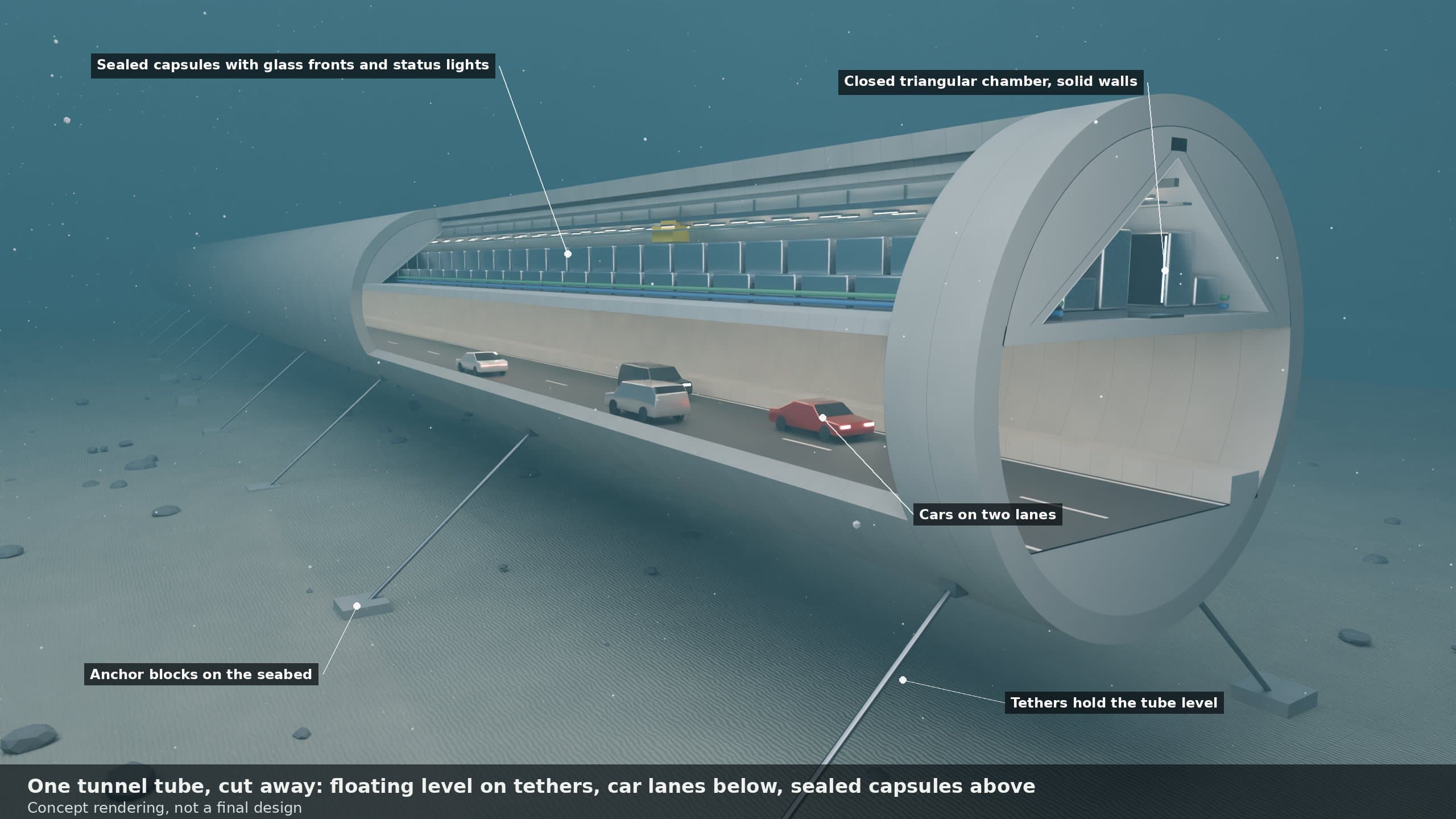
Cutaway of one concept tunnel tube floating in open water above a sandy seabed, held level by pairs of angled tethers to anchor blocks: cars on two lanes below, and above a closed triangular chamber lined with rows of sealed glass-fronted capsules either side of a lit service aisle.
One concept tunnel tube, cut away, floating in the water column and held level by tethers to anchors on the seabed. Cars run on two lanes below; a concrete slab carries a closed triangular chamber of sealed capsules on both sides of a grated service aisle, with an overhead rail cart and low downward lights. Sizes, spacing, depth and mooring are illustrative only. Rendered in Blender. Concept rendering, not a final design.

Why sealed pods

  • Microsoft's Project Natick put a sealed data center on the seabed: a vessel about 40 feet long and 9 feet across holding 12 racks and 864 servers, filled with dry nitrogen at one atmosphere, and planned to run up to five years without maintenance.[Microsoft Research]
  • It was deployed 117 feet deep off Scotland's Orkney Islands in spring 2018 and retrieved in the summer of 2020.[Microsoft]
  • Microsoft reported that the sealed servers failed at one-eighth the rate of a matching group on land.[Microsoft Research; Microsoft]
  • Data centers already run inside rock: Lefdal Mine in Norway keeps its IT spaces about 2,300 feet inside a mountain, Green Mountain uses former NATO ammunition halls cooled by fjord water from about 330 feet down, and Bahnhof's Pionen in Stockholm sits in a former Cold War civil-defence shelter about 100 feet under the bedrock.[Lefdal; Green Mountain; Bahnhof]

Concept-level caveat: We found no data center operating inside a road tunnel today, so this is a new combination of proven building blocks. Any version would need its own engineering, fire separation, environmental and tribal review, and permits.

The 3D scenes use USGS 3D Elevation Program terrain, USDA NAIP aerial imagery and OpenStreetMap streets and buildings, with procedural trees and generic architecture.[USGS 3DEP; USDA NAIP; OpenStreetMap]

Quiet termini

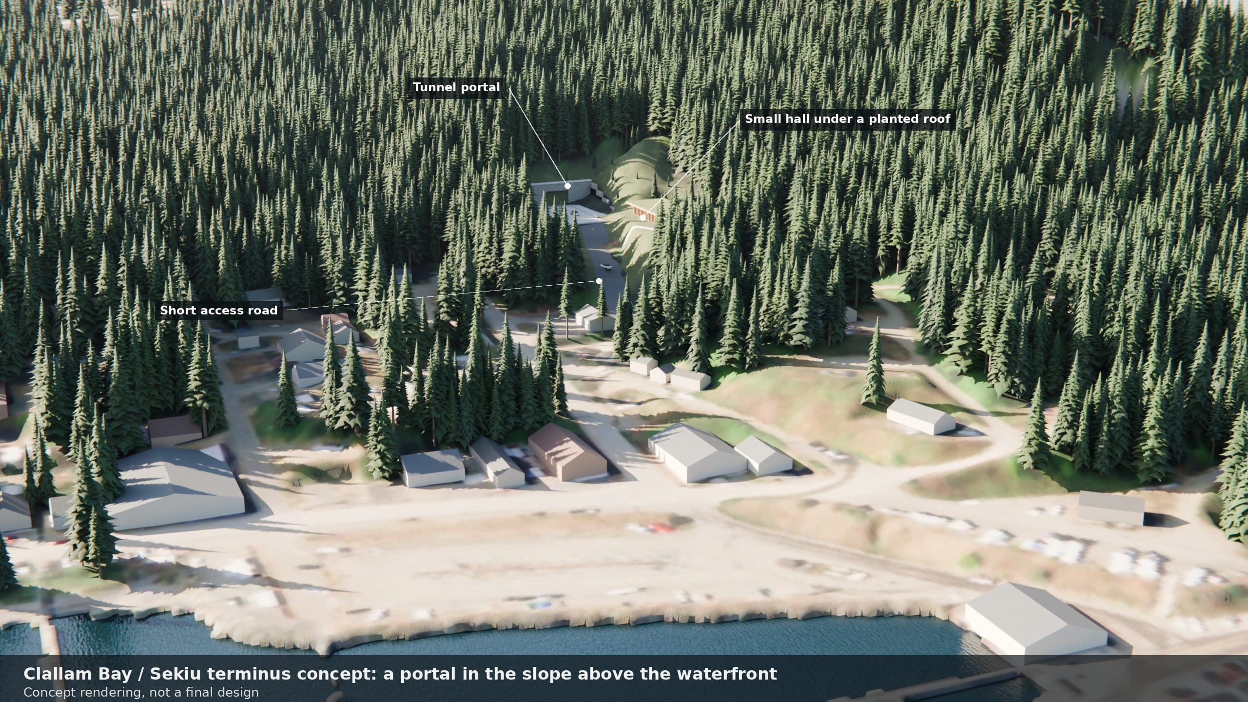
Where a tube comes ashore, the idea is that most of it stays out of sight: a portal tucked into the ground or a hillside, a short drive, and one low building under a planted roof, with the forest kept around it.
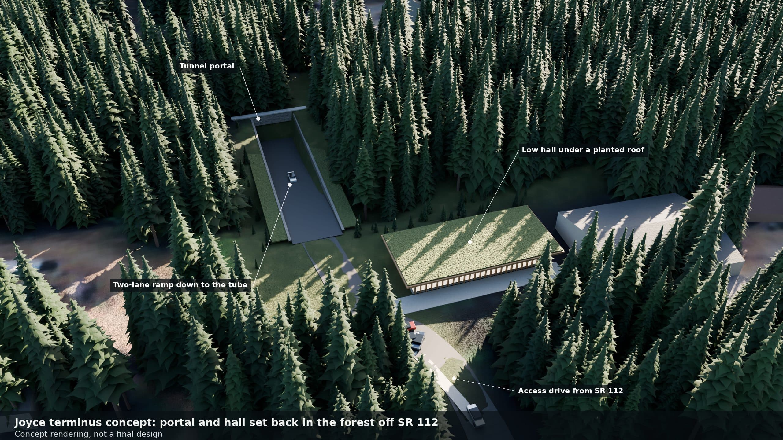
Drone view of a wooded lot in Joyce: a two-lane ramp descends between stone walls to a tunnel portal under the trees, beside a low cedar-and-glass hall with a planted roof and a drive from the highway.
Joyce, concept. A wooded lot on the south side of SR 112 in central Joyce, shown for illustration only. The portal and a two-lane ramp sit below grade inside the trees, and a low hall under a planted roof is the only building. Rendered in Blender on real terrain and aerial imagery. Concept rendering, not a final design.
Aerial view over the Sekiu waterfront toward a forested slope where a stone tunnel portal, a short access road and a small planted-roof hall sit in a clearing above the town.
Clallam Bay and Sekiu, concept. Concept location near Mason's Resort, Sekiu. Concept location, no affiliation or agreement. A portal set into the forested slope above the waterfront, reached by a short access road, with a small hall under a planted roof. Rendered in Blender on real terrain and aerial imagery. Concept rendering, not a final design.

The mill site as a campus

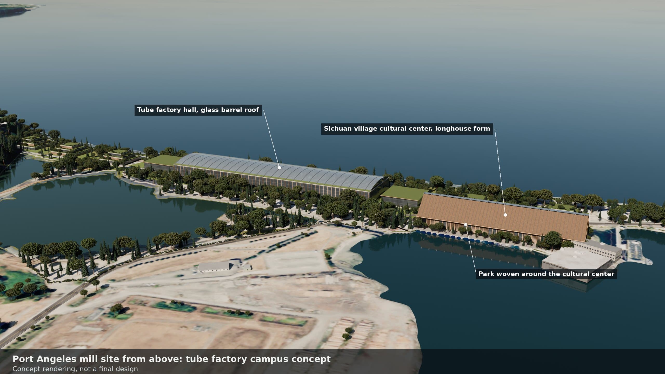
The vision for the mill site itself: a glass tube factory at the heart, glass pavilions with planted terraces along a central walk, and the rest given back to native trees, meadow and the existing ponds as a wetland park with a boardwalk. On the harbor side, a cultural center called Sichuan village takes the form of a longhouse scaled up to stadium proportions, and a seawall with a planted crest runs along the Strait. Everything stays inside the former mill site.
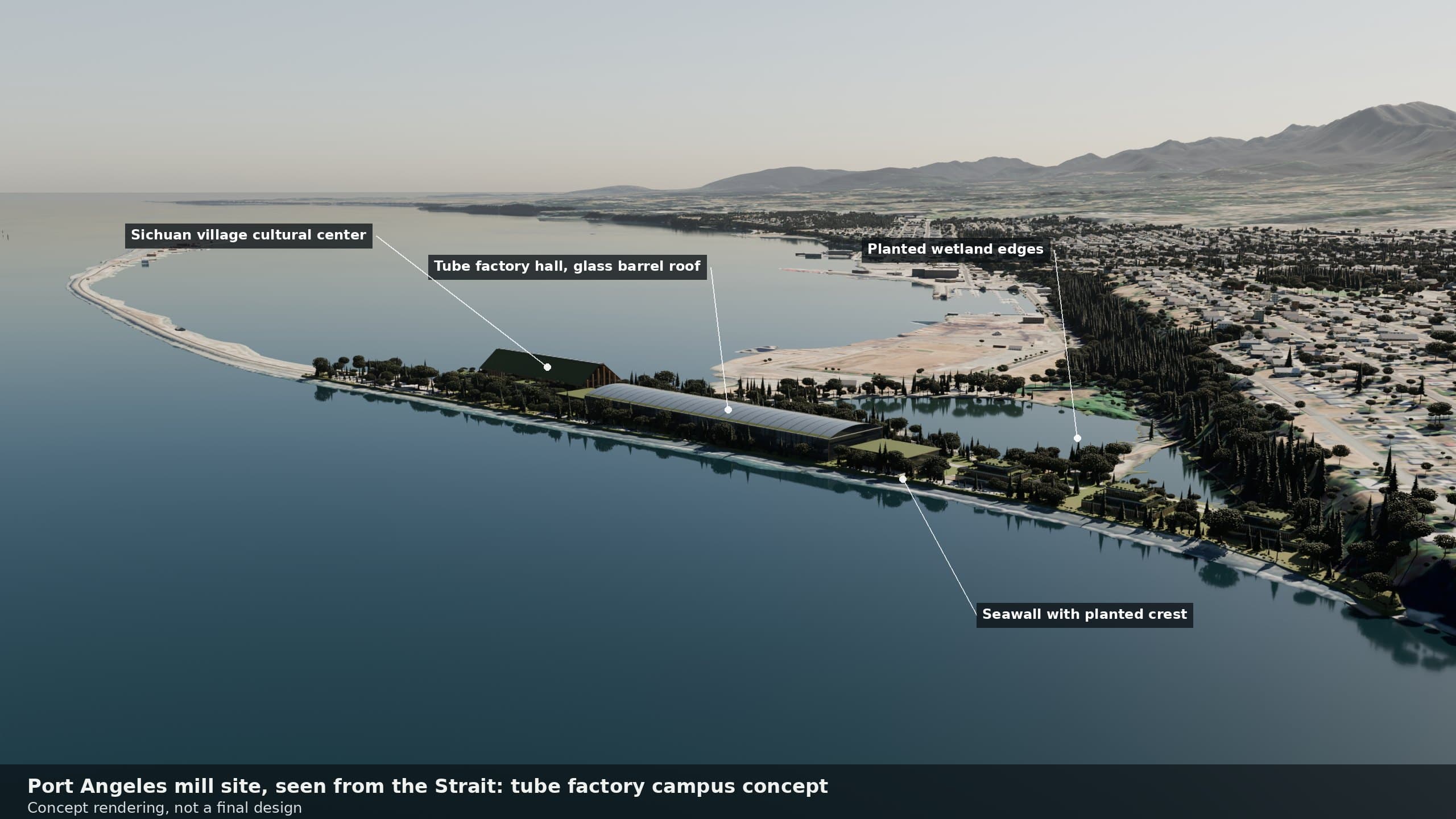
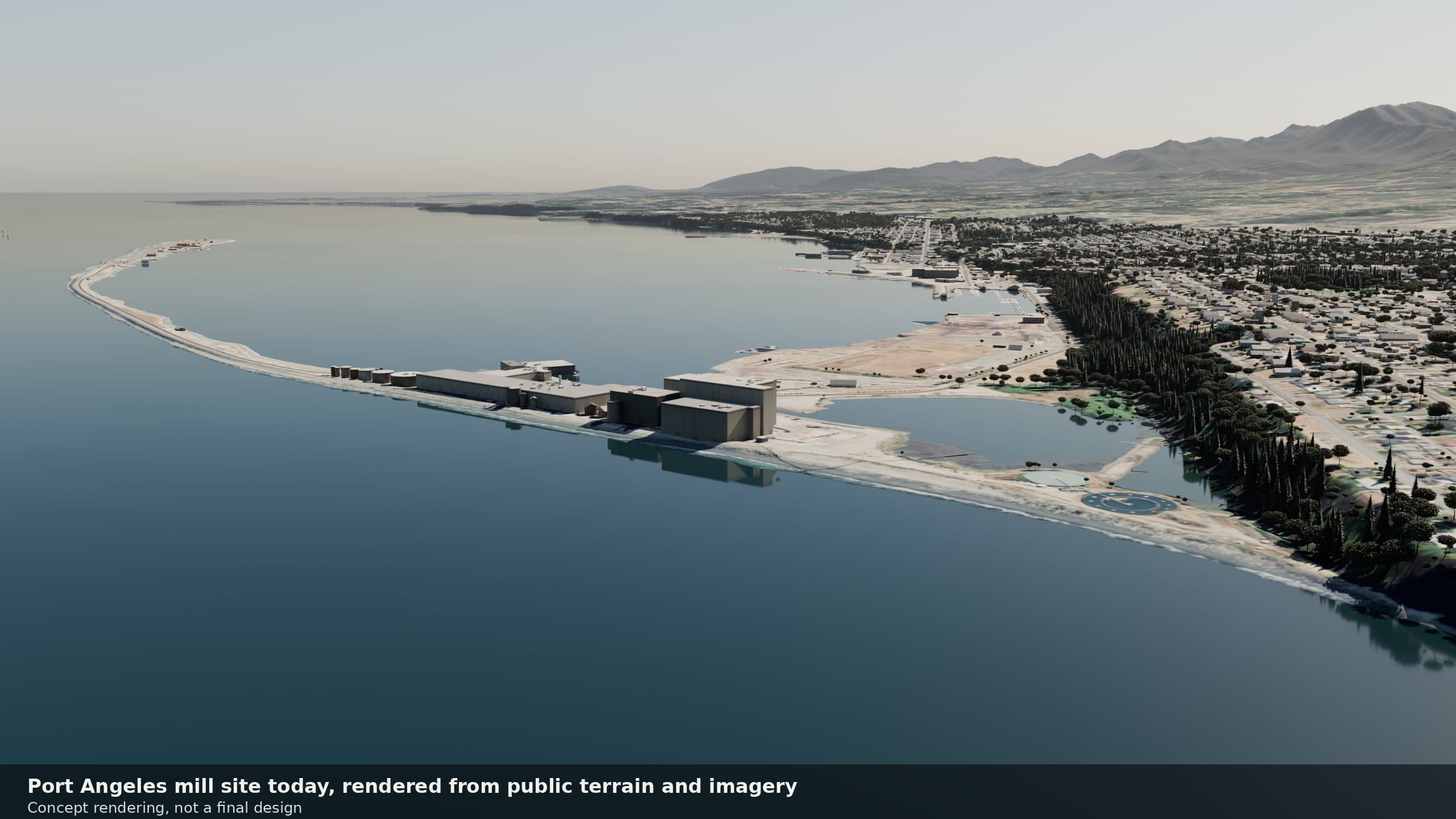
Concept rendering. Wipe comparison from over the Strait: today the mill site holds large industrial buildings on the shore; in the concept a long glass-roofed factory hall and a timber longhouse cultural center sit among trees, meadow and planted pond edges, behind a seawall with a planted crest.
Today. Wipe comparison from over the Strait: today the mill site holds large industrial buildings on the shore; in the concept a long glass-roofed factory hall and a timber longhouse cultural center sit among trees, meadow and planted pond edges, behind a seawall with a planted crest.
TodayConcept rendering
The mill site from over the Strait, today and as a concept. Drag to compare. In the concept the industrial buildings give way to one long tube factory hall under a glass barrel roof, a cultural center called Sichuan village in the form of a scaled-up longhouse, and trees, meadow and planted wetland edges around the existing pond cells. A seawall with a planted crest runs along the Strait shore of the site. Everything stays inside the former mill site; nothing is drawn at the base of Ediz Hook. Today view rendered from public terrain, aerial imagery and OpenStreetMap buildings. Concept rendering, not a final design.
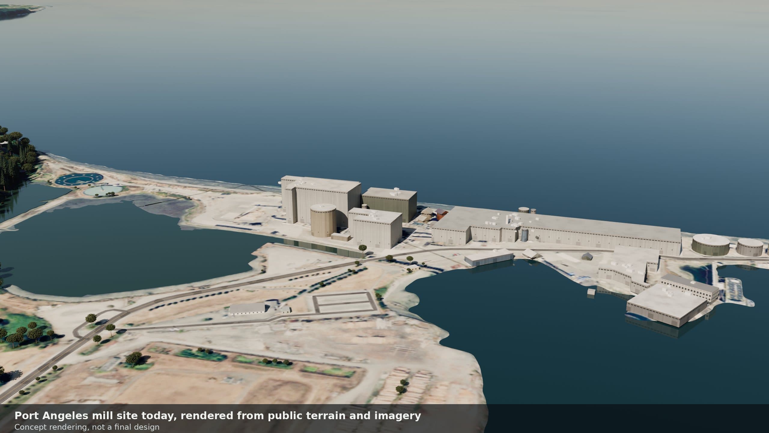
Concept rendering. Wipe comparison from above the harbor: today large mill buildings and tanks; in the concept a glass-roofed factory hall and, to its right, a long cedar-roofed longhouse cultural center set in park and trees on the harbor edge.
Today. Wipe comparison from above the harbor: today large mill buildings and tanks; in the concept a glass-roofed factory hall and, to its right, a long cedar-roofed longhouse cultural center set in park and trees on the harbor edge.
TodayConcept rendering
The mill site from above the harbor, today and as a concept. Drag to compare. A glass-roofed tube factory hall with a research wing and a gallery wing, and on the harbor side a cultural center called Sichuan village: a longhouse form scaled up to stadium proportions, with paths, trees and a plaza woven around it. Sizes and layout are illustrative only. Concept rendering, not a final design.
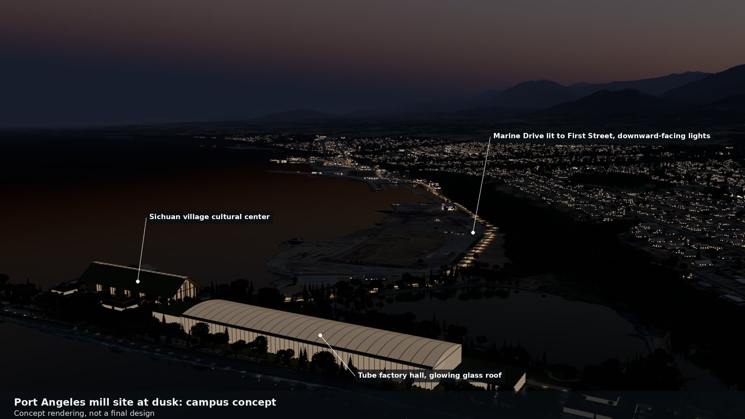
Dusk view from over the Strait looking east: the glass factory hall and the longhouse cultural center glow softly in the foreground, and a chain of warm street lights follows Marine Drive along the harbor to First Street and downtown, with the Olympic Mountains dark against an orange and violet sky.
The campus at dusk, concept. Marine Drive is lit all the way to First Street with downward-facing, full-cutoff street lights in a warm white, and traffic runs in and out of town. Road alignments from OpenStreetMap; lighting, buildings and traffic are illustrative. Concept rendering, not a final design.
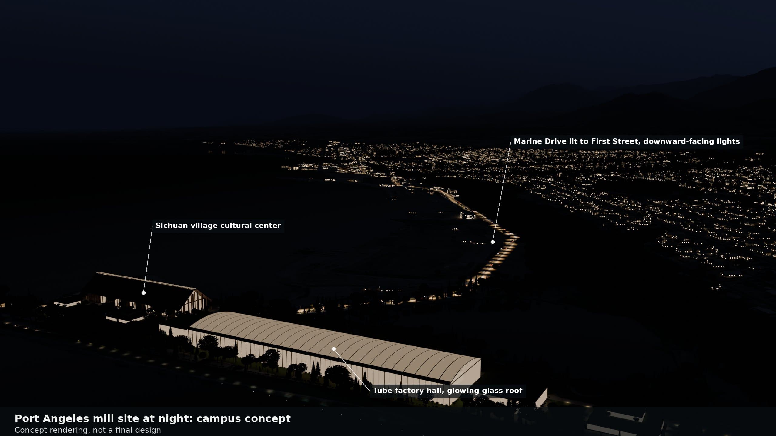
Night view from the same point: the campus halls glow, and the lit line of Marine Drive curves along the dark harbor toward the lights of downtown Port Angeles and the mountains beyond.
The same view at night, concept. Street lights point down rather than out, so the road is lit and the sky stays dark. Road alignments from OpenStreetMap; lighting, buildings and traffic are illustrative. Concept rendering, not a final design.

The Salish Tunnel system: flat map

The Salish Tunnel system has three concept lines that meet at the Rayonier hub, drawn as one continuous tunnel with no breaks between stops. The Olympia and Seattle lines share the east trunk as far as Port Townsend:

  1. West End: Rayonier hub to Joyce (about 13 mi), then Clallam Bay (about 26 mi), ending at Neah Bay, Makah connection (about 18 mi), about 57 mi in all
  2. East trunk: Rayonier hub to Sequim at Port Williams (about 24 mi), then Port Townsend (about 17 mi)
  3. Olympia: Port Townsend to Olympia under Hood Canal (about 108 mi), about 149 mi from the hub
  4. Seattle: Port Townsend to Edmonds, subsea through Admiralty Inlet (about 31 mi), then under the Sound to downtown Seattle (about 17 mi), about 89 mi from the hub
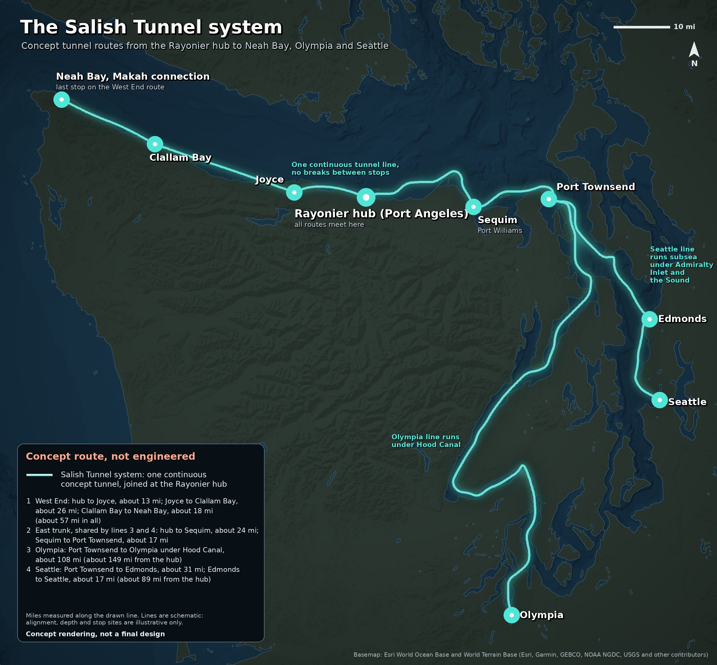
Concept map of the Salish Tunnel system, schematic tunnel lines from the Rayonier hub in Port Angeles: the West End line to Joyce and Clallam Bay, ending at Neah Bay, Makah connection; an east trunk to Sequim at Port Williams and Port Townsend; then the Olympia line under Hood Canal to Olympia and the Seattle line under Admiralty Inlet to Edmonds and under the Sound to Seattle. All lines are drawn as one continuous network joined at the hub, with miles along the line in the legend.
Concept. Concept routes, not engineered alignments. Basemap: Esri World Ocean Base and World Terrain Base.

Tubes built at the mill site would serve this network, which starts at the Rayonier hub in Port Angeles. Lines are schematic, not routes anyone has studied, engineered or approved.

More on the hub on the Rayonier hub page, and on the mill site itself on the Mill site page.

Concept only. Nothing on this page has been approved by, or agreed with, any agency, tribe or company.