
History · Olympic National Park
Olympic Hot Springs: a walk back through time
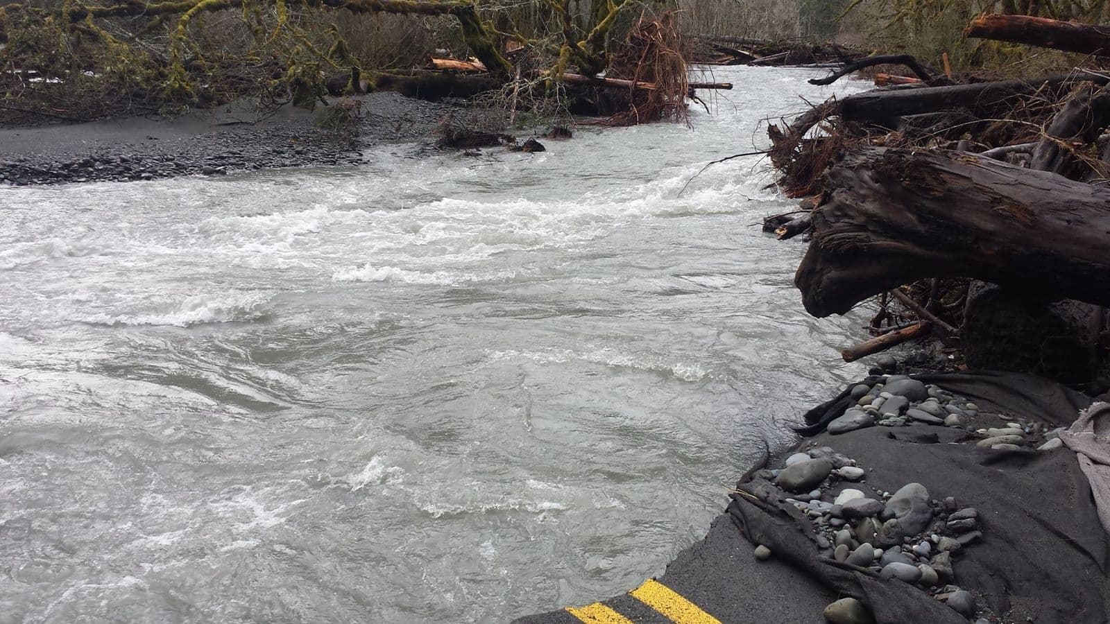
For almost sixty years there was a resort on a bench above Boulder Creek, high in the Elwha valley: a lodge, cabins, a big outdoor pool once filled with spring water. First you reached it by pack trail, then by a narrow road. Today the buildings are gone, the dams below are gone, and the road ends at a washout.
This page walks through that story in order, using the public record and free historical photos. The last section is a concept: Third Harvest's view of what a tribal-led future here could look like. It is a vision, not a plan, and it is clearly marked.
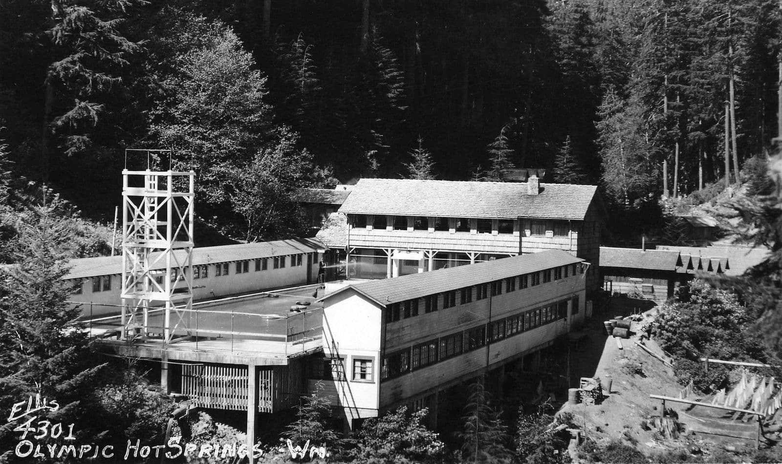
Before 1907
The Elwha River runs north out of the Olympic Mountains to the Strait of Juan de Fuca, just west of Port Angeles. The Lower Elwha Klallam Tribe describes itself as a sovereign, federally recognized Indian Nation that has lived in this area since time immemorial, in the lower Elwha valley and the bluffs along the coast.13
The hot springs sit on Boulder Creek, a tributary of the Elwha. The Park Service's historic resource study records that a settler first reported them in the early 1890s and came back in 1906 with a bottle of the water to prove it. A plan to develop them that year came to nothing.1
1907 to 1909
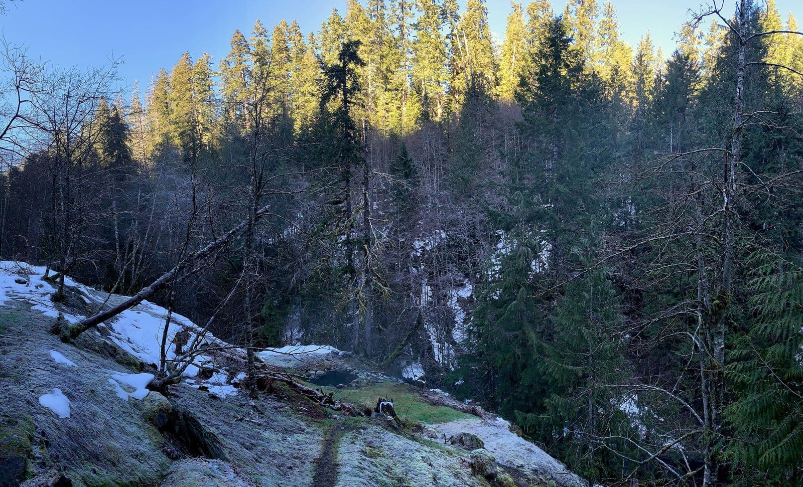
In 1907 or 1908, a local settler and two companions on a hunting trip found the seeps again, on a narrow bench about 200 feet above Boulder Creek. They cut a rough trail up from the Elwha to the site at about 2,100 feet. The settler's family then built wooden tubs, dug mud baths into the hillside, and put up a cabin and a bathhouse.1 The Court of Claims later described the springs as discovered in 1907 and developed under a Forest Service permit, since the land was then national forest.2
The springs opened to the public in 1909. A 1911 brochure listed several hot springs from 113 to 132 degrees Fahrenheit, plus cold ones, all on that one narrow bench.1 In 1910 the City of Port Angeles, 21 miles north, applied to pipe the water to town for fountains, bathhouses and bottling. A permit was issued, but the study doubts the city ever used it.1
1910s to 1920s
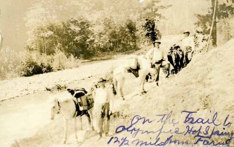
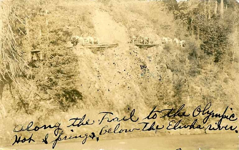
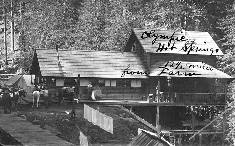
Everything came in on horseback. Packers hauled machinery and supplies up from 1908 to 1913. The family built a dam and water wheel on Boulder Creek to make electricity, and a sawmill in 1909. Guests first slept in tents. A lodge with a dining room went up, along with a wooden pool 75 by 25 feet and a large bathhouse, and the first cabins replaced the tent frames in 1919.1
The trail limited the crowds. The resort counted 1,100 guests in 1920, 850 in 1921 and 600 in 1922, while Sol Duc Hot Springs, which reopened in 1921, could be reached by car. Olympic Hot Springs was still an 11-mile ride or walk. By 1923 the site had a bathhouse with six tubs, dressing rooms, a store, room for 90 guests, and a truss bridge 80 feet above Boulder Creek.1
1910 to 1927
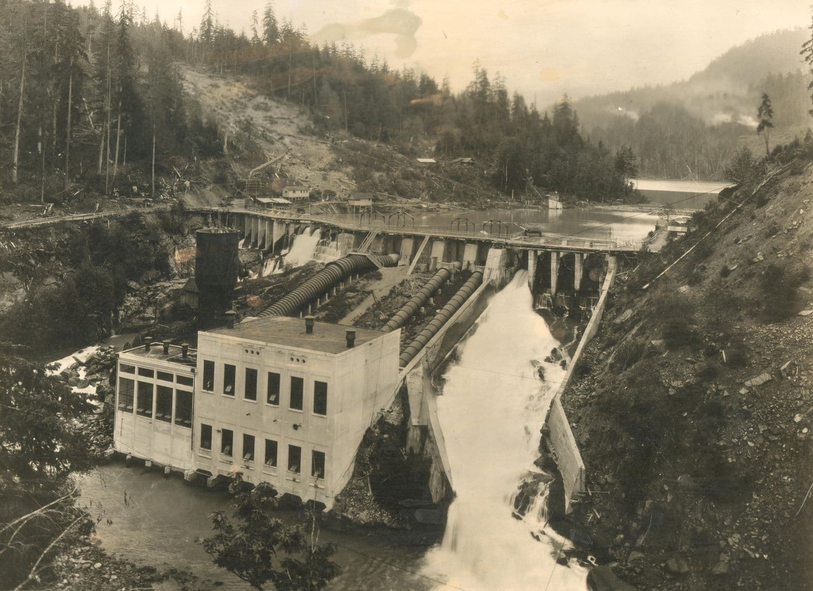
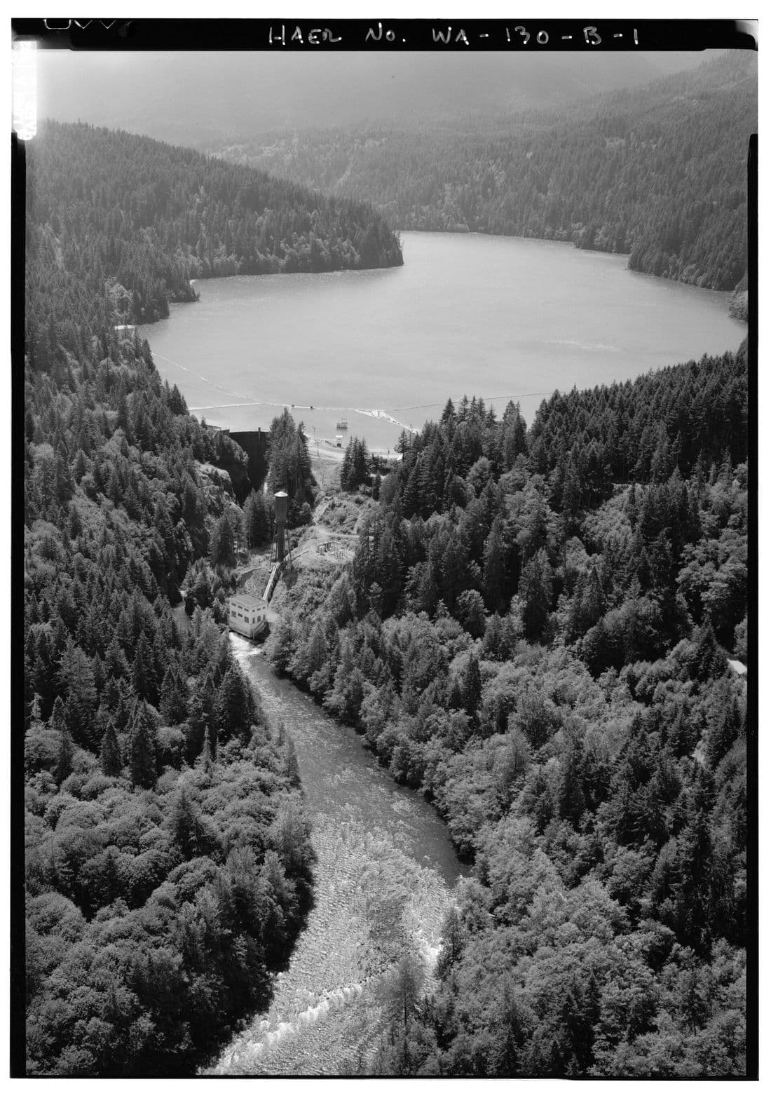
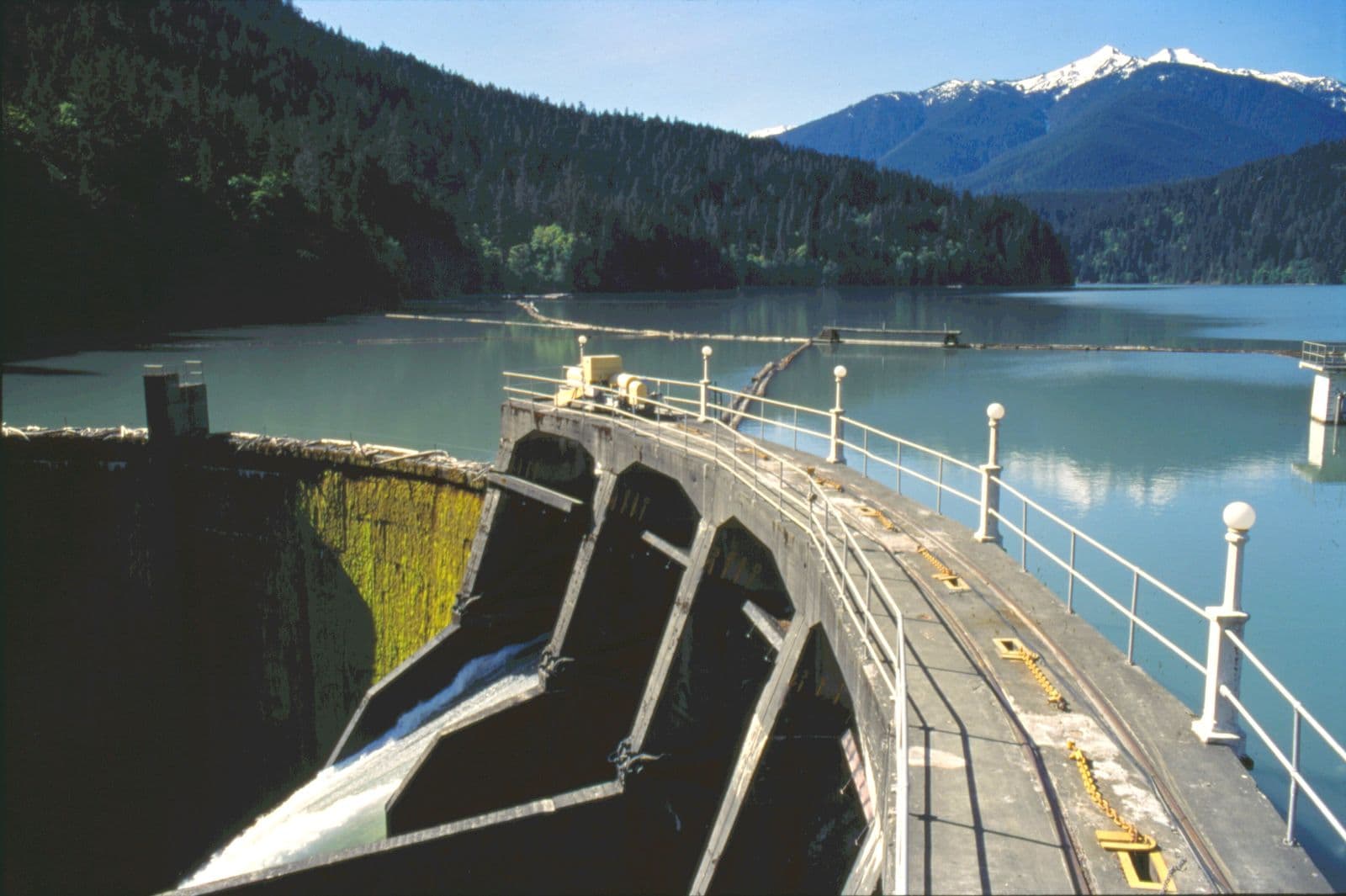
Downstream, the river was being put to work. Construction of the Elwha Dam began in 1910, and it was working by 1913, powering a pulp mill in Port Angeles. By 1927 Glines Canyon Dam stood 8 miles upstream, and its reservoir became Lake Mills.4
Neither dam had fish passage. The Park Service writes that returning sea-run fish were left with only 5 miles of river, and that the dams had many impacts on the Lower Elwha Klallam Tribe: areas of religious significance were flooded, and salmon runs of great spiritual and economic value were decimated.4
1924 to 1930s
The road followed the dams. Army engineers built a bridge near Altair in 1924 to reach the Glines Canyon dam site, and by 1927 the road had been improved for dam construction.3 In 1930 Forest Service and Clallam County crews finished the road to the hot springs.1 In the 1930s, a summer taxi ran round trips from Port Angeles to the resort for $3.75.1
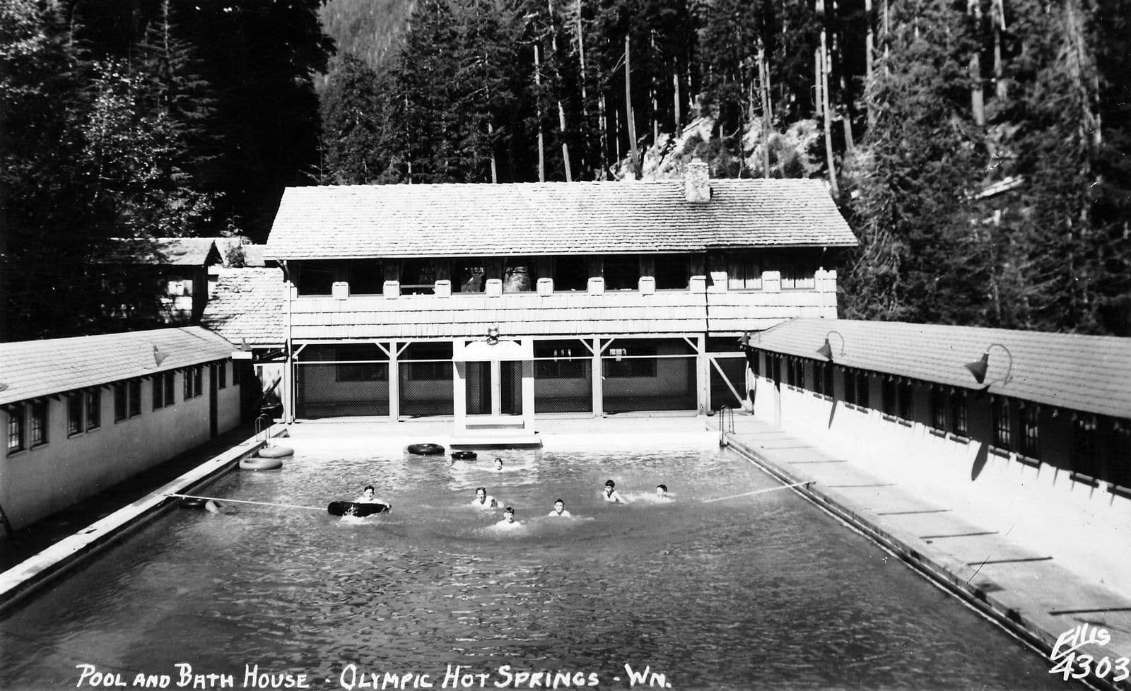
The resort grew with the road. A log hotel with a lobby, a dining room and 12 upstairs bedrooms opened in 1927. A new pool followed in 1930, and 10 more rooms in 1932. New and remodeled cabins came later in the decade, and by 1937 a new lodge stood at the end of a narrow, winding dirt road.1 The family that ran it from 1924 kept it going for more than forty years.1
1940
In late January 1940, fire destroyed the main hotel. The same year, the Boulder Creek and Elwha area was added to Olympic National Park, which had been created in 1938, and the family began operating under Park Service permits and contracts. Their 1940 permit covered 10.96 acres.1,2
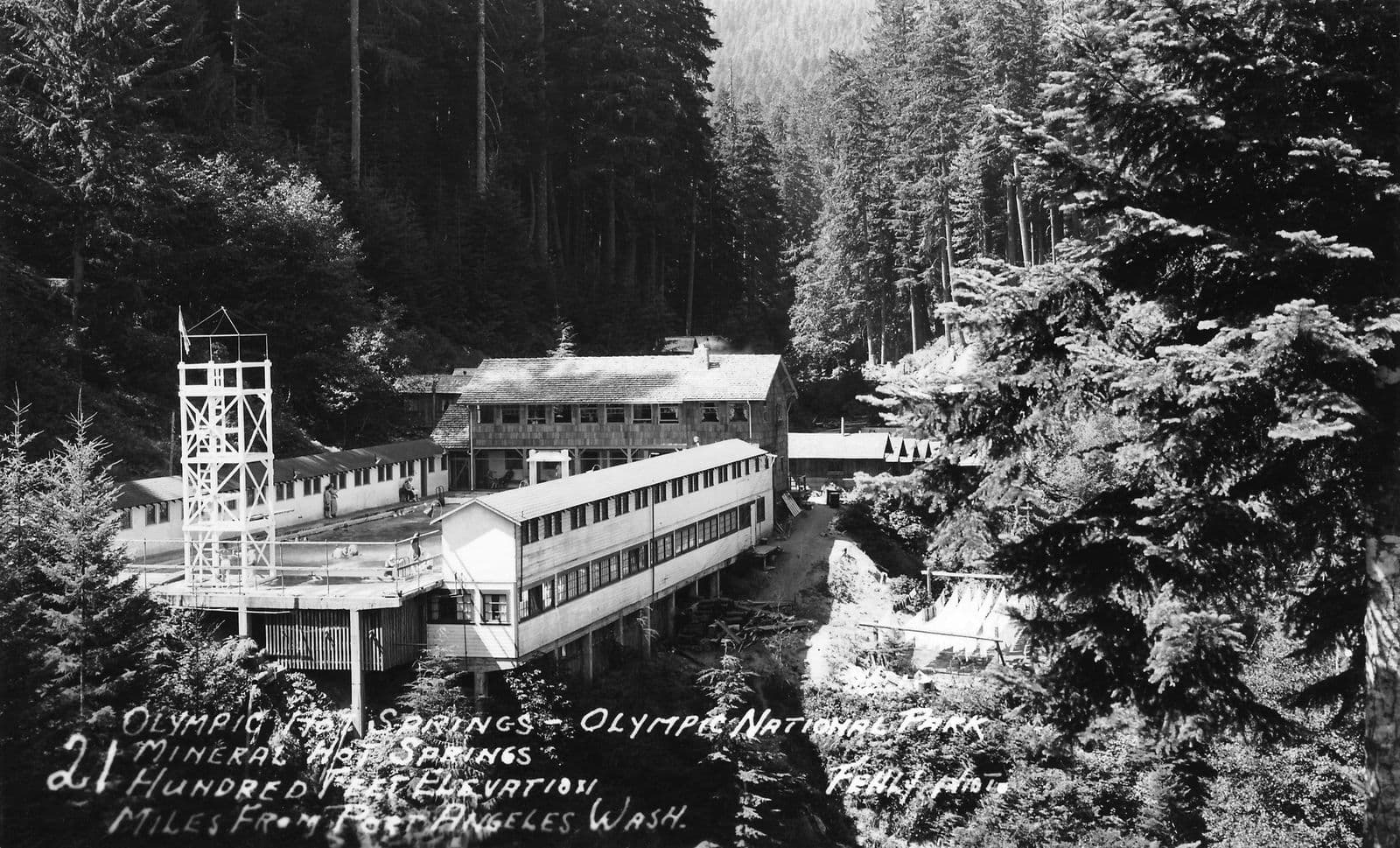
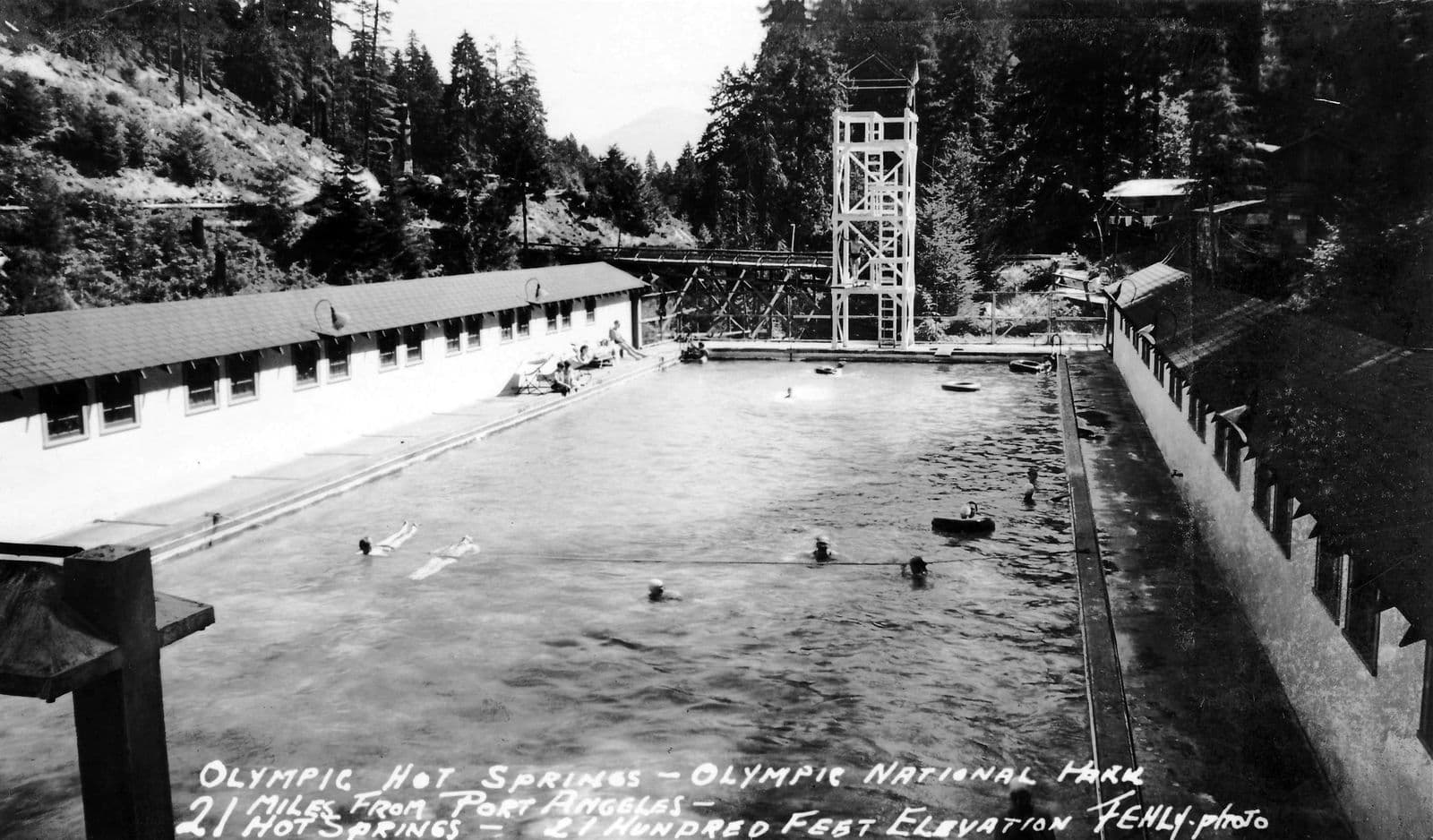
The records differ on what came next. The Park Service study says the lodge was rebuilt right away.1 The court record says the 20-bedroom hotel was never replaced, and describes the resort in its later years as 24 guest cabins, a two-story kitchen and dining building, bathhouses, and a concrete swimming and wading pool 41 by 133 feet.2
1950s to 1973
In 1954 the Public Health Service found that the untreated hot spring water in the pool did not meet health standards. The pool was converted in 1958, and the Park Service ultimately required fresh water in the pools.2 The Park Service study says the treatment requirement caused a substantial decline in business.1
The family was told on August 22, 1966 that their contract would not be renewed. The court record lists the Park Service's reasons: returning the area to its natural condition, terrain too steep for a resort, deficiencies in the facilities, steady losses since 1961, and competition from a public pool built in Port Angeles in the mid-1950s. It also records that the Park Service did not intend to continue commercial operation of the springs through any concessionaire.2 The resort closed to the public in 1966.1
Heavy snow caved in roofs in the late 1960s and early 1970s. In late 1972 the Park Service surveyed every structure for removal, and over the following months 18 buildings, the main lodge and the pool were torn down. Only traces remain.1
1927 to 2011
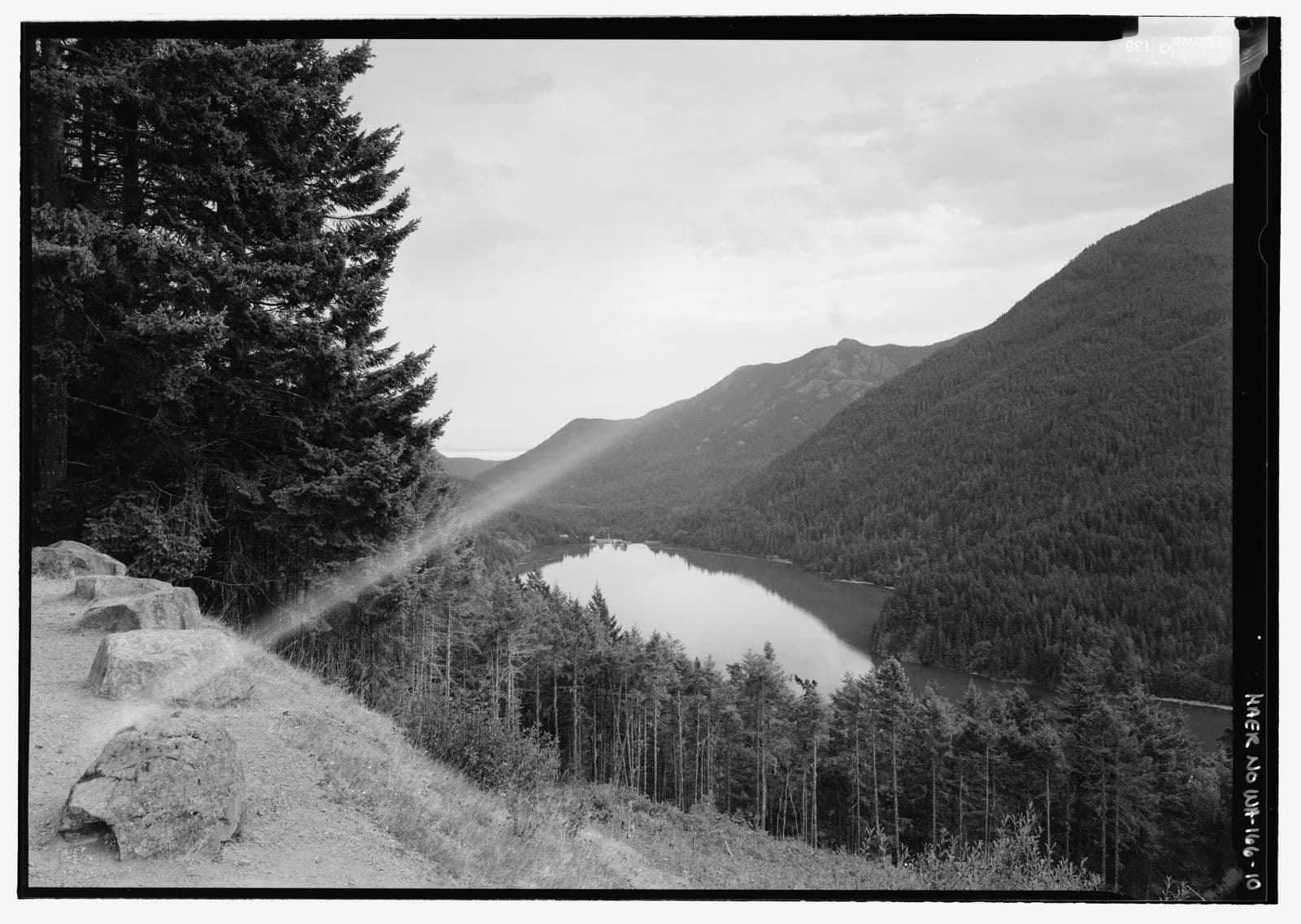
For most of the century, the drive to the hot springs ran past a lake. Lake Mills filled the valley behind Glines Canyon Dam, and the road climbed above it to viewpoints like Observation Point. Around 1930 an auto camp near the Elwha ranger station offered pack trips up the valley and boat trips on Lake Mills.1
1992 to 2014
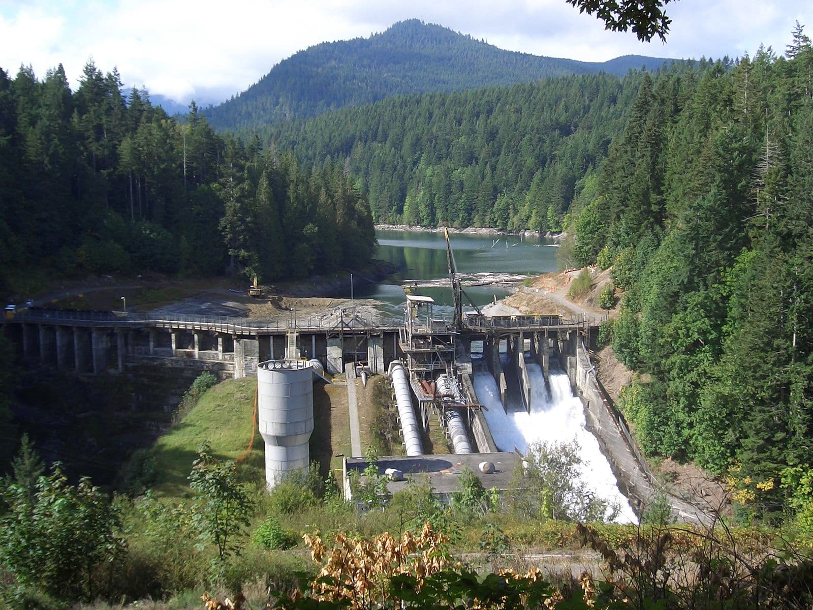
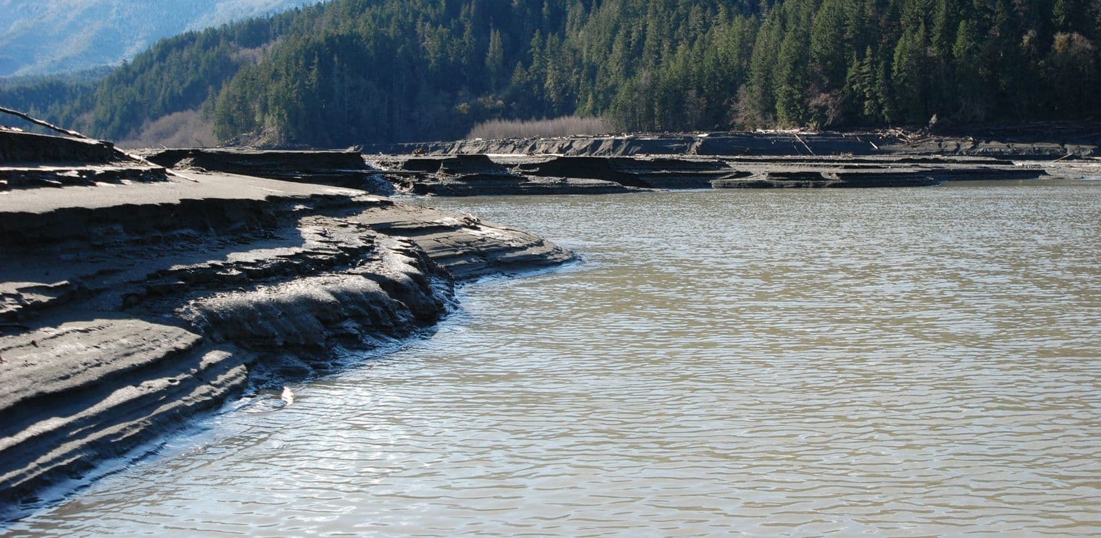
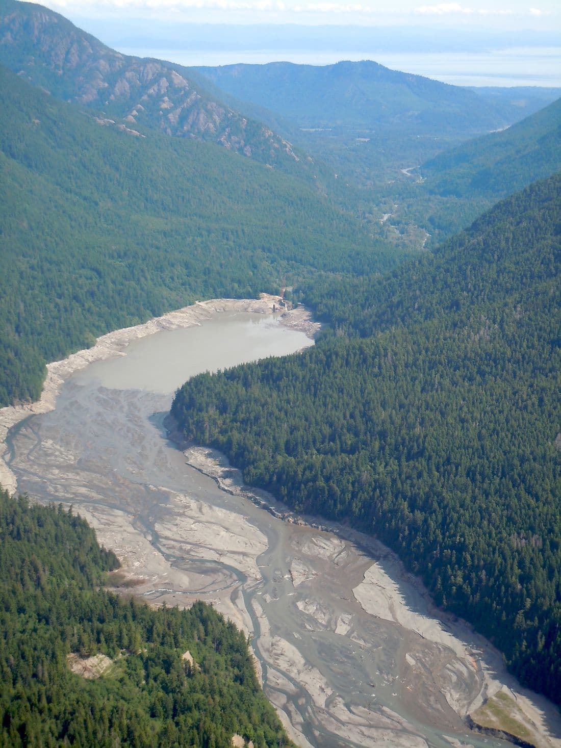
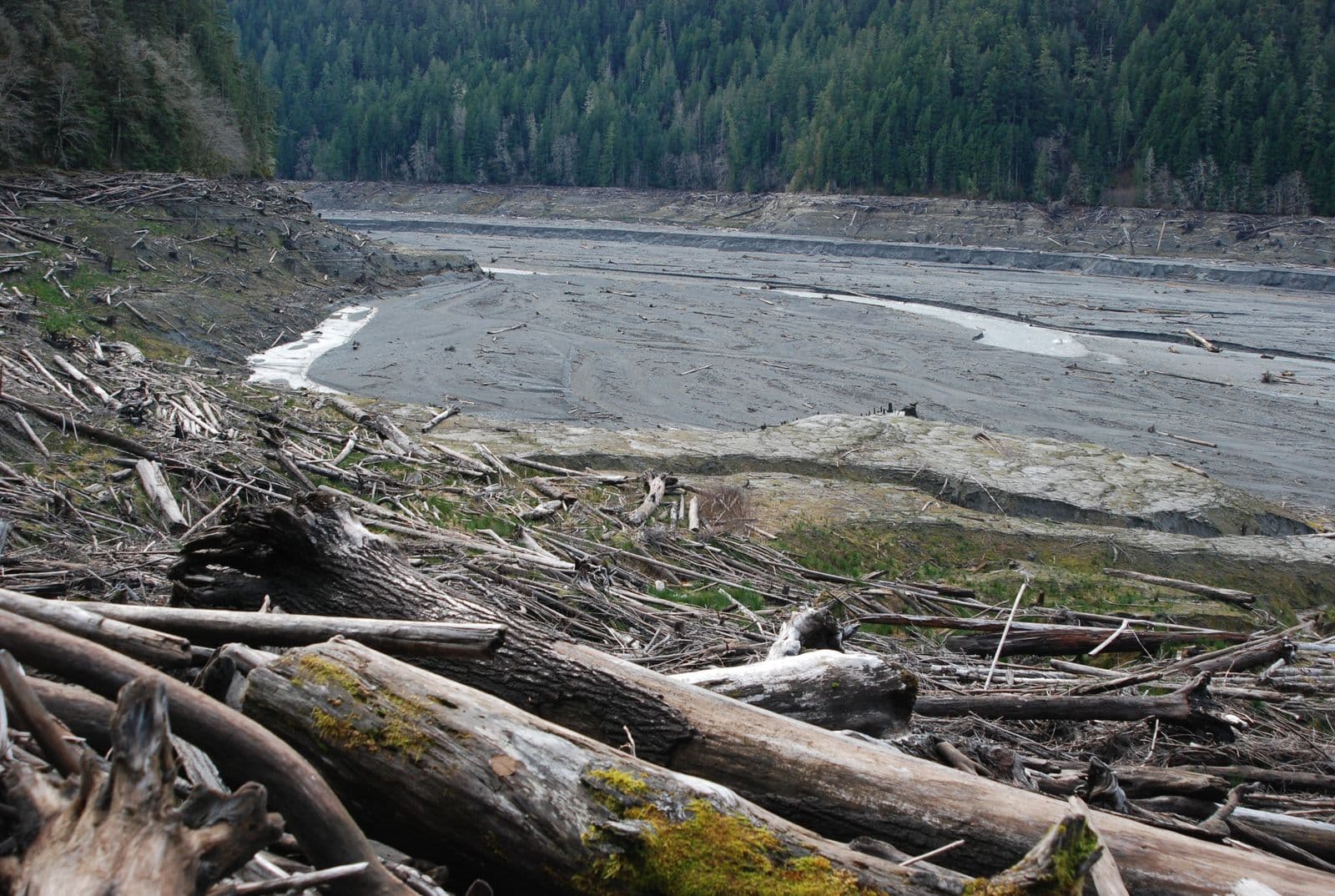
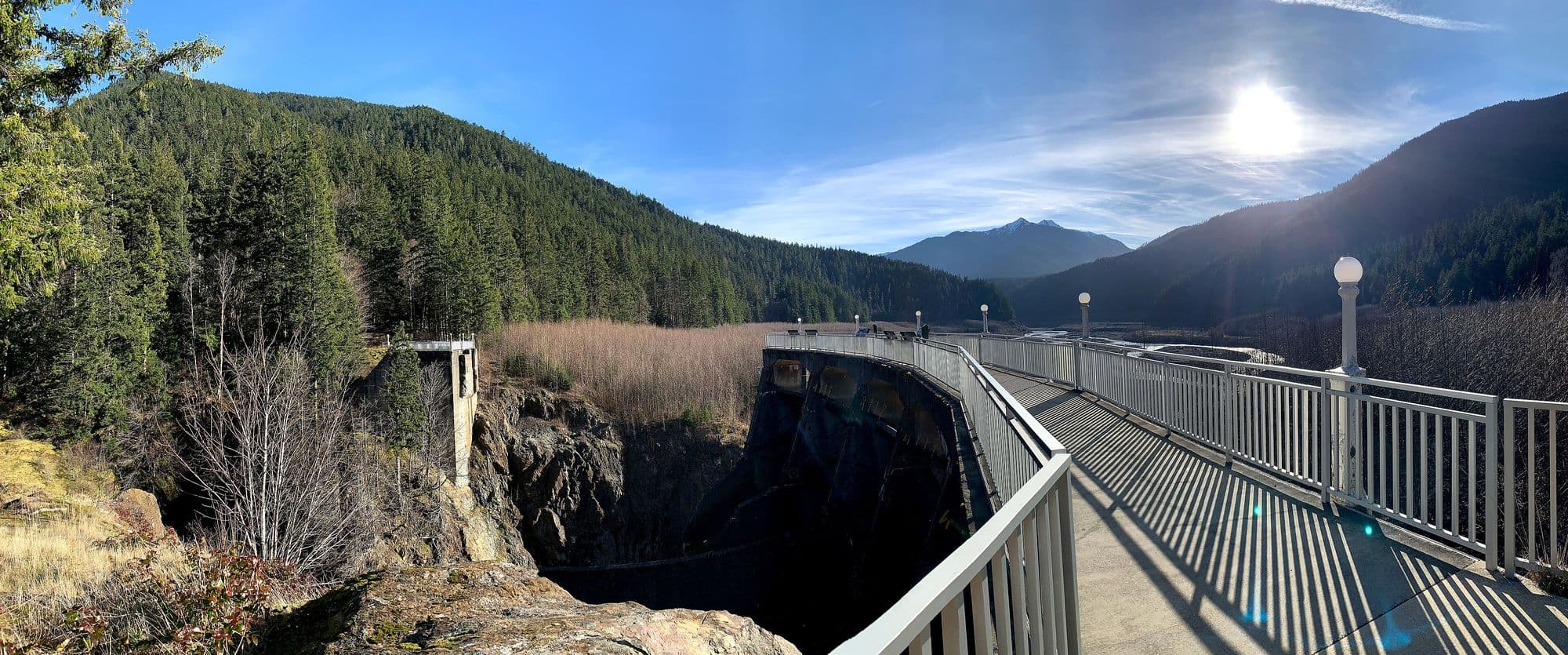
In 1992, Congress passed the Elwha River Ecosystem and Fisheries Restoration Act, Public Law 102-495, which authorized the Interior Department to buy both dams and restore the river.4 After two decades of planning, the Park Service writes, the largest dam removal in U.S. history began on September 17, 2011. The Elwha Dam was gone six months later, and Glines Canyon Dam followed in 2014.5
The Lower Elwha Klallam Tribe calls it the first large-scale dam removal in history. The Tribe writes that the reservoirs had flooded about 715 acres, that the dams blocked fish from more than 70 miles of upstream habitat, and that restoration work continues after the dams.14
2010 to 2018
The road above the Glines Canyon Spillway Overlook was closed from 2010 to 2015 during dam removal. Below the old dam, the road had seen highs of about 900 vehicles a day.3
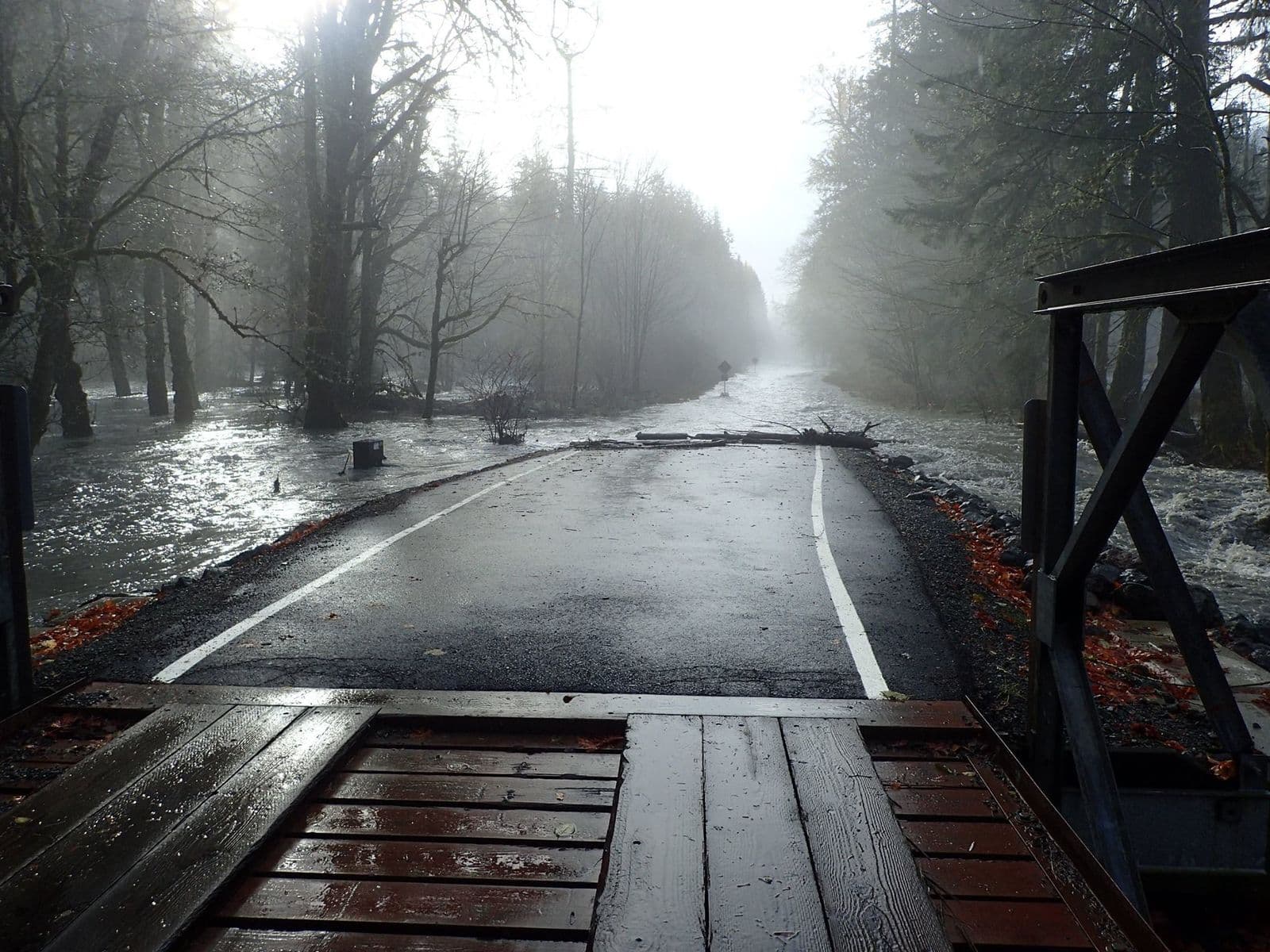
With the dams gone, the river took back a former channel that matched the road near the Elwha Campground. In 2015 the park put in two temporary bridges, and floods badly damaged the Elwha and Altair campgrounds, which were closed. Floods in 2017 meant two more temporary bridges. By summer 2018 the park limited the road to administrative use, and in autumn 2018 it pulled the bridges out before winter high water.3
Today
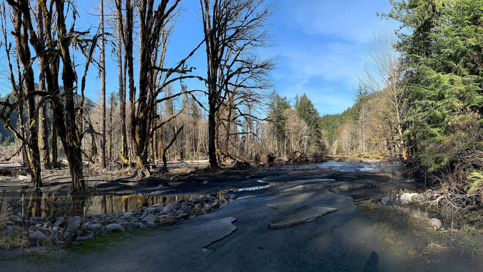
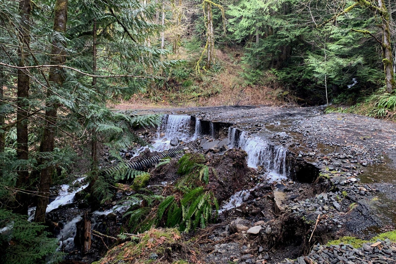
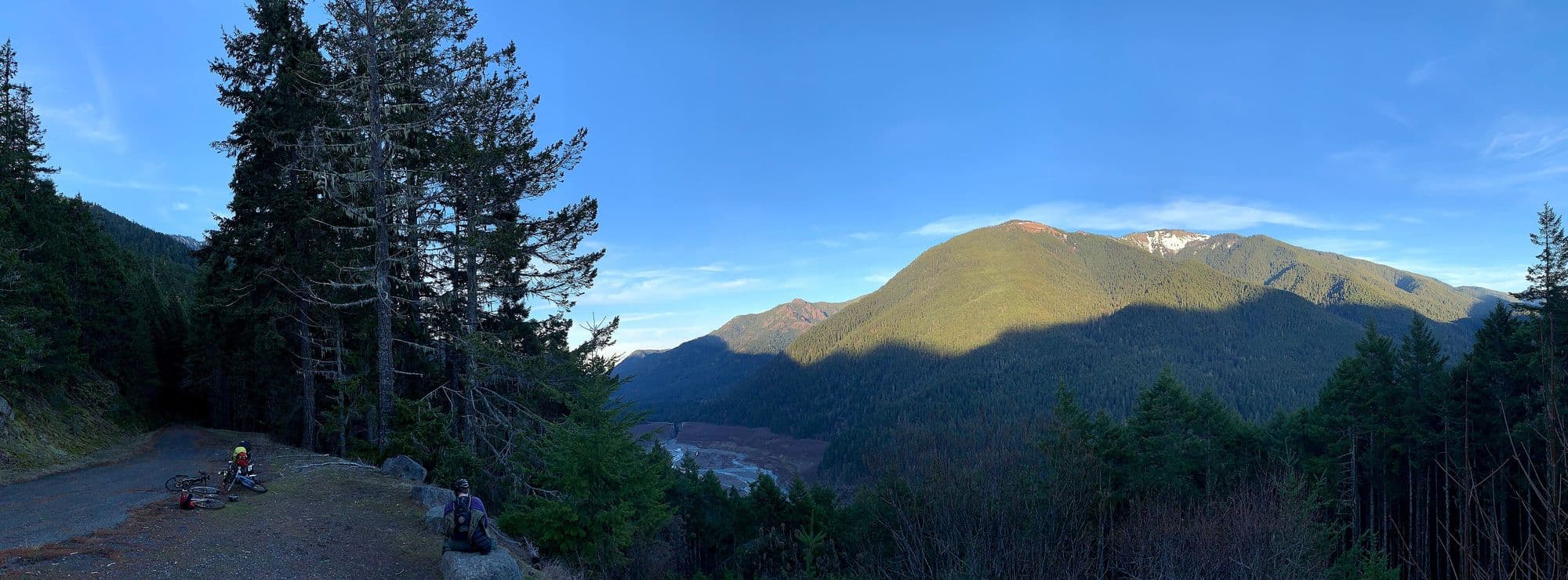
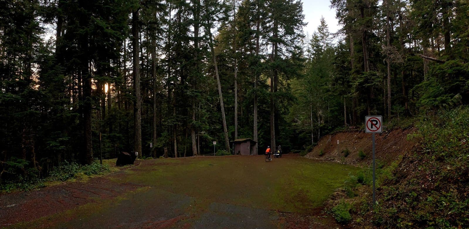
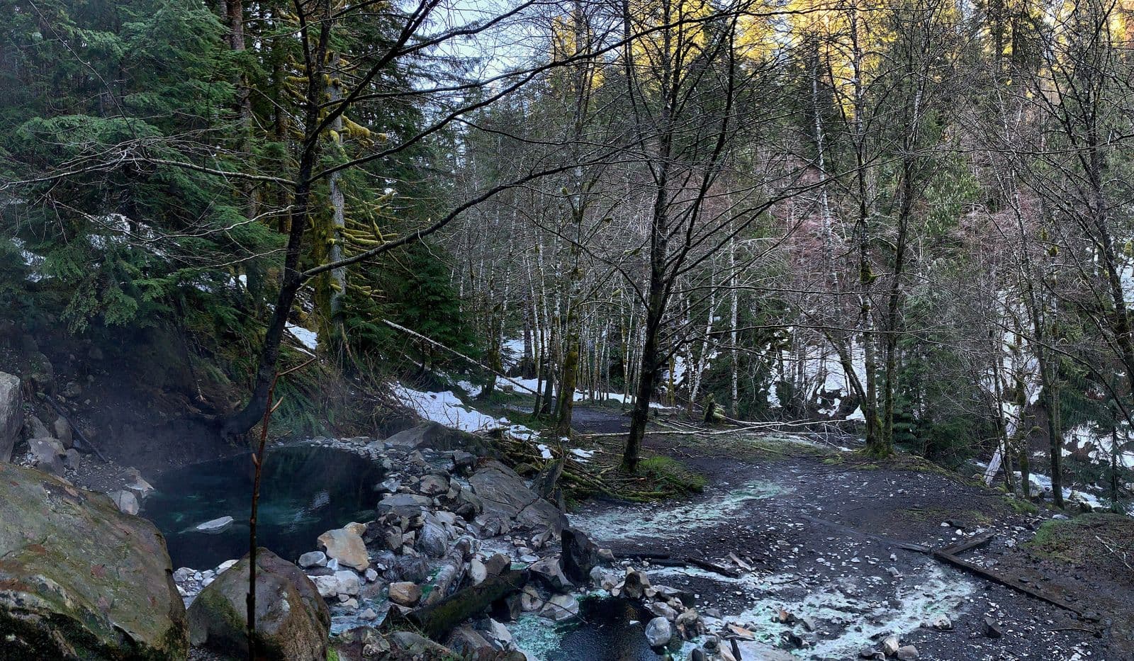
Today the Elwha road is closed to vehicles at the Madison Falls Trailhead. Visitors walk or bike 9 miles on Olympic Hot Springs Road, using a bypass trail around the washout, then hike the last 1.5 miles on foot.7,8 The park describes the springs as natural, unmaintained hot water seeps in a wilderness area, not tested or treated, and used at your own risk.7
The Park Service studied options for restoring road access in a 2019 environmental assessment. Its project page lists that plan as on hold.3,6
Future project vision · Third Harvest's position
This is a concept from Third Harvest, not a current plan. Third Harvest has not consulted the Lower Elwha Klallam Tribe or the National Park Service about it, and neither has endorsed or agreed to anything here. Nothing on this page speaks for the Tribe.
The idea. Third Harvest believes the best future for Olympic Hot Springs would be one the Lower Elwha Klallam Tribe chooses and leads. In our view, that could someday include a Tribe-run resort and gathering place that welcomes visitors back to the Elwha, on the Tribe's own terms, if the Tribe ever wanted it.
Why we think it fits. The record above shows a valley where the dams flooded places of religious significance to the Tribe, and where the river has now been set free.4,14 We think the next chapter of the hot springs, whatever it is, should be shaped by the people whose river it is, and should share its benefits with them.
What would have to be true. The decision is not ours. It would belong to the Tribe and the Park Service, and possibly to Congress. Third Harvest would only offer help if asked.
The numbers. Third Harvest's return-on-investment model, built on stated assumptions, runs two cost views side by side: the resort alone, about $10.3M for a first phase of 7 cabins and a timber-frame lodge, and the resort plus a rebuilt road, about $27.8M with bridges or $23.5M with culverts. In our view the road is part of the real bill. At every nightly rate modeled, from $300 to $600, a 7-cabin first phase loses money each year and never pays back. At the 24-cabin maximum, which would need new legislation, payback is about 14 to 21 years at $500 to $600 a night and 80% occupancy, but only with the road publicly funded. Once the resort makes money, public funding for the road would cut payback by about half or more. See the full numbers.
See the full future vision →Our First Nations position →Lower Elwha Klallam Tribe ↗
The facts that shape any future here
- Federal land. The springs are inside Olympic National Park, managed by the National Park Service.7
- Designated wilderness. In 1988 Congress designated about 95 percent of the park as wilderness, and the park describes the springs as in a wilderness area.9,10,7 The Wilderness Act says there shall be no commercial enterprise and no permanent road in a designated wilderness, except as the law provides.11
- Commercial services. Lodging and other services in national parks run under agreements with the Park Service.12
- The 1966 decision. When it closed the resort, the Park Service said it did not intend to continue commercial operation at the springs through any concessionaire.2
- No road today. The road is closed at Madison Falls, and the access plan is on hold.6,8
So in our view, any resort at or near the springs would need decisions by the Park Service and possibly Congress, and it would only make sense if the Tribe wanted it. Other paths are possible too, such as leaving the springs wild and building any lodging outside the wilderness. Those choices are not Third Harvest's to make.
- 1. National Park Service, Olympic National Park Historic Resource Study (1983), Chapter 4, Olympic Hot Springs. nps.gov (archived)
- 2. Schoeffel v. United States, 193 Ct. Cl. 923 (1971), U.S. Court of Claims opinion on the resort permit. plainsite.org
- 3. National Park Service, Olympic Hot Springs Road Access Environmental Assessment (October 2019), Background. parkplanning.nps.gov
- 4. National Park Service, History of the Elwha. nps.gov
- 5. National Park Service, Elwha River Restoration. nps.gov
- 6. National Park Service, Olympic Hot Springs Road Access, project status. parkplanning.nps.gov
- 7. National Park Service, Olympic National Park, Hot Springs. nps.gov
- 8. National Park Service, Olympic National Park, Current Road Conditions. nps.gov
- 9. National Park Service, Daniel J. Evans Wilderness. nps.gov
- 10. Washington Park Wilderness Act of 1988, Public Law 100-668. govinfo.gov
- 11. The Wilderness Act, Section 4(c), 16 U.S.C. 1133(c). law.cornell.edu
- 12. National Park Service, Commercial Services. nps.gov
- 13. Lower Elwha Klallam Tribe, home page. elwha.org
- 14. Lower Elwha Klallam Tribe, Elwha River Restoration: an overview. elwha.org
Dates and figures on this page come from these sources. Where sources differ, this page follows the Park Service study and the court record. See also History: The Olympic Peninsula and Vision.
Every photo here is in the public domain or under an open license. Photos were resized for the web. Images under CC BY-SA may be reused under the same license.
- 1. “On the trail to Olympic Hot Springs, 12 1/2 miles from farm,” written across a real-photo postcardAbout 1920. Unknown photographer. University of Washington Libraries, Special Collections, Washington State Localities Photographs (WASTATE 1530). Public domain (published before 1931). Source
- 2. “Along the trail to the Olympic Hot Springs, below the Elwha River.” The postcard is postmarked 1920About 1920. Unknown photographer. University of Washington Libraries, Special Collections, Washington State Localities Photographs (WASTATE 1495). Public domain (published before 1931). Source
- 3. The resort in the trail years, with pack animals out frontAbout 1920. Unknown photographer. University of Washington Libraries, Special Collections, Washington State Localities Photographs (WASTATE 1038). Public domain (published before 1931). Source
- 4. The Elwha Dam powerhouse, about 1913, when the lower dam went into serviceAbout 1913. Unknown photographer. National Park Service, Olympic National Park, History of the Elwha. Public domain (published before 1931). Source
- 5. Olympic Hot Springs, card number 4301: the lodge, the cabin rows and the diving tower over the poolUndated. Ellis Post Card Co. (real-photo postcard). U.S. Forest Service, Pacific Northwest Region, Olympic National Forest historic photos. Public domain (U.S. Forest Service public domain mark; no copyright notice on the card). Source
- 6. “Pool and Bath House, Olympic Hot Springs,” card number 4303Undated. Ellis Post Card Co. (real-photo postcard). U.S. Forest Service, Pacific Northwest Region, Olympic National Forest historic photos. Public domain (U.S. Forest Service public domain mark; no copyright notice on the card). Source
- 7. A later card lettered “Olympic Hot Springs, Olympic National Park,” 21 miles from Port Angeles at 2,100 feet1940 or later (undated). Real-photo postcard, credited “Teall photo” on the card. U.S. Forest Service, Pacific Northwest Region, Olympic National Forest historic photos. Public domain (U.S. Forest Service public domain mark; no copyright notice on the card). Source
- 8. The pool and diving tower on a card from the national park years, lettered “21 miles from Port Angeles, 21 hundred feet elevation.”1940 or later (undated). Real-photo postcard, photographer not named. U.S. Forest Service, Pacific Northwest Region, Olympic National Forest historic photos. Public domain (U.S. Forest Service public domain mark; no copyright notice on the card). Source
- 9. Lake Mills from the Observation Point turnout on the road up the valley, recorded for the Historic American Engineering RecordUndated (HAER documentation). Historic American Engineering Record. Library of Congress, Prints and Photographs Division, HAER WA-166. Public domain. Source
- 10. Looking south over Glines Canyon Dam and Lake Mills, with the Elwha River below the dam1995. Historic American Engineering Record. Library of Congress, Prints and Photographs Division, HAER WASH,5-POAN.V,3B. Public domain. Source
- 11. Glines Canyon Dam and a full Lake Mills, three years before removal beganMay 2008. National Park Service, Olympic National Park. Olympic National Park, Flickr. Public domain. Source
- 12. The Elwha Dam on September 17, 2011, the date the Park Service gives for the start of removalSeptember 17, 2011. Ben Cody. Wikimedia Commons. CC BY-SA 3.0. Source
- 13. Revegetation planting day on the exposed sediment of Lake Mills as Glines Canyon Dam came downMarch 1, 2012. National Park Service, Olympic National Park. Olympic National Park, Flickr. Public domain. Source
- 14. The Lake Mills basin from the air, with the Elwha cutting a new channel through the old lakebedJune 2012. National Park Service, Olympic National Park. Olympic National Park, Flickr. Public domain. Source
- 15. The former Lake Mills basin in January 2013, with logs and stumps uncovered by the drawdownJanuary 7, 2013. National Park Service, Olympic National Park. Olympic National Park, Flickr. Public domain. Source
- 16. Floodwater across Olympic Hot Springs Road in 20152015. National Park Service. National Park Service, NPGallery. Public domain. Source
- 17. Floodwater and uprooted trees at the edge of the Olympic Hot Springs Road washout, 20152015. National Park Service. National Park Service, NPGallery. Public domain. Source
- 18. A former section of Olympic Hot Springs Road, washed out by the Elwha RiverFebruary 2022. Andrew Kvalheim. Wikimedia Commons. CC BY-SA 4.0. Source
- 19. Stukey Creek running over the road, carrying rock across the pavementFebruary 2022. Andrew Kvalheim. Wikimedia Commons. CC BY-SA 4.0. Source
- 20. The Glines Canyon Spillway Overlook, built on the part of the dam that was left standingFebruary 2022. Andrew Kvalheim. Wikimedia Commons. CC BY-SA 4.0. Source
- 21. From Olympic Hot Springs Road: the former Lake Mills, Glines Canyon and Hurricane HillFebruary 2022. Andrew Kvalheim. Wikimedia Commons. CC BY-SA 4.0. Source
- 22. The end of the road: the Olympic Hot Springs trailhead, 1.5 miles below the springsFebruary 2022. Andrew Kvalheim. Wikimedia Commons. CC BY-SA 4.0. Source
- 23. A shallow pool built from rocks and mud at the springs todayFebruary 2022. Andrew Kvalheim. Wikimedia Commons. CC BY-SA 4.0. Source
- 24. Boulder Creek in winter, seen from the bench where the resort once stoodFebruary 2022. Andrew Kvalheim. Wikimedia Commons. CC BY-SA 4.0. Source
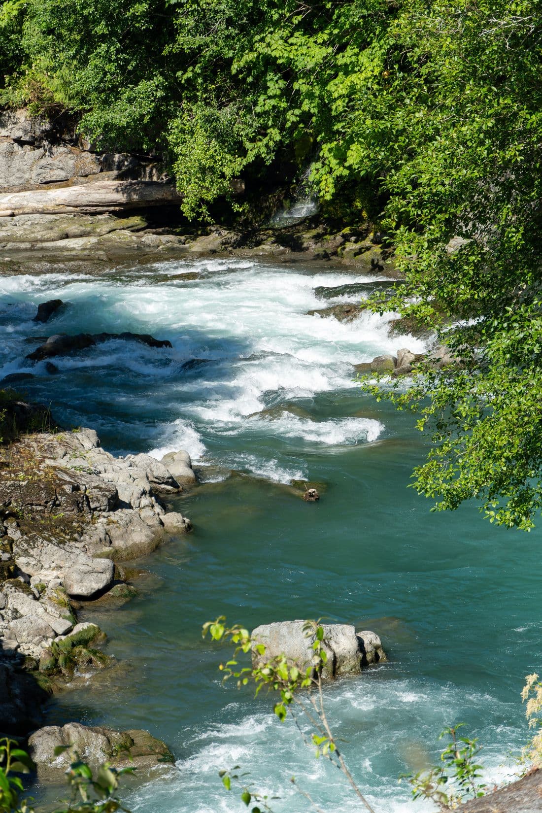
- 25. The Elwha River just below the site of a removed dam, flowing free in July 2022July 20, 2022. U.S. Fish and Wildlife Service. U.S. Fish and Wildlife Service, Pacific Region, Flickr. Public domain. Source