
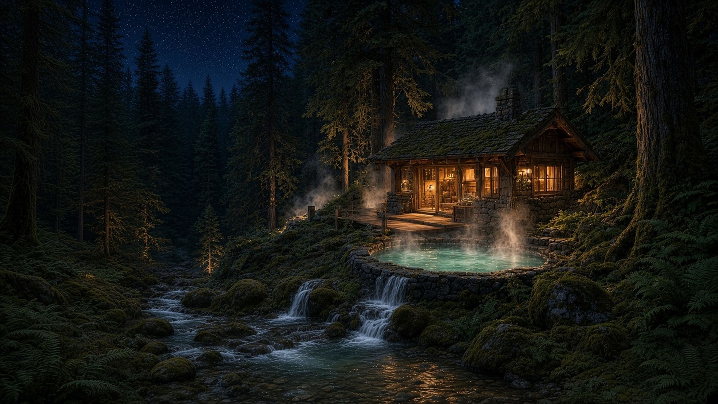
Future vision · Not a plan
Olympic Hot Springs, restored to life
For almost sixty years, people came up Boulder Creek to soak, stay and gather at these springs. Today the buildings are gone, and cars stop well below, at Madison Falls. This is Third Harvest's vision of what the place could be again, and an honest account of what the record says it would take.
How to read this page. Facts from the public record carry a numbered source. Everything else is marked as Third Harvest's position. Terrain figures are estimates from public lidar data; nothing has been checked on the ground. For the history of the springs, see Olympic Hot Springs: a walk back through time.
The concept · Third Harvest's position
Two ways to arrive
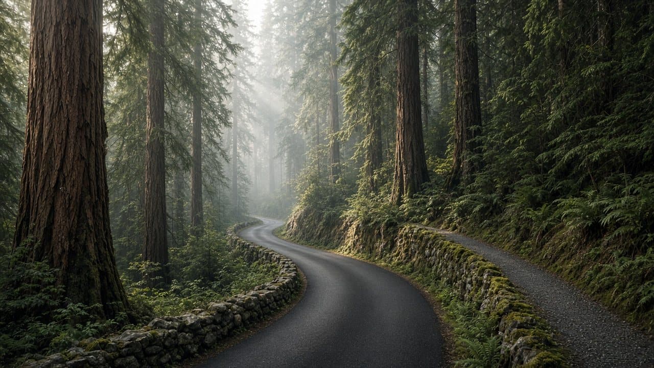
PositionRebuild the road up to the site on its old alignment, as the arrival experience: a drive up through old-growth forest. Beside it runs a separate walking path for guests who want to arrive on foot, starting from the lower lot at today's Boulder Creek Trailhead.
Today vehicles stop at Madison Falls, and the trail from the Boulder Creek Trailhead to the springs is about 1.5 miles.1 The last 2.2 miles of road to the old resort were closed to vehicles in 1982 “because of slope failure and serious erosion,” and became the Boulder Creek Trail.17 The road below has had repeated washouts since the Elwha dams were removed.2
PositionThe walking path would run below the road, on the downhill side, from the old parking lot below the washout up to a landing near the springs. Its lower part would follow the Elwha River from the Madison Falls area to the Boulder Creek Trailhead, and its upper part would follow Boulder Creek to the top. Above the trailhead the non-wilderness strip is only about 50 feet wide on steep side slopes, so a trail below the road would often cross into wilderness, where only a non-motorized trail could be considered, and only with Park Service approval. (Estimates from public lidar.)6
On names: in this concept “the creek” means Boulder Creek, which runs past the springs. Crystal Creek and Hell Creek are side streams the road crosses, and the Elwha River runs along the lower stretch.
Every cabin its own spring-fed water
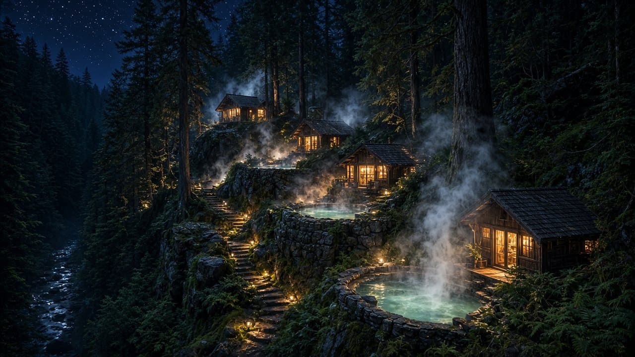
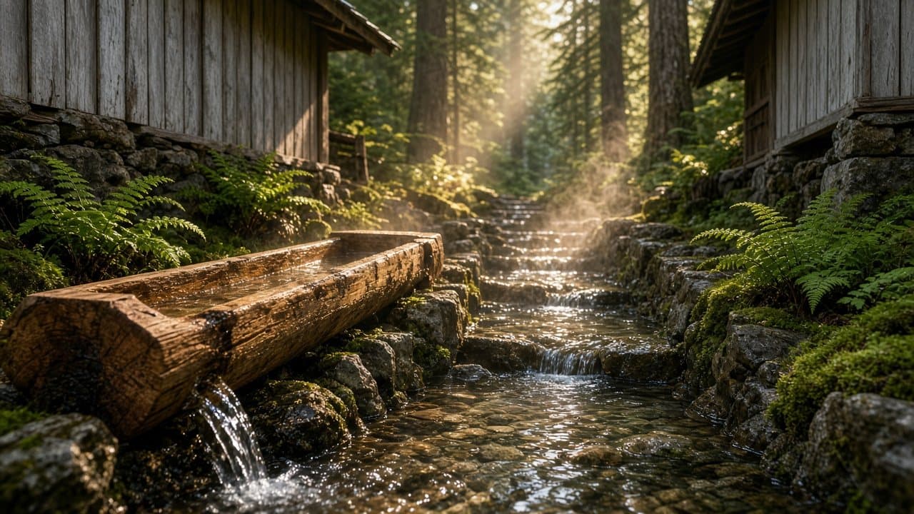
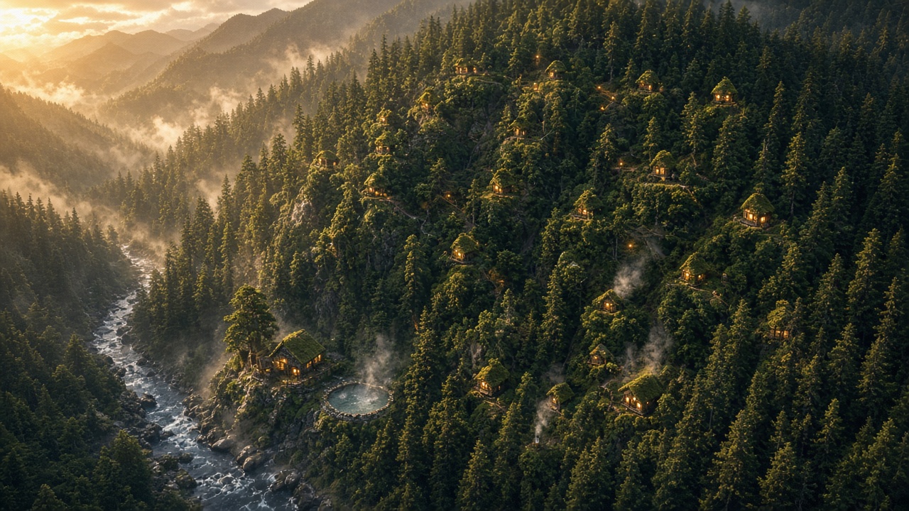
PositionEach cabin would have its own flow of hot spring water, not a shared pool. Hot water would move downhill between the cabins in open cedar troughs and stone-lined channels, linking the whole village into one visible system that catches the light by day and steams in the cool air at night.
What the record says about the water: a 1911 resort brochure listed springs from 113 to 132 degrees Fahrenheit;4 a family account describes pools from 89 to 109 degrees;16 in 1952 to 1954 the Public Health Service made a finding on the pool water, and the Park Service then required chlorination and later fresh water.4,5 Today the park describes the springs as natural, unmaintained seeps, not tested or treated.1 No flow-rate figure was found. Flow, temperature and water quality would all need professional study before any design could be tested.
A village built into the landscape
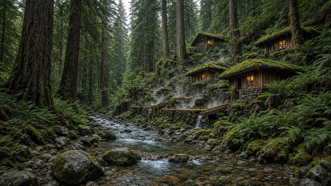
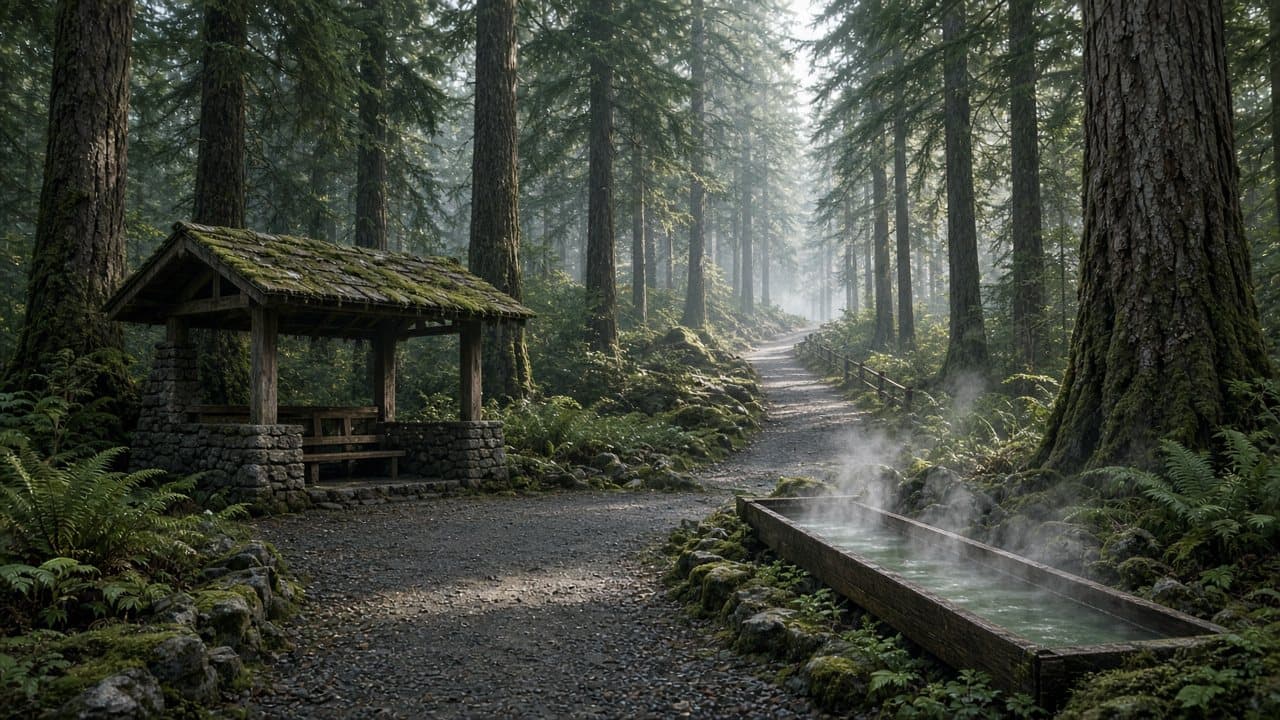
PositionAn organic village, warm and alive. Cedar and stone, with terraces stepping down the slope toward the creek. Buildings sit among the trees rather than replacing them, linked by walkways and by the hot-water channels. Compelling and elegant. A full village like this would sit mostly inside designated wilderness and would need new legislation (see below).
The Lower Elwha Klallam Tribe
Any future here would be a potential future project with the Lower Elwha Klallam Tribe, and a tribal-led partnership is one possible path. Whether and how the Tribe takes part would be the Tribe's decision alone.
Economic vision
- PositionA potential economic engine for the Lower Elwha Klallam Tribe: jobs, income and long-term enterprise, if the Tribe chose to take part.
- PositionShared tax revenue, so Clallam County benefits as well as the Tribe.
- PositionOpen to everyone: visitors from anywhere, not only local residents.
How taxes would apply is complex. Washington's Department of Revenue rule says the state may not tax Indians or Indian tribes in Indian country, as federal law defines it, and treats other cases separately.15 Whether a site inside Olympic National Park would qualify, and how revenue could be shared with the county, would need review by lawyers for the Tribe, the county and the Park Service.
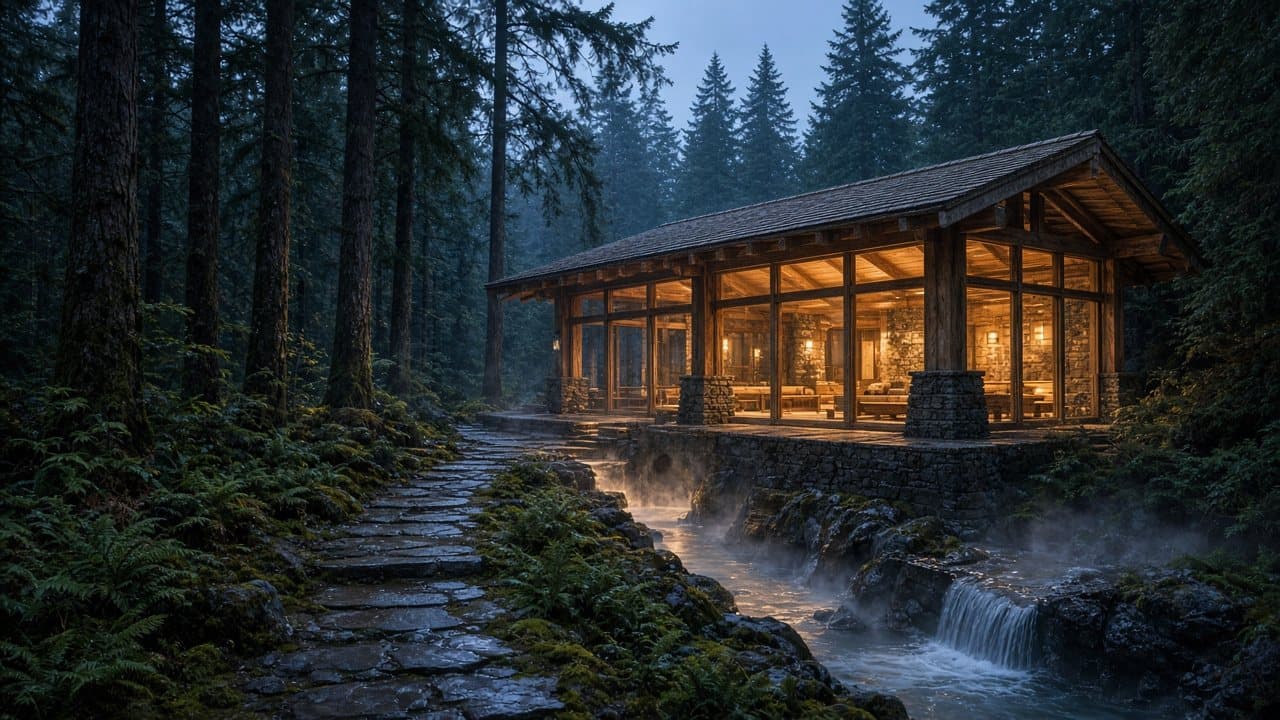
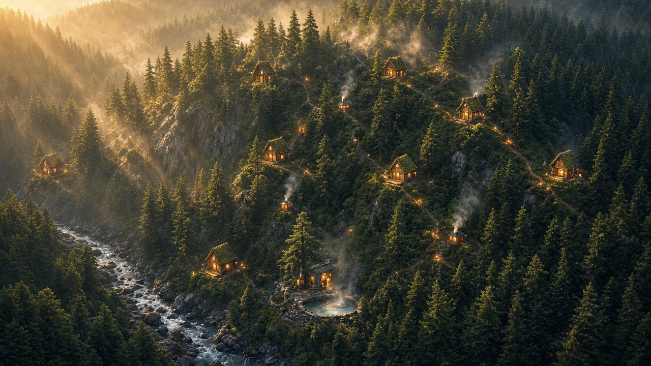
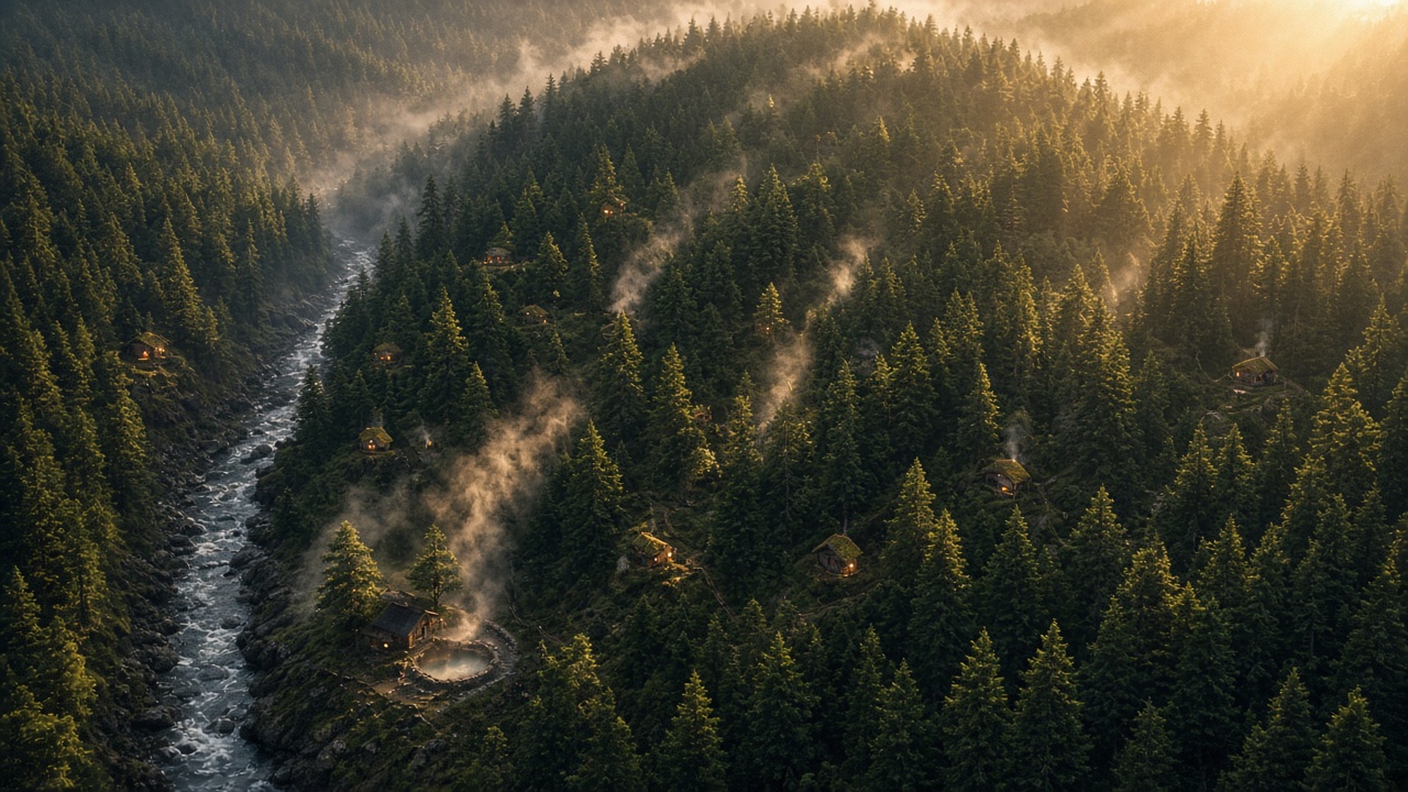
Concept renderings
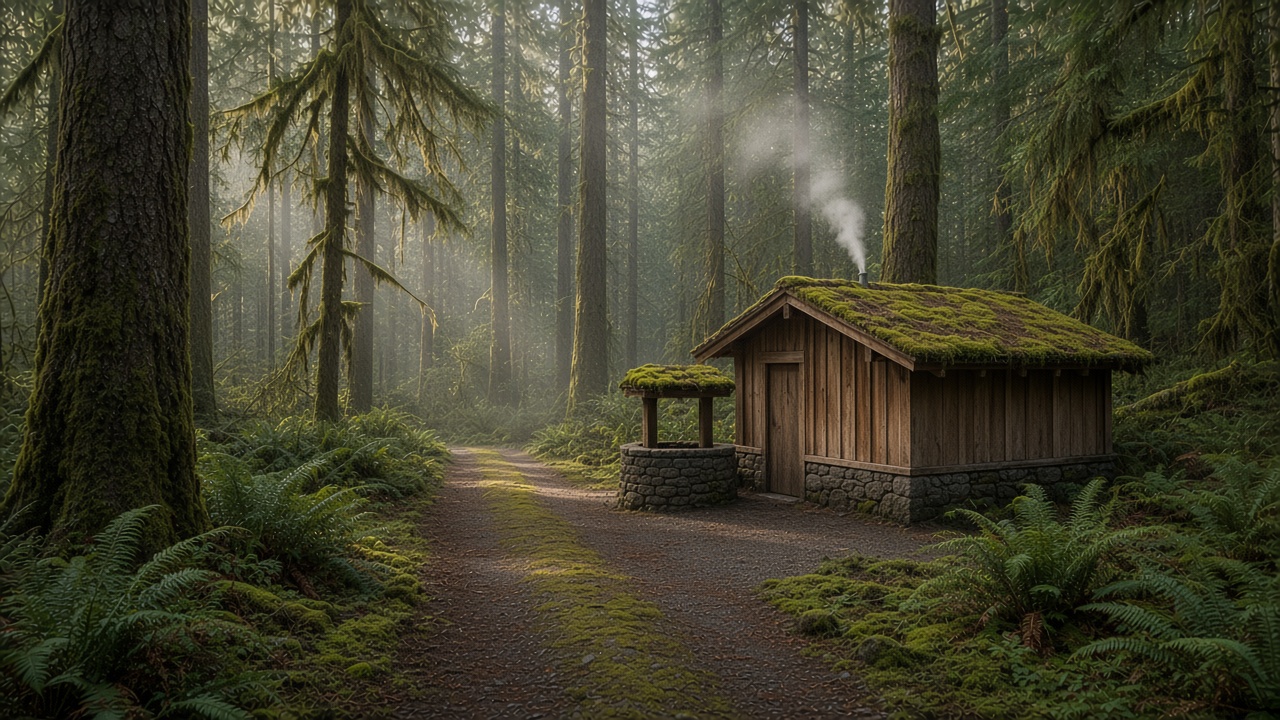
Concept illustrations only. They show mood and materials, not designs, real buildings, layouts or a surveyed site.
The record · Public lidar
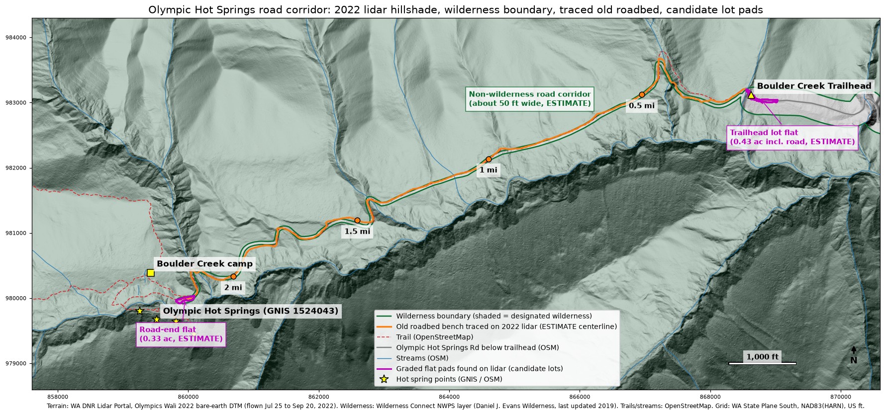
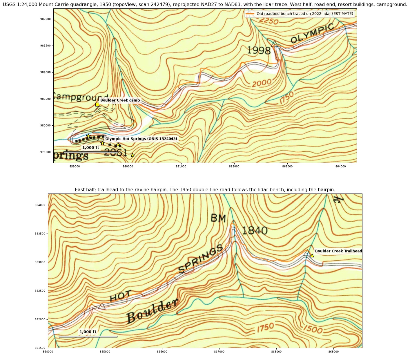
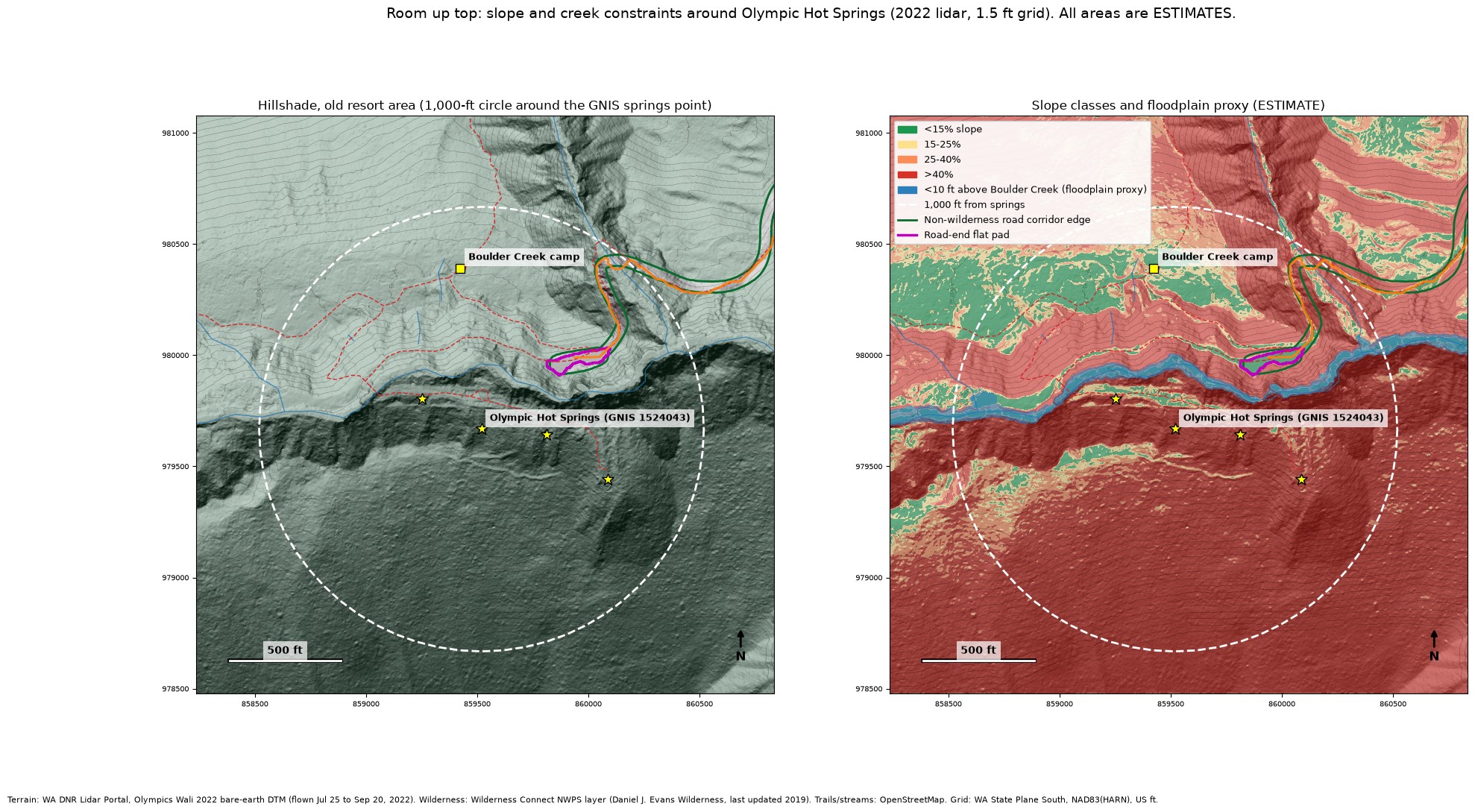
Third Harvest traced the old road on the public 2022 bare-earth lidar for the area6 and compared it with the 1950 USGS topographic map7 and the national wilderness boundary layer.8 All figures below are estimates from terrain data. Nothing has been checked on the ground.
| Feature | Finding (estimate) | Confidence |
|---|---|---|
| Old roadbed | A continuous cut ledge about 18 feet wide, running about 2.26 miles from the Boulder Creek Trailhead (about 1,805 ft) to a graded flat near the springs (about 2,085 ft). It matches the road on the 1950 map, including a hairpin around a ravine. | Confirmed in terrain data |
| Grades | Median about 5 percent; mostly under 10 percent away from the creek crossings. | Estimate |
| Creek crossings | At least three appear washed out: the ravine hairpin, Hell Creek and Crystal Creek. At Crystal Creek the road dips about 150 feet into an incised crossing, about 20 feet lower than in 2014. | Probable |
| Trailhead flat | A graded flat of about 0.43 acre, outside wilderness. Whether it is the historic lower lot or later trailhead parking is not verified. | Confirmed as a flat |
| Turnaround at the top | A road-end flat of about 0.33 acre (about 80 by 293 feet) at the tip of the non-wilderness strip. Third Harvest's founder has been to the site and recalls this big turnaround (a field recollection, not a survey). | Probable |
| Wilderness boundary | The old road sits in a non-wilderness strip about 50 feet wide. About 98 percent of the ground within 1,000 feet of the springs is inside the Daniel J. Evans Wilderness. Only about half an acre of gentle ground nearby lies outside it. | From the GIS layer, not the legal map |
PositionFollow the old roadbed rather than cut new ground, widen the turnaround at the top into parking, and use the trailhead flat as the lower lot where the walking path begins.
Third Harvest's position
This is Third Harvest's reading of how the concept divides under current law. It is not a legal opinion, and the line rests on terrain estimates and the GIS wilderness boundary.
Possible without new legislation
- Rebuilding the road on its old alignment, inside the roughly 50-foot non-wilderness strip.
- Widening the turnaround at the top into parking.
- Using the graded trailhead flat as the lower lot.
- Repairing the washed-out creek crossings on the old alignment.
- A small cluster of cabins at the top, on the only buildable footprint inside the strip.
Needs new legislation
- A village of up to 24 cabins.
- Permanent structures on the roughly 98 percent of ground around the springs that lies in wilderness.
- Any commercial resort operation inside wilderness.
The Wilderness Act says that, except as the Act provides, “there shall be no commercial enterprise and no permanent road within any wilderness area.”9
What the record adds
- “Without legislation” still means inside Olympic National Park. Any rebuild or building would need Park Service authorization.1
- Major federal actions significantly affecting the environment require a detailed environmental statement under NEPA.10 The Park Service's road project was already under environmental review,2,3 and the Tribe told Congress in 2025 that the planning “is starting over with a new EIS” (environmental impact statement).13
- Lodging in a national park is authorized through concession contracts, generally awarded by competitive selection,11 and limited to accommodations that are “necessary and appropriate” and consistent “to the highest practicable degree” with preserving the park.12 In 1971 the court recorded that the government did not intend to continue commercial operation at the springs through any concessionaire.5
- The non-wilderness strip is narrow, and only about half an acre of gentle ground near the springs lies outside wilderness. A cabin cluster and a widened lot would have to share that space, or cross into wilderness. The turnaround is about 0.33 acre and already touches the boundary. (Estimates.)
- The old ledge, about 18 feet wide on steep side slopes, fits a single lane or a narrow two-lane road with turnouts. A modern two-lane road with shoulders would spill outside the strip into wilderness. (Estimate.)
- The boundary used here is the national GIS layer, not the official legal map, which would control.
On May 21, 2025, the Tribe's chair told Congress the Tribe opposed the Park Service's road realignment project “for failure to adequately protect fisheries.”13 Any path, with or without legislation, would need a partnership with the National Park Service and the Lower Elwha Klallam Tribe.
The path forward · Third Harvest's position
PositionThe path forward runs on two parallel tracks. The same principle applies to both: each track gets only what the record supports.
Track one
The state and the Tribe
- The road alignment and the tribal relationship, plus any state land or state approvals that apply.
- The springs, the old road above the trailhead and the turnaround are inside Olympic National Park, which is federal land.1 Which state land or approvals are involved, for example on the lower approach, is still to be identified.
- Any decision would be the Tribe's, through its own governance, such as a vote of its council.14
The numbers · Third Harvest's position
This is Third Harvest's position, built from a desk model with stated assumptions. It is part of a future vision, not a financial projection, an offer or a plan. All money is in 2026 dollars, and figures are the mid cost case unless marked. Third Harvest's view is that the mid cost estimates are probably high. The operating model is Third Harvest's; if the Lower Elwha Klallam Tribe ever took part in a potential future project, how a resort is staffed, run and shared would be the Tribe's decision.
Two cost views, side by side
PositionThe road is part of the real bill in every case. The model runs two views so the effect of paying for the road publicly can be seen, without pretending the road costs nothing.
View A
Resort only: $10.3M
Phase one, 7 cabins. Low $5.8M, high $20.3M.
- 7 modern modular cabins at $250,000 each, all-in, including site prep ($1.75M).
- A central timber-frame lodge in the Northwestern style, $1.5M all-in, with laundry, showers and a gift shop.
- Geothermal heating with ground-source heat pumps.
- A support building, a lodge soaking pool, paths and terraces, the spring water system, power, water, septic and about 55 parking spaces, with remote-site, design and contingency markups and environmental review.
View B
Resort plus road: $27.8M or $23.5M
Phase one, 7 cabins. Low $9.7M, high $76.7M (bridges) or $63.3M (culverts).
- View A plus rebuilding the road and its creek crossings.
- With bridges: $17.5M (low $3.8M, high $56.4M).
- With culverts where they could work: $13.2M (low $3.8M, high $43.0M). Crystal Creek stays a bridge in every case.
- View B is what the whole project costs. View A is what the resort itself would have to pay back if public funding covered the road. No such funding is committed or identified.
The short answer
- Phase one, 7 cabins, never pays back in either view. It loses money every year at every rate modeled, before any construction cost is counted: about $516,000 a year at the $300 base, $362,000 at $500 and 65% occupancy, $281,000 at $500 and 80%, and $190,000 at $600 and 80%. A lean crew of 7 costs about $604,000 a year against total revenue of about $415,000 to $901,000.
- Growth is the whole economic case. Within the 24-cabin maximum and with no entry fee, a 20-year payback is reached only in view A, with the road publicly funded, and only at $600 and 80% (21 cabins). At 24 cabins, payback in view A is 14 years at $600 and 80% and 21 years at $500 and 80%; with the road on the books it is 27 to 45 years.
- The road is the biggest single lever. Wherever the resort makes money, taking the road off its books cuts payback by about half to two-thirds and the break-even cabin count by about 40%. It cannot rescue 7 cabins, which lose money either way.
- Even 24 cabins need far more room than the roughly half acre of gentle non-wilderness ground near the springs, which fits about 5 to 7 cabins. Growing past phase one would need new legislation (see above).
- Entry fees help only at the top of the range, $50 a person with about 100 day visitors a day (see below).
Rates and the Sol Duc benchmark
Sol Duc Hot Springs Resort, the nearest comparable, has 32 cabins plus a suite,18 a 2026 season of March 20 to November 1 (226 nights),19 and a pool day-use charge of $19 for adults and $15 for children, seniors, disabled visitors and military.20 Its gross receipts were $3,010,986 in 2016.21 Cabin rates run about $235 to $353 a night, with the suite over $500.18
AssumptionThe base case is $300 a night at 65% occupancy over a 226-night season, shown beside $300 at 50% and at 80%. Higher cases are $400 at 65%, $500 at 65%, $500 at 80% and $600 at 80%. Third Harvest's position is that comparable private-soak places likely reach $500 or more a night. The franchise fee follows the tiers in the nearby Lake Crescent concession offering.22
Break-even cabins for a 20-year payback
Growing from the 7-cabin phase one at $250,000 for each added cabin, up to the 24-cabin maximum. “Over 24” means no size within that maximum reaches a 20-year payback. Rates where no case reaches a 20-year payback within 24 cabins are not shown. Each cell shows view A, resort only / view B with bridges / view B with culverts. Entry-fee columns are the scenario described below.
| Rate | No entry fee | $35, 50 a day | $50, 50 a day | $50, 100 a day |
|---|---|---|---|---|
| $500 at 65% | Over 24 / Over 24 / Over 24 | Over 24 / Over 24 / Over 24 | Over 24 / Over 24 / Over 24 | 18 / Over 24 / Over 24 |
| $500 at 80% | Over 24 / Over 24 / Over 24 | Over 24 / Over 24 / Over 24 | 22 / Over 24 / Over 24 | 12 / Over 24 / Over 24 |
| $600 at 80% | 21 / Over 24 / Over 24 | 20 / Over 24 / Over 24 | 18 / Over 24 / Over 24 | 9 / Over 24 / 22 |
A $20 fee makes every case slightly worse than no fee, because it is barely above the $18 day-use charge already in the base and attendants and water treatment take the difference.
Payback in years, no entry fee
Each cell shows view A / view B with bridges / view B with culverts. “Never” means the resort loses money every year at that size.
| Rate | 7 cabins | 24 cabins |
|---|---|---|
| $300 at 65% (base) | Never | Never |
| $300 at 50% | Never | Never |
| $300 at 80% | Never | 132 / 288 / 249 |
| $400 at 65% | Never | 72 / 157 / 136 |
| $500 at 65% | Never | 33 / 73 / 63 |
| $500 at 80% | Never | 21 / 45 / 39 |
| $600 at 80% | Never | 14 / 31 / 27 |
What the road does to the math
| Case | A: resort only | B: plus road, bridges | B: plus road, culverts |
|---|---|---|---|
| Capital, phase one, 7 cabins | $10.3M | $27.8M | $23.5M |
| Payback at 7 cabins, any rate, no entry fee | Never | Never | Never |
| Payback at 7 cabins, $500 at 80%, $50 fee, 100 a day | 31 years | 81 years | 68 years |
| Payback at 7 cabins, $600 at 80%, $50 fee, 100 a day | 24 years | 64 years | 54 years |
| Payback at 24 cabins, $400 at 65%, no fee | 72 years | 157 years | 136 years |
| Payback at 24 cabins, $600 at 80%, no fee | 14 years | 31 years | 27 years |
| Break-even, $600 at 80%, no fee | 21 cabins | Over 24 | Over 24 |
Compared with Third Harvest's earlier estimate of $31.8M for phase one with the road and bridges, view B is now $27.8M. The drop comes from pricing all 7 cabins at the $250,000 all-in figure, with site prep inside it. Two assumptions are worth naming: the $250,000 is taken to include each cabin's private tub and furnishings (if not, add about $230,000 a cabin), and the $1.5M lodge is taken as all-in (if it is hard cost only, markups would take it to about $3.4M). The power line shares a trench with the road but stays on the resort's side of the ledger.
Entry fees for built soaking pools
PositionFees of $20, $35 or $50 a person per two-hour block would apply only to built soaking pools at the lodge, fed by spring water, inside the non-wilderness corridor. The natural seeps would stay free and open to hikers, and that free option a short walk away limits what people would pay.
Federal law lets the Park Service charge an amenity fee when a visitor uses “a specific or specialized facility, equipment, or service,”23 which hiking to the seeps is not. A concessioner's prices are judged “primarily by comparison with those rates and charges for facilities, goods, and services of comparable character under similar conditions” and “may not exceed the market rates.”24 Revenue to the United States is “subordinate” to protecting the park and providing services “at reasonable rates.”25
| Benchmark | Price | Visitors or limit |
|---|---|---|
| Sol Duc pools, Olympic National Park | $19 adults, $15 children and seniors20 | No published day-use count found |
| Olympic Hot Springs and the Boulder Creek Trail | Free | No annual count found. A 2009 Park Service assessment describes trailhead parking for about 15 vehicles, with up to 55 seen on busy days26 |
| Goldmyer Hot Springs, Washington | $30 adults, $25 seniors, children free27 | 20 people a day27 |
| Scenic Hot Springs, Washington | Trail use fee $30 to $35 a person by season28 | Reservations only, limited each day28 |
| Breitenbush Hot Springs, Oregon | Day use $40 weekdays, $50 weekends (13 and over)29 | Reservation required; no count published29 |
- Assumption20, 50 or 100 day visitors a day over the season (about 4,520, 11,300 or 22,600). About 30 trailhead parking spaces cap day visitors near 150 a day. Built pools hold 40 bathers at a time on the phase-one path, lodge guests first.
- AssumptionAdded costs: 1 to 3 seasonal pool attendants, more hours for the contracted water treatment operator, chemicals and testing, a permit, pump power, insurance, and $0.5M for enlarged pools, changing rooms and an entry desk.
- At 7 cabins, only $50 with about 100 visitors a day turns a profit at every rate modeled. Payback is then 87 years in view A at the $300 base, and 31 years at $500 and 80% (81 with bridges, 68 with culverts). At $600 and 80%, it is 24, 64 and 54 years.
- If parking filled every day (about 150 visitors at $50), 7 cabins would pay back in 20 years at the $300 base and 14 years at $500 and 80%, but only in view A, with the road publicly funded.
- Price approval is a risk. The Park Service would compare a $50 fee with $19 at Sol Duc, and only the high end of the range moves the numbers.
- Washington's health code requires lifeguards at general use swimming pools, while spas may run without them under posted rules.30 Third Harvest's position is to design the built pools as shallow soaking spas, with a certified water treatment operator, as the code requires of all pool facilities.30
How the resort would run
- PositionA lean crew of 7 to 10: a general manager, project manager and security year-round, and a seasonal assistant manager, gift shop manager, grounds and cleaners. Pay is at Washington median wages with taxes and benefits.
- PositionPrivate cabins, no lifeguards. Each cabin has its own private soak, and no lifeguarded public pool is assumed.
- PositionA contracted water and wastewater operator, a certified operator hired as a service, about $32,000 to $65,000 a year.
- PositionAutomated back-office software and a blockchain ledger for financials, in place of a traditional back office. The effect on break-even is small.
- PositionTransparency. Every Park Service concession files an annual financial report, with a CPA review or audit above $1M of gross receipts.31 Third Harvest's position is to go further and publish the ledger, so the public can check the record.
- PositionLocal timber. Timber for the lodge frame, decks and siding would come from working forests outside the park, as a renewable supply.
- PositionGeothermal heating with ground-source heat pumps or a heat exchanger on spring water, if a survey confirms the resource. It is in the base of both views. Its effect on the numbers is small; it is worth doing for comfort, emissions and fewer fuel deliveries. Federal law bars geothermal leases on National Park System lands and on Indian trust or restricted lands,32 so a geothermal power plant would need its own Act of Congress. A geothermal power plant is part of this vision, as a separate project with its own funding, outside the resort return on investment figures here; see the geothermal section.
- OptionHelicopter delivery of factory-built cabin modules to pads in the non-wilderness corridor, outside bird nesting seasons and with a park permit. About $1.1M for phase one (low $0.3M, high $3.2M).
- Future scenarioRobots, such as Tesla's Optimus, are kept as a separate, speculative case for work above the 10-person crew cap. They are not a product that can be bought today, and they make no difference at 24 cabins or fewer.
The staffing ceiling, back-office, helicopter, robot and geothermal side cases were run on an earlier cost basis (road included with bridges, at $400 and $600 a night) and are shown for direction only. All rate, occupancy, visitor and cost figures not tied to a numbered source are Third Harvest's assumptions or estimates.
Future vision · Third Harvest's position
This is Third Harvest's position: a hypothetical, macro view of what could be possible, not a plan. Nothing here has been tested on the ground, priced or reviewed by any agency, tribe or town.
A wider view
PositionStep back from the cabins and the road, and look at the Peninsula as a whole. Heat in the ground is one of the region's quiet assets. If our communities worked together on certain areas of our geography, chosen with care, geothermal heat and power could benefit our townships for generations. This is a picture of what could be possible, not a proposal for any one site.
A shared opportunity for our peoples
PositionThe land and waters in question belong to the story of many peoples: the tribes whose homelands these are, and the townships that grew up along the rivers and the coast. Geothermal is best seen as a shared opportunity for all of them, not as a technology pitch. Steady local energy, local jobs and revenue that stays close to home could serve the tribes and the towns alike. Tribes are potential future partners only. Whether any tribe takes part, and how, would be that tribe's own decision.
Low risk, real upside
- Small footprint. The Department of Energy says geothermal has the smallest land footprint of any comparable energy source: about 4,350 square feet per gigawatt hour, against about 39,200 for coal, 14,400 for wind and 34,800 for solar panels (converted from its square-meter figures).44
- Low emissions. Geothermal electricity produces about one-sixth of the carbon dioxide of a natural gas plant, and closed-loop binary plants release essentially zero emissions.43 Direct-use heating has almost no negative effects on the environment.45
- Steady power and heat. Heat in the ground does not depend on the weather. Federal policy now calls it “reliable, steady-state baseload energy.”48
- Direct heat. The same water can warm buildings, pools and sidewalks without making electricity at all, as Boise and Klamath Falls show below.51,52
- Local jobs and revenue. PositionHeat is used where it is found, so the work stays local. On federal lands, bonus bids, rentals and royalties from geothermal leases are shared among the U.S. Treasury, the state and the counties where the leases are located.50
- Risks exist and are managed. Moving fluid into or out of any well can trigger small earthquakes. The Department of Energy says high-pressure injection is uncommon in conventional geothermal, so the risks to people and property are correspondingly small, and it requires a mitigation protocol for higher-risk enhanced systems.43,46 Plants use scrubbers to remove hydrogen sulfide, and most inject used water back into the ground.45 Every project still goes through environmental review.43
The federal government is behind geothermal
- Tax credits kept. The 2025 budget reconciliation law, the One Big Beautiful Bill Act, cut wind and solar credits short but kept the full clean electricity credits for geothermal projects that begin construction by the end of 2033, phasing down after that.49
- Faster permits. On May 29, 2025, the Interior Department announced emergency permitting procedures to speed geothermal projects. Secretary Doug Burgum said, “Geothermal energy is a reliable energy source that can power critical infrastructure for national security and help advance energy independence.”47
- Annual lease sales. In December 2025, the Bureau of Land Management told its state offices to hold geothermal lease sales every year where nominations are pending.48
- Record demand. In August 2026, a Bureau of Land Management geothermal sale in Utah set the bureau's records for the highest parcel bid ($4,168,725) and the highest per-acre bid ($1,207), with $24,706,280 in total receipts.50
PositionThis support is a reason to start the conversation now. It does not change the federal law that applies inside a national park (below).
It already works
- Chena Hot Springs, Alaska. Has generated about 400 kW from 165°F water since 2006, the lowest-temperature geothermal power on record.38 It is the closest real comparison for a small plant on modest heat.
- Boise, Idaho. The city runs one of the oldest and largest geothermal systems in the world. Hot water heats offices, restaurants, community spaces and the Boise State campus, then goes back underground to reheat. The city says it cuts carbon emissions by the equivalent of taking more than 2,000 gas-powered cars off the road.51
- Klamath Falls, Oregon. The city's geothermal utility heats 23 commercial, non-profit and government buildings downtown and runs sidewalk and bridge snow melt, using water at 200 to 220°F that is re-injected so the resource is not depleted.52
One chapter of the river's story
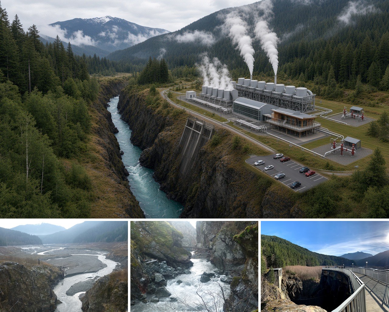
The Elwha shows what the region can do when people work together. Removal of the Glines Canyon and Elwha dams began in September 2011.40 On August 26, 2014, the last 30 feet of Glines Canyon Dam came down, and the Park Service wrote, “The largest dam removal in history is complete.” Within weeks, Chinook salmon had spawned above Glines Canyon “for the first time in over 100 years.”41 The old spillway is now a public overlook above the 200-foot-deep canyon.42
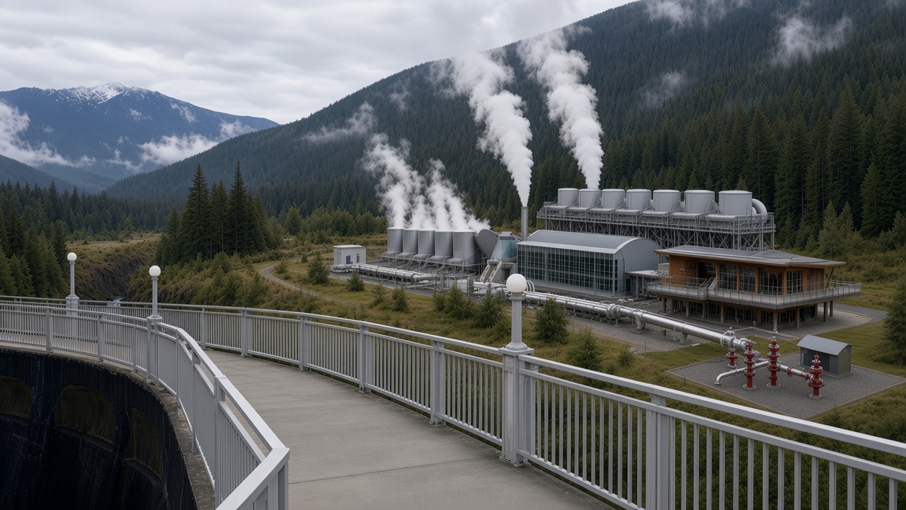
PositionA small geothermal plant near the old Glines Canyon site could be one possible next chapter: power drawn from the ground instead of from a reservoir, with the river left to run free. It is one example in a wider picture, not the whole vision.
What the record shows here
- The springs run about 118 to 122°F at the surface. The USGS measured 119°F,33 and Washington DNR lists the warmest spring at 118°F and about 122°F.34,35
- Estimates from the water's chemistry suggest about 160 to 240°F at depth.33,35 These are estimates, not measurements.
- No one has drilled there or measured heat flow. The state's 1983 survey suspected low heat flow on the Peninsula and suggested a shallow drilling program that was never done.35 The resource is unproven.
Two sites in the vision
- PositionUpper site: a small, discreet wellhead and micro generator near the road-end flat above the trailhead, outside wilderness, where the site concept already places a heat plant for the cabins.
- PositionLower site: a plant at the former Glines Canyon Dam site, on the canyon shoulder where the dam once stood, above the free-flowing Elwha River. The springs sit at about 2,128 feet; the river at the old dam is about 453 feet.6,39 A lower starting point does not by itself mean a shallower well. How deep useful heat lies depends on how fast the rock warms with depth, and that has never been measured here.
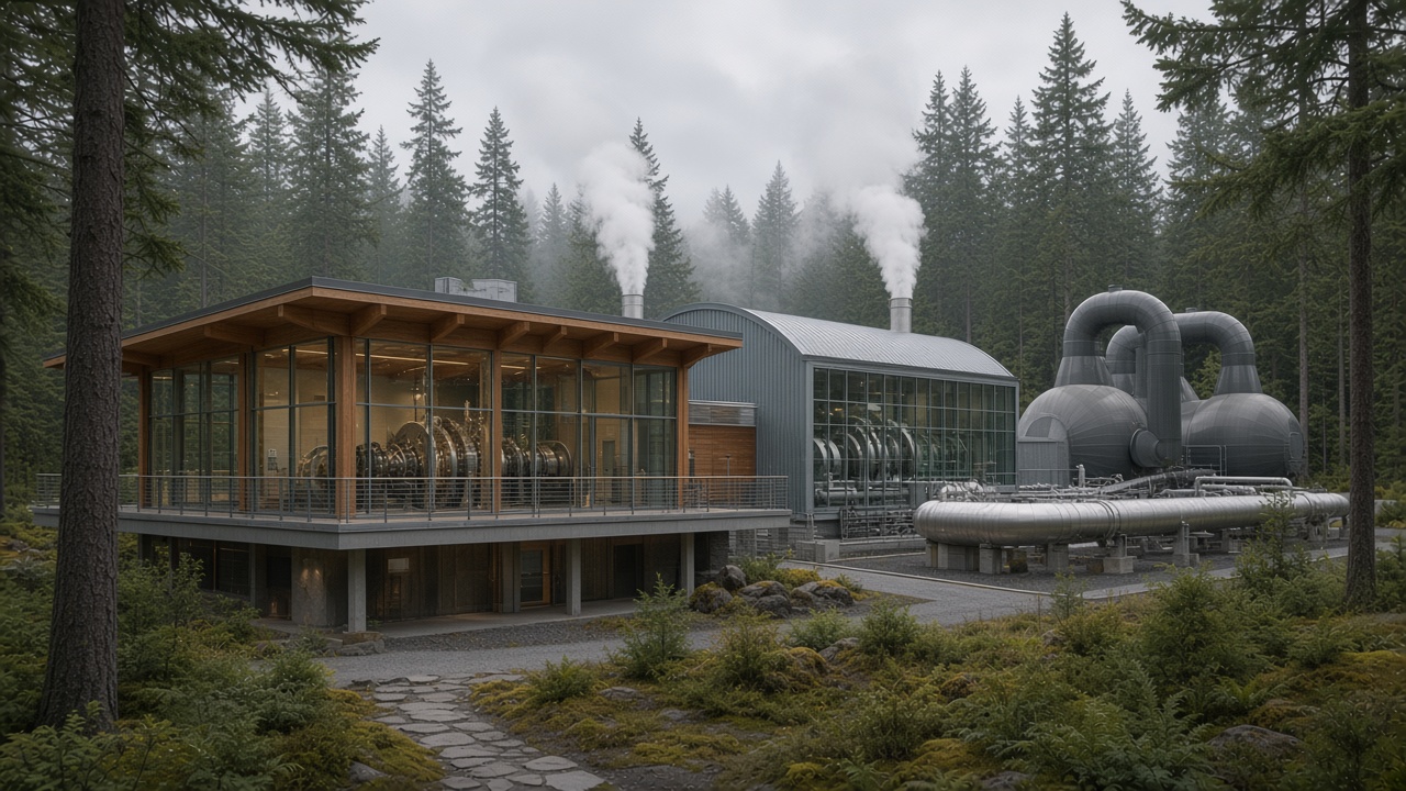
Future vision · What it would take
- Test drilling first. Exploratory wells and heat-flow measurements would have to prove the heat before any design or cost could be trusted.
- Congress. Federal law bars geothermal leases on National Park System land.32 Both sites are inside Olympic National Park. The dam site and nearby Altaire Campground are park tracts (OLYM-20-106 and OLYM-14-106)37 and were not part of the land restored to the Lower Elwha Klallam Tribe under Public Law 119-128.36 A plant would need its own Act of Congress, or would ride on the legislation the resort already needs. The same law also bars geothermal leases on Indian trust lands,32 so a land transfer alone would not open the door.
- Review and permits. Park environmental review,10 and possibly state drilling permits and a water right.
Power or heat
Whether the heat here is hot enough, or flows enough, for power is unknown. PositionDirect heat is the most likely first use: warming the cabins, the bathhouse and the water.
Funding
PositionGeothermal is a separate, parallel project with its own funding. It sits outside the resort's return on investment, and the resort numbers on this page assume no power plant.
The Lower Elwha Klallam Tribe
The Tribe could be a potential future partner. Whether and how it takes part would be the Tribe's decision alone.
- 1. National Park Service, Olympic National Park, Hot Springs. nps.gov
- 2. National Park Service, Olympic Hot Springs Road Access Environmental Assessment (October 2019). parkplanning.nps.gov
- 3. National Park Service, Olympic Hot Springs Road Access, project status. parkplanning.nps.gov
- 4. National Park Service, Olympic National Park Historic Resource Study (1983), Chapter 4, Olympic Hot Springs. nps.gov (archived)
- 5. Schoeffel v. United States, 193 Ct. Cl. 923 (1971). plainsite.org
- 6. Washington DNR Lidar Portal, Olympics Wali 2022 bare-earth terrain model (flown July 25 to September 20, 2022). lidarportal.dnr.wa.gov
- 7. USGS Historical Topographic Map, Mount Carrie, 1:24,000 (1950). usgs.gov
- 8. Wilderness Connect, Wilderness Areas in the United States (GIS layer; Daniel J. Evans Wilderness). arcgis.com
- 9. The Wilderness Act, Section 4(c), 16 U.S.C. 1133(c). law.cornell.edu
- 10. National Environmental Policy Act, 42 U.S.C. 4332(2)(C). law.cornell.edu
- 11. National Park Service concessions: concession contracts, 54 U.S.C. 101913. law.cornell.edu
- 12. National Park Service concessions: policy on public accommodations, 54 U.S.C. 101912. law.cornell.edu
- 13. Testimony of Frances G. Charles, Chairwoman, Lower Elwha Klallam Tribe, U.S. House Natural Resources Subcommittee on Federal Lands, May 21, 2025. congress.gov
- 14. Lower Elwha Klallam Tribe, Tribal Government. elwha.org
- 15. Washington Administrative Code 458-20-192, Indians and Indian country. app.leg.wa.gov
- 16. Sequim Gazette, "Granddaughter pays homage to ancestors," March 24, 2014. sequimgazette.com
- 17. National Park Service news release, Boulder Creek Trail rehabilitation (August 13, 2010). nps.gov
- 18. National Parks Traveler, Lodging in Olympic National Park (Sol Duc Hot Springs Resort). nationalparkstraveler.org
- 19. Olympic National Park lodging concessioner, Sol Duc Hot Springs Resort, accommodations and 2026 season. olympicnationalparks.com
- 20. Olympic National Park lodging concessioner, Sol Duc mineral hot springs pool. olympicnationalparks.com
- 21. National Park Service Commercial Services, 2016 concession gross receipts by park (contract OLYM008). nps.gov
- 22. National Park Service, Lake Crescent Lodge concession business opportunity, CC-OLYM003-26. nps.gov
- 23. Federal Lands Recreation Enhancement Act, 16 U.S.C. 6802. law.cornell.edu
- 24. National Park Service concessions: rates and charges, 54 U.S.C. 101916. law.cornell.edu
- 25. National Park Service concessions: franchise fees, 54 U.S.C. 101917. law.cornell.edu
- 26. National Park Service, Boulder Creek Trail environmental assessment (December 18, 2009). parkplanning.nps.gov
- 27. Goldmyer Hot Springs, Visiting. goldmyer.org
- 28. Scenic Hot Springs, Visitor information. scenichotsprings.com
- 29. Breitenbush Hot Springs, Day use (2026). breitenbush.com
- 30. Washington Administrative Code 246-260-131, Water recreation facilities: operation and management. app.leg.wa.gov
- 31. National Park Service Commercial Services, Annual Financial Report. nps.gov
- 32. Geothermal Steam Act, lands subject to leasing, 30 U.S.C. 1014. law.cornell.edu
- 33. U.S. Geological Survey Open-File Report 82-98 (Mariner, Presser and Evans, 1982), chemistry of thermal waters in Washington and Oregon. usgs.gov
- 34. Washington DNR Open File Report 80-11, thermal and mineral springs of Washington. dnr.wa.gov
- 35. Washington DNR Open File Report 83-7, geothermal resource survey and target-area assessment (1983). dnr.wa.gov
- 36. Lower Elwha Klallam Tribe Project Lands Restoration Act, H.R. 2388, enrolled bill (Public Law 119-128). govinfo.gov
- 37. National Park Service Land Resources Division, boundary and tract data service. arcgis.com
- 38. U.S. Department of Energy, Geothermal technology breakthrough in Alaska: harvesting heat below boiling temperatures (Chena Hot Springs). energy.gov
- 39. USGS 3D Elevation Program lidar (2014), Elwha River at the former Glines Canyon Dam. usgs.gov
- 40. National Park Service, Olympic National Park, Dam Removal. nps.gov
- 41. National Park Service, Elwha River Restoration Blog, "The Last Dam Blog Post" (October 2, 2014). nps.gov
- 42. National Park Service news release, New Glines Canyon Spillway Overlook Opens in Elwha Valley (May 29, 2015). nps.gov
- 43. U.S. Department of Energy, Geothermal environmental analysis. energy.gov
- 44. U.S. Department of Energy, 5 common geothermal energy myths debunked. energy.gov
- 45. U.S. Energy Information Administration, Geothermal energy and the environment. eia.gov
- 46. U.S. Department of Energy, GeoVision: Harnessing the Heat Beneath Our Feet (2019). energy.gov
- 47. U.S. Department of the Interior, emergency permitting procedures to accelerate geothermal energy development (May 29, 2025). doi.gov
- 48. Bureau of Land Management, Instruction Memorandum 2026-004, Promoting Annual Competitive Geothermal Lease Sales (December 16, 2025). blm.gov
- 49. Tax Law Center, Navigating OBBBA: phaseouts, prohibited foreign entity rules, and other new rules. taxlawcenter.org
- 50. U.S. Department of the Interior, Record $24M in winning bids for Utah geothermal leases (August 19, 2026). doi.gov
- 51. City of Boise, Geothermal. cityofboise.org
- 52. City of Klamath Falls, Oregon, Geothermal. klamathfalls.city
- 53. USGS Pacific Coastal and Marine Science Center, Elwha River and the former Lake Mills above Glines Canyon, November 30, 2015 (photo P1310658, CC BY-SA 2.0, via Wikimedia Commons). commons.wikimedia.org
- 54. USGS Pacific Coastal and Marine Science Center, the Elwha running free through Glines Canyon, November 30, 2015 (photo P1310672, CC BY-SA 2.0, via Wikimedia Commons). commons.wikimedia.org
- 55. Andrew Kvalheim, Glines Canyon Dam spillway overlook, February 11, 2022 (CC BY-SA 4.0, via Wikimedia Commons). commons.wikimedia.org
- 56. Nesjavellir Power Plant, Iceland (public domain, via Wikimedia Commons). commons.wikimedia.org
- 57. Hellisheidi Geothermal Power Station, Iceland (CC BY-SA 4.0, via Wikimedia Commons). commons.wikimedia.org
Renderings and the hero image are concept illustrations by Third Harvest. Lidar maps were made by Third Harvest from the public data cited above.